Letters, Points of Interest, Kudos and Conundrums, Week in Review (Announcements, Contracts, Products, Events, Training, Hires) Back Issues, Advertise, Contact, Subscribe/Unsubscribe If, for some reason you cannot read this document, visit: http://www.gismonitor.com/news/newsletter/archive/042904.php
Surveying puzzle you? Get unpuzzled. Sign up for a free subscription to Professional Surveyor Magazine. (U.S. residents only; postal fees apply for international subscribers.)
Batty began by noting that the U.S. Department of Labor recently included geotechnologies along with biotech and nanotech as high growth areas in the coming years. With that, he launched into a discussion of some six technologies/trends. The Internet is not just about browsers, but about other sorts of clients. Web services and the XML that enables them are growing. He noted that Microsoft's choice of MapPoint Web Service for its first such service is telling. While XML standards and other vendor standards are in development (OGC's, OMA's, ESRI's and utility specific ones like Multispeak) it's unlikely a single one will "win." Batty was quick to praise Microsoft and MapPoint. He noted MapPoint's schematic directions and soon-to-be integrated real-time traffic with directions as particularly clever. And, he put Microsoft's work with MapPoint squarely in Clayton Christensen's "disruptive technologies" category. In other words: watch out. The same goes for Oracle with databases. Next up, he explored wireless. While he noted that we do not have ubiquitous coverage it is on the way, along with faster network speeds and longer range (30 miles for WiMax, for example). Once wireless is ubiquitous and a commodity, Batty offers, the difference between office and field disappears. [I'm writing this in a hotel room with free wired DSL just like I have at home.] Location tracking was the next topic. I was surprised at the audience's laughter when Batty explained how Wherify tracking devices are locked onto children's wrists. Was this a new idea to them? Had these geospatial people missed the discussion of such products in the past few years? Of more importance to Batty are local positioning systems, locating people and assets within a smaller area, say indoors. The fourth topic was sentient computing. The idea here is that based on your location, computers simply know what you want. Stand in front of a panel at an amusement park, and the sensor knows you are interested in tracking your children and presents a map of their locations. The fifth topic was sensors. Batty outlined the four location technologies on his new car (GPS navigation, laser-guided cruise control [it adjusts speed based on how close other cars are], smart keys [no need to insert a key in the ignition, just having it in your pocket is enough to open the door or allow a push button start], and a real-time video feed to provide information when backing up. The ability to track anything anywhere, may well lead, he suggests to "self updating GIS" - that is trackable assets insert themselves in the database with attributes from an RFID tag and locations from GPS. He noted that accessing sensors via the Web (sensor Web in OGC speak) is coming, but the challenge is filtering out those that are not of interest, something like Tivo does for those with Direct TV (credit to Joe Berry for that comment). The final topic was hardware form factors and their implications. Wireless Bluetooth headsets keep hands free for other tasks, for example. Special paper allows a pen to track its path during markup and deliver it to a computer via a USB port. Batty also highlighted that there are many situations where we don't need paper - voiced directions for driving for example, may be enough. To wrap up, Batty outlined short and long term trends. In the short term we'll see the trend toward specific applications, instead of horizontal ones, continue (what the vendors alluded to above) along with vendors' choice to put 80% of tools into a solution with 20% open for customization. Users will bend their workflows to take advantage of those offerings, when needed. The applications service provider (out of shop hosting of online applications) trend that came and went will return. Tracking of assets and people will grow. In the medium to long term wireless will become ubiquitous, as will tracking. Disruptive technologies will make their mark, as will sensors and sentient computing. But, will GIS go away? Batty noted that there are no conferences for technologies that use numbers (as we have one for spatial concerns), and that we are seeing more meetings focused on specific industries. We are seeing more GIS in other applications. These trends, he offered, mean that our specialized technology will in time become a commodity offered by Microsoft and Oracle. My conclusion from these statements? Yes, it will go away for many people in its current form.

Autodesk The communications and utilities areas are regulated, which places specific demands on them. Other demands that drive the need for solutions include profits, reliability, and customer service and safety (both of employees and the public). Unlike other workflow pictures I've seen of late that are linear (have a beginning and an end) David Salzberg showed me a circular one, noting that in utilities especially, there's a cycle of changes and updates to infrastructure. (Salzberg, for those who like history, was a founder of Image Systems Technology, the company that launched what is now Autodesk Raster Design.) Each of the solution teams aims to simplify how users put together solutions from Autodesk's many partners. Until recently, if a user wanted tools that work with Autodesk products they were presented with a paper catalog or a website list of partners. It was, to use Salzberg's term, a bit "overwhelming." Now, Autodesk is selecting strategic partners to put together solutions. One solution highlighted at GITA was for mobile asset management, a fancy term for keeping track of trucks (for any type of utility). The MapGuide-based solution involves partner, Gatekeeper Systems, and promises quick implementation and return on investment. The City of Los Angeles, for example, invested more than $1 million in the system and expects the investment to pay for itself in about two years. Field and office staff both access the same interface. (The field staff uses a truck-mounted laptop.) Geoff Zeiss outlined a configurable group of technologies aimed at electric utilities. Among the products: Utility Design (once from Gentry Systems), Autodesk Map, Raster Design, and Autodesk GIS Design Server (AGDS, once Vision). Autodesk has developed a data model specifically for electric utilities and developed interfaces to key industry tools such as Milsoft. Zeiss noted that when he suggested several years ago that perhaps utility crews in the field actually update maps, the suggestion was not well-received. More recently, it's become one of the specific goals of at least one big customer. I asked why. In these times, return on investment (ROI) is king. Zeiss joked that you even need an ROI statement for a pencil. Moreover, competitive pressures are mounting. So, if making the switch to field-based updates can cut costs up to 70-90%, organizations are willing to listen. It means for example, that at one user site the GIS staff has dropped from 12 to 4. That concerned me. Where did they go? Zeiss noted that the work they had done was the mundane updating. Now they were free to "do more interesting things." Further, he noted, making the field staff responsible for data updates means, "the field workers who need good data are now accountable for it." Zeiss noted that Autodesk has, in the past, focused on the core platform technology. Now, it's ready to move to providing "productivity applications." That was a comment I heard many times during the show from vendors. The one core platform discussed was last week's release of Autodesk Map 3D (at right). There are, according to Autodesk, still tens of thousands of vanilla AutoCAD seats in utilities. Autodesk may now, with the new 3D capabilities and productivity applications, be ready to move them to the next level.
Bentley
Data management for Bentley does not mean "everything in the database." In fact, Mann is quite confident many things will remain in files. "You would not want to break up parts of a contract into paragraphs and sentences and words in a database," he offered as an example. In the spatial realm there are practicality limitations of cleaning and normalizing hundreds of thousands of drawings. And, 3D support in the database, while possible, may not deliver the performance required. In short, Mann put it, "Bentley will not be judgmental about what's best." Instead, it will offer solutions that manage files (spatial and non-spatial) as well as data stored in a database or another server system via connectors (like those to ArcGIS and an upcoming one to Oracle 10g). Bentley has several new offerings in the near term. MicroStation V8 2004 Edition is expected April 29. A bit later the "sync" release will include the first version of the ArcGIS Connector. The latest version of MicroStation will include support for XML feature management (XFM) which allows geospatial rules (think of topological or database value restrictions) to be carried inside a design file. There's also an enhancement to ProjectWise called Geospatial Management that will provide for a geographical interface. That is, a user will be able to query ProjectWise via a map for documents related to specific geographies. It will support native projections in both imagery and vectors, meaning a query can be done against a single index map, while the data itself stays in its many different projections. Mann also described Bentley's evolution from being a platform provider to a solution provider. The distinguishing feature of the offerings, he feels, is that Bentley delivers from design through distribution.

GenaWare
The core product, GenaMap is at version 8.1.1, right up there with another GIS company now readying release 9.0 of its product line. GenaMap includes Accessors that will directly read other data formats (some are writeable, too) and IMAGIS, an image analysis tool. (And, no, these are not based on code licenses from others, they are all written by GenaWare). GenaServer, which layers on top of GenaMap, serves up the full functionality of the core product to the Web (via thick HTML or Java clients) or the desktop clients (below). One neat twist I've not seen elsewhere is the ability to run analyses on the server (say from a Web-client) then publish that result to make it available to other users. Imagine the implications for such things as emergency response. The reps did note they have customers they can't mention. That's a good sign for the future.
GenaWare offers an SDK of very small stand-alone components. These have found their way into applications from "areas that don't know what GIS is" such as finance. Other key users are in local government. System integrators are drawn to GenaWare because of its flexibility to run on a variety of hardware (Intel, Itanium, P-series), operating systems (UNIX, Linux, Windows), and development environments (Java, VB). Genaware is partnering with companies jumping on the Linux bandwagon, including IBM and Silicon Graphics. One final note, while GenaWare products run on Linux, the products are not open source.
Intergraph He then outlined the "marketing" story for IMGS. It begins with a dedication to "open geospatial data." Mr. Spencer impressed me by being quite specific about what he meant by "open" here: "open in the relational database," "all you need is an SQL statement" to access data, and "no middleware." Intergraph is taking GIS mainstream, or as he put it, "implementing GIS should be no different from implementing a customer database." Another part of the story sounded reminiscent of Bentley's statements regarding management: Intergraph is moving beyond GIS to Geospatial Resource Management. Again, like Bentley, the company serves all the business technologies, the entire workflow. Spencer then illustrated the return on investment of moving to GIS. Early GIS implementations, "automated mapping/facilities management" yield about 1:1 ratios, while design analysis jumps to 2:1 with "enterprise access" reaching 4:1. What "enterprise operations" (including mobile workforce management and dispatch) will yield is still unknown, but clearly, it's expected to be higher still. He reviewed some customer quotes. My favorite: "GIS is no longer fashionable, but a survival kit." Then it was numbers time: Intergraph's InService product has 18 U.S. customers, plus others in Europe and Asia/Pacific. G/Technology launched in 2001 now has 85 users in electric, gas, and water. Spencer noted that Intergraph has "crossed the chasm" with that product, while detailing the 350 FRAMME sites still in operation. Key tools in G/Technology allow users to pull FRAMME rules into G/Technology implementations. Those, and other tools, bring implementation time for G/technology down to as few as five months to acceptance. I've never been involved in such a switchover, but that sounds impressive to me! And for some final financial numbers: revenues for IMGS outside the U.S. run between 50-60% with the remaining 40-50% inside this country. IMGS brings in about half of the corporate revenues. The division added 30 new customers since last year. Much of the new business is in what Spencer called "green field" areas in developing countries. A mobile asset management demo looked like many other dispatch demos I've seen, save the application was designed to be run from a ruggedized laptop in a truck. It included "big fat buttons" to be pushed by "big fat fingers." The best news was that acceptance of such tools has jumped since even five years ago as more field staff have computer familiarity. Once crews realize the safety aspects of GPS tracking, there should be few issues in that area as well . A discussion of ROI highlighted that delivering routes directly to crews meant "less time hanging around talking in the morning" before setting out, and that keeping real-time records of payments meant any monies collected in the field (for example to prevent shut off of service) were easily reconciled as crews returned in the evening, and that actual assets were easier to locate.
But, now I can report we don't have to wait. Layton Graphics has some GIS goodies for those in the Adobe Acrobat camp. As Andy Skillen put it, the company provides tools to take "GIS to the masses." Here's how it works: you take your GIS data and turn it into PDFs via either a server-based customized batch process or a one by one process. The former requires a sizeable investment, the latter a $1,000 add-on to Adobe Acrobat Professional (the writer for PDF). Both support many GIS formats and will soon support even more. Both will georeference the data and include projection and coordinate system information. Users view the PDFs via the standard Adobe Reader with a free add-on and can use regular PDF tools (zoom, search) and the tools from the add-on: measure, turn annotation off and see lat/lon as the mouse moves, and change projections. (If you look at the PDFs in Professional, with its tools, you can tap into live GPS, make notes, etc.) Big users include utilities which daily (or less often) dump out PDFs for field crews to use. There's no learning curve and the crews have the data they need. Selected attribute data in a GIS can be included in the PDF, so there need not be an "external" data set. It's possible too, to use PDF as a format for sharing local government data - something that I've seen offered alongside an interactive Web map. This way is quite a bit more elegant than a "raw" PDF.
Tidbits from the Floor I stopped in to get the lowdown on RADARSAT. I knew the company was Canadian since it includes a maple leaf in its logo, but that was about all. The company's satellite, RADARSAT, funded by the Canadian government, was launched in 1995 to study polar ice. The 8-meter resolution radar sensor (which can go through clouds and operate in darkness) is now used for a variety of applications including oil exploration. The company is now readying RADARSAT 2, scheduled for launch in 2005, which will increase resolution to three meters. Since the first launch, the company has become a reseller of virtually all the other satellite imagery from other vendors. Pangaea CAD Solutions is one of the long-time CAD players. The company has been offering a library for reading and writing DGN files for as long as I can recall. When I asked what was new, I was shown a T-Mobile phone running a Windows Mobile app that whizzed around a DGN file. With hard drive sizes increasing to 64 Mb, it's possible to carry rather large files. But, the big challenge with such a small screen, is seeing details. One of the big changes since I last saw CAD files on handhelds is the speed of panning and zooming. With the increased responsiveness, the user is less likely to lose the context of "zoom." Also of interest, with wireless capability, there's no need to sulk if the correct file is not already on the handheld, it's possible to simply pull it off the server when it's needed. Battery life is approaching five hours of active use, so it's possible to work a full day with such a device. Manifold was showing off Version 6 of its product of the same name, which includes some huge number of new features over 5.5. The literature for the product is telling: it uses the term "old-fashioned" several times when describing the software most of us currently use and notes 31 categories into which its "thousands of features and capabilities" fall. The product comes in four flavors running from Professional at $245 to Universal at $495. The latter includes debugging tools for scripts, enterprise support ("replaces ArcSDE/Oracle Spatial"), an Internet map server, and other goodies. Manifold clearly wants to be king of features. Is that enough to propel it to stardom? Stay tuned. DeLorme just announced its Blue Logger, a low-cost Bluetooth GPS data capture device. A PC application sets up how often the GPS should capture a reading or if the user wants to flag when motion exceeds or drops below a certain speed. Drop the device on the dash or in a fanny pack and off you go. Data can be cleaned up either via tools provided or post-processed. About the size of a deck of cards, the Logger has battery life of about eight hours, meaning a whole day's worth of routes can be captured onto the device's hard drive. Uses include any situation when real-time tracking is not needed. One user simply has drivers keep it in the car so that when they are out sick, a replacement can simply follow the "latest" path printed on a map.
GE Energy was showing off Smallworld 4.0 (at right) highlighting improved usability and reduction of custom code. Said one representative, the idea was to weave many of the custom applications users had created into the core product. That will, among other things, reduce maintenance costs. The database and development environment remain the same. The company also announced an updated schematics product and new field product, Smallworld Field Information System. (Image Courtesy GE Energy Copyright General Electric Company 2004. All Rights Reserved.) Hitachi announced its Any*GIS client is now an OGC Web Map Service client. In fact, its server is actually a WMS client that in turn delivers data to the client. Hitachi will be working on WMS server support and in time, OGC Web Feature Service, WFS support. ESRI was showing off ArcGIS, which ships in early May. Among the highlights, ArcGIS server, ArcGlobe, improved interface tools including new keyboard shortcuts, interoperability enhancements such as those from Safe, and quite a lot more. I spoke briefly with David Maguire about ArcGIS Server, which I think is perhaps the "biggest leap" for many users. He explained that information technology people want it yesterday but that ArcGIS end-users will need to explore the new server-side offering to see where it fits. I asked if adoption might parallel that of ArcSDE and noted some similarities. The big difference for ArcGIS server, unlike SDE which first shipped with just a C API (programming interface), ArcGIS server already speaks to ArcView and other products.
Steve Grise of ESRI tackled the provocative question: "Web Services-A Replacement for Desktop GIS?" The standing room only crowd learned that technology developers really do want what Web services offer: cross platform support, multiple development language support, the ability to use existing tools, the ability to build heterogeneous solutions, and more. That means, he suggested, its time for server-side GIS. And, while he didn't mention the name, most of audience was, I believe, aware he was speaking to the forthcoming ArcGIS Server product. Such a solution he suggested makes GIS "just like other IT." It provides an application server (the software that manages data in an RDBMS) and allows for support of applications (HTML) and Web services (XML). Further, it's possible to build 2, 3, or 4-tier architecture to an organization's preference. The opportunities for the technology include its use in server-based GIS, Internet mapping, embedded business applications, and its integration with other enterprise servers. But, Grise suggested server-side GIS would not come without a price. It would, he said, mean higher development costs, higher hardware costs, and higher software costs. But, it would be less hard core development of apps, and more of a focus on performance, scaling, and testing of solutions. Questions, perhaps not surprisingly, were specifically geared to ESRI products. Licensing was at the top of the list. ESRI is leaning toward per server licensing but recognizes that there is a difference between intranet and Internet usage, and a line must be drawn to compensate for that difference.
Geography Markup Language Don Murray, the founder and president of Safe Software, explained his experiences with Geography Markup Language, GML, an XML encoding for geospatial data. In short, he argued there are two roles assigned to GML. One is to be an "expressive" tool for complexly modeled data. That is, it can capture and distribute all the complexity of the Ordnance Survey's MasterMap in a vendor-neutral way. From his account, it works great for that type of use. The second use is to deliver a solution to the request, "Hey Fred, can you get me some data about this area of town?" For this type of "quick sharing across GIS packages" GML has not fared so well. That was his conclusion based on experience from a recent GML Relay where data ideally was to be loaded into and edited in a software package then passed to the next participant to do the same. It didn't happen as was hoped, to put it gently. Still, the Relay experience was valuable as were some of Safe Software's implementations for customers. Murray noted that he and his colleagues have learned that GML: -is not a database The challenge then is to explore how GML can better serve the quick data sharing needs of geospatial (and other) users. And, the answer seems to involve some type of profiling that will simplify the process. A profile basically means "rules about what types of things go into" GML. As Murray put it, one part of a profile might be "Thou shalt not have embedded objects" (object made up of other objects). Until one or more profiles are defined and agreed upon, most users will rely on the "old faithful" ways of quick data transfer, via shape files or MIF/MID. For GML to take hold, it needs to be at least as easy and effective as these methods. The example Murray used that sticks with me: imagine if when you tried to load a Web page you had to "spend a morning" deciphering its language. The Internet would never work. That's akin to the current state of GML for data exchange.
Homeland Security Panel Scottie Barnes, editor of Geospatial Solutions and GeoIntelligence moderated. She asked the first question regarding concerns related to data sharing. In response, Crowe outlined GMO's role and noted that of DHS' 77 business lines, 67 have key geospatial parts. Frisbie outlined his command's role and highlighted its need for good intelligence on terrorists. The data comes from multiple sources and he explained the challenges of knowing to share it with the right people at just the right time. Richardson noted data plays key roles in prevention and response. When it comes to response, the quicker first responders can get things back to normal, the less motivation terrorists may have. His biggest concern: getting the right geospatial tools/data in the hands of first responders. Schoonover explained that there is an easy way to secure data and to classify it, but agreed that raised other issues. He did note there is a list of critical infrastructure for Washington State and that being on or off the list is significant. If a big campus, such as a large manufacturing plant, is on the list, its insurance goes up. So, while the plant may want the protection, it may not want to be on the list. Yoshioka explained the challenges of his utility which uses the city of Honolulu's land base in a data sharing agreement. The electric company provides the city with a "cleansed version" of its network. One day, the company learned that its network data was being made public on the Web. A quick phone call pulled it down, but taught him that sharing data is easier than securing it. He did note he had great confidence that vendors could solve the technology challenges raised by different systems. The floor was then opened to questions. Linda Gerull of Pierce County, Washington explained that even if she did hand over her county's data she was not sure federal or other personnel would be able to use it effectively. She argued that homeland security requires a partnership with local government that taps not only its data, but its staff expertise. In discussing response to an earthquake she noted how her staff was up and running for a day and when FEMA arrived, it started from scratch. There was applause before Crowe stated she was "singing his song" on the matter and that such ideas were in the GMO's plan and supported by its service-based architecture. He suggested this architecture would enable such partnerships. I confess I didn't follow. A question about how agencies will "get the right data" yielded a discussion from Schoonover suggesting that inputting better data yields better results from models, and that in turn should encourage better data and data sharing. He did admit that "having too much data is like having no data at all." Richardson noted that requiring a security clearance for data access made him nervous as most local government users and responders did not have clearance. He offered that face-to-face discussions about sharing are far more effective. A question about what tools vendors can provide to help data sharing led to an explanation that each service branch describes a Humvee differently, but that they do need to share information. Yoshioka, after asking permission to use a vendor name, noted his company's success with GeoMedia on that score. "The tools are out there today." Richardson noted that the technology was not the problem, but rather policy and education to distribute them were to blame. Schoonover explained that the goal was to turn data in to a decision-making tool. Crowe highlighted the need for "truly interoperable systems" and open source. I followed the first comment and was a bit surprised at the second. A question on grant monies for GIS for homeland security prompted Crowe to point to the Office of Domestic Preparedness (ODP). He noted the criticism levied about the focus on "suits and boots," but assured attendees he was working with ODP to create a geospatial profile such that monies would be available and a methodology to evaluate proposals for them. A local Seattle person asked what DHS might do with maps of the city's sewers and why high resolution imagery of the city was on the Web. Said Schoonover, "We are in the infancy of collecting." He went on to explain that data collection is a negotiation. In short, if you don't think DHS needs the data, "keep arguing." As for the imagery, Barnes noted that the Rand study relieved that such imagery was not a resource for terrorists and Crowe explained that USGS must have felt its value to the public outweighed such risks. The final discussion points revolved around better communications between all parties. That part, and much of what came before, reminds me of discussions between local, state, and federal governments and agencies I've heard before. This was the beginning of a dialog, one with more questions than answers, but a beginning nonetheless.
Keynote Then came the keynote. I was curious to hear "speaker, humorist, and author Ben Glenn." (That's him a left.) I've received several e-mails in the past few months asking for suggestions for keynote speakers for GIS conferences. All specifically requested someone "in the field" to speak about "the field" or a related technology. So, I wondered how someone clearly "outside the field" would fit. Mr. Glenn alluded to "the field" twice by referencing GPS in the context of guiding one's life. Mostly though, he focused on the concept of encouragement and its importance in his life in overcoming attention deficit disorder (ADD) and dyslexia. I found myself thinking about those in my world with those challenges and certainly felt more in tune with their successes. That would have been enough for me, but the discussion, which was amusing and informative, was followed by an artistic performance, set to music. Mr. Glenn drew a scene in chalk while John Williams (or John Williams-esque) music played. The performance was followed by a short, animated presentation highlighting the theme of the conference (Information, Strategy, Vision�Building Performance for a New Age), complete with motivational music. The details regarding purchasing smaller versions of the art produced were shared. Those I spoke to agreed that the first part was interesting. Everyone seemed to know someone directly or indirectly affected by these two challenges. One fellow shared that his son had just been diagnosed with ADD a few days before and that he found the presentation particularly touching.
Points of Interest � I saw my first Tablet PC (not in the hands of a vendor) this week. A fellow was using it to take notes during a session. � There were many queries as to why Autodesk chose not to exhibit. The company did sponsor the CyberCafe and did have a literature table nearby, as well as a suite in the Sheraton across the street. One attendee noted to me that virtually every utility in attendance had quite a few Autodesk seats and was surprised at the choice. I also was told that several traditional 50x50 booth-holders had dropped to 40x40 and that exhibitor personnel were down by some 200. Attendance figures were not available from GITA. � Most vendors I spoke with described traffic as "brisker" than last year.
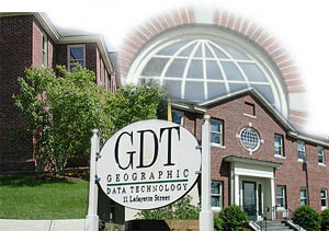
Tele Atlas to Buy GDT I was a bit surprised since I like to think of GDT as a small independent New Hampshire "live free or die" sort of company. That's not quite true since GDT's major investor, Polk, is in the driver's seat. From what I can tell, however, the company pretty much does its own thing. And, that's what must have attracted not just Tele Atlas, but that company's investors. I wrote at length about how GDT "makes" data some years ago, and that's a good deal of what TA wants. TA also wants the large loyal userbase GDT has in the U.S. TA is very strong elsewhere but, despite progress in developing its data for the North American market, has a bit of a "hole" in the U.S. I sat down with Pat Kearney (VP Sales and Marketing) and John Auble (Government Market Director) at GITA to discuss the acquisition. Neither was involved in the discussions, and both were interested in talking about the impact on customers at the outset. Many GDT customers have made their sentiments about GDT's coverage limitations (the U.S. and Canada and that's it) clear, bemoaning having to find vendors for other geographies. But GDT, stuck to its knitting. Now, international customers will have a "one stop shop." Kearney also noted TA's experience with dynamic content (weather and traffic), its complementary street database and its particularly good Points of Interest database as benefits for GDT users. "It's a 'no lose' for our customers," as he put it. From a business perspective two aspects are important. First, noted Kearney, you need to look at the numbers. TA revenues are some $80 million worldwide but $8 million in the U.S. GDT brings in some $40 million in the U.S. It's much like fitting two just slightly overlapping puzzle pieces together to cover the globe. That minimum overlap is true in sales and customers, as well. Second, he explained, TA will benefit from GDT's process. Recall that GDT uses brain not brawn to collect data. On one hand, Tele Atlas sends fleets to drive every corner of the U.S. and Canada as well as uses aerial imagery to update; competitor NAVTEQ uses a similar methodology but only drives the U.S. GDT, on the other hand, provides highly trained technicians with the sources and tools to update databases. This acquisition means TA/GDT customers will get data leveraging the benefits of both methodologies. Recall too, that NAVTEQ drives its streets on speculation while GDT customers have funded development (and actually participate in it via partnerships) over the last few decades. I also asked about potential layoffs, a downside of acquisitions. Kearney noted an expected $20-$25 million savings in duplicate investments. That translates mostly to duplicate staff. GDT will take the lead in North America: TA's North America headquarters will move to New Hampshire with GDT's Mike Gerling as its North American head. What about a market with two big players, instead of three? Kearney smiled, "We like being one of two players, rather than three!" More seriously, though, he explained, "the market is ready for two players. That's what this acquisition really means." There is one hurdle left. The acquisition must clear any Federal Trade Commission issues. Business people tell me the process would not have come this far if there were any concerns that the acquisition would not get approval there.
Letters
"I used to work for Navtech (no Q!) and during my years there IPO was always bandied about - now I know it's for real! As well as having Microsoft they also sell huge amounts of data to Mapquest (now AOL) and Vicinity (now Microsoft!) so they have a pretty neat customer base that investors understand. They also have some real blue chip customers with solid revenues, such as BMW and Ford." � Richard Hilton caught an error. I'd written: "Mixing Old and New. The Matsu idol travels a 300-kilometer pilgrimage across Taiwan in an ancient right. " He asks: "Did you mean rite?" The editor replies: Yes I did. � Tom Inloes of TCI Corp. found the discussion of the USDA Gateway timely. I'm holding some technical letters for next week, awaiting a response from USDA. Stay tuned. "Your tip and link to the Dept. of Agriculture site was very helpful to me. They had two different county-wide orthorectified images of Payette County in MrSID format. Exactly what I needed and free for the download. Thanks for the heads up."
Points of Interest Cleaning Up the Map. A state senator in Florida feels that it's time for Florida to clean up its map of offensive language. The plan is to remove some historical names that are currently considered offensive. Some concerned names related to the Civil War may also be impacted, but he says they will not. It's always tough to tell what's offensive and what is historical. My high school mascot was and still is the Sachems. Wanted: ArcGIS Reviewer. Are you an ArcGIS user? Want to tell other GIS Monitor readers the inside scoop on ArcGIS 9? Drop me an e-mail. No GPSs Allowed. Off the coast of Alabama some charter captains are barring fishermen from bringing handheld GPS receivers on board. Why? To help protect the secret spot where they've built their own reefs. Ideally, a guest on the boat can mark the location and return there to fish, basically "stealing" what might be a significant investment in a man-made reef. One captain who found a passenger with contraband said either the GPS went overboard or the passenger did. The GPS was tossed. One question: what will become of cell phones with embedded GPS? DigitalGlobe Barred from Upcoming NextView Procurement. The National Geospatial-Intelligence Agency put out its follow-up to the NextView bid won by DigitalGlobe last year. The only real difference is that company may not bid. NGA notified some 30 companies of the RFP and hopes to nurture new players. While Space Imaging and OrbView are likely contenders, Boeing, Northrop Grumman, and Lockheed Martin, are also mentioned as possible players. DigitalGlobe notes that it's unlikely it will act as a subcontractor on a bid.
Kudos and Conundrums Kudos (concepts we applaud) QuickBird Imagery Identifies Man-made Object on Mount Ararat. Last summer was a good time to look for Noah's Ark. Warm weather caused a meltdown meld-down on the mountain in Turkey where the Ark was said to land, revealing in DigitalGlobe imagery what appears to be a man-made object. A group of researchers intend to explore it later this year.Conundrums (concepts we question) Going After #1. Autodesk took out a full page ad in the Washington Post Tuesday to go after rival ESRI. A naked man, apparently in the woods, covered only by a map illustrates the headline: "Has ESRI left you stranded?" The text below offers a trial of Autodesk Map 3D. I have to believe this is the beginning of a concerted campaign. It certainly falls outside the box of what I know about advertising. Tracking Johnny for Profit. Bluesoft, Inc., KidSpotter A/S, and LEGOLAND have deployed a child-tracking application within LEGOLAND Denmark, a large amusement park. Parents can track children using what's called the world's largest Wi-Fi location network. And, the park collects information about where little Johnny goes, too. If that's the case, should Johnny (and Mom and Dad) receive a discount on admission instead of being charged for the privilege of being tracked?
Please note: Material used herein is often supplied by external sources and used as is. � Announcements A new map locator tool is now available in the USGS online store and provides a quick and easy way to find and order a topographic map. The catalog is online. MapInfo will resell KOREM's Push'n' See customizable Web-mapping solution for use with MapXtreme Java Edition and MapInfo Professional in the United States and Canada. har*GIS, LLC, and Enspiria Solutions, Inc. formed a business partnership to help customers improve field crew operations through the integration of advanced mobile technologies into existing business processes. The Carbon Project, an effort producing Windows-based toolkits that leverage OpenGIS Consortium, Inc. (OGC) specifications, is expanding its market development efforts through a distribution agreement with GeoLeaders. Ten Sails announced the formation of a new global business, Ten Sails Consulting, which includes its existing TerraPrise subsidiary. In addition to its existing management consulting services, Ten Sails Consulting now offers industry and location technology research, outsourced solution development, and location technology strategy consulting including mobile/field system solutions and Web Mapping/Intranet services. National Geographic's award-winning MapMachine Internet application has been completely redesigned using 100 percent ESRI ArcWeb Services. The Public Service Company of New Mexico (PNM) received a 2004 Geospatial Information & Technology Association (GITA) Innovator Award. The award is presented to organizations for their outstanding contribution and long-standing commitment to the geospatial industry. PNM is the largest provider of electricity and gas in the state of New Mexico. Trimble's Q1 results exceeded guidance: the company reported record revenues of $156.5 million versus guidance of $146.0 - $148.0 million or 24 cents per share vs. guidance of 17. Tele Atlas and FiRST Responder Systems & Technology announced a joint strategic initiative to deliver navigation, mapping, and data sharing products to the public safety agencies in the United States. In addition, the companies will host educational seminars at key national and regional events to assist first responder agencies in their research and understanding of how geographic information and data sharing systems for their operations can directly improve response times and ultimately assist in saving lives. � Contracts and Sales Telcontar, a leading supplier of software and related services for Location-Based Services (LBS), announced that gpmobile(TM) from gpware will be using Telcontar's Drill Down Server (DDS) spatial software platform for its unique navigation solution for the U.S. and Europe. gpmobile provides users with real-time turn-by-turn directions and route planning using speech input in multiple languages. Red Planet Consulting Inc. of Boulder, Colo., has used TensingoSKS SPY technology to develop FieldStorm, a truck-mounted wireless field solution for electric utilities. POWER Engineers, Inc. announced a contract to support the migration of JEA's current Intergraph FRAMME platform to ESRI's ArcGIS geodatabase format. North West Geomatics' announced its purchase of a second ADS40 Airborne Digital Sensor. � Products Spatial Business Systems Inc. is extending its current Smallworld GIS spatial interoperability tools to support the recently announced ESRI ArcGIS Data Interoperability extension and Safe Software's Feature Manipulation Engine (FME) product. The solution enables users of ESRI's ArcGIS 9.0 Desktop applications to directly access information that is stored in the Smallworld Version Managed Datastore (VMDS). Red Hen Systems, Inc., released MediaMapper version 5.1 which shortens the time to produce mapped video imagery over other competitive solutions by a factor of 10 and dramatically increases IDELIX Software Inc. released a Java version of the award-winning Pliable Display Technology (PDT) Software Development Kit (SDK). SPATIALinfo released its latest iteration of its Water Management solution, which enables Water Utilities to fully model, design, manage, and maintain their network. Taylor Technologies announced that Rapid Integration Toolkit (RITTM) release 4.o.4, for Web GIS sites, is now available. Strata launched its new PenmapGPS range of Rugged TabletPCs for field surveyors and engineers. The PenmapGPS is the first TabletPC that contains an integrated RTK GPS receiver which can deliver accuracies of 5mm. Miner & Miner (M&M;) announced the release of Responder 8.3.2, a GIS-hosted, distributed Outage Management System (OMS) as part of the ArcFM Solution. Responder is an OMS based on ESRI's ArcGIS. Red Hen Systems, Inc. released its latest spatial video collection solution, VMS-X, which fully integrates global positioning system (GPS) with digital video cameras. Safe Software Inc.'s FME spatial data translator product now supports reading several new XML (eXtensible Markup Language)-based formats: Geodatabase XML for ArcGIS 9.0, Landonline (LandXML), GPX, and IUF. The MathWorks announced the general availability of the Mapping Toolbox 2, a MATLAB toolbox that enables users to access geospatial data, build and manipulate map displays, and analyze geospatial data within MATLAB. � Events Geomatics Atlantic 2004 will be held June 7-9, 2004, in Fredericton, NB, Canada. The theme of the conference will be "DATA: Talk'n the talk." The conference program will include pre-conference workshops, exhibitions, keynote speakers, technical presentations, poster presentations, and The first ESRI Business GeoInfo Summit will take place June 28-29, 2004, at the Drake Hotel in Chicago, Illinois. This event is an opportunity for business managers, marketers, analysts, CIOs, information technology (IT) managers, CEOs, and others to learn about geographic information system (GIS) applications, georeferenced business data, and Web-based location tools. ESRI will offer a series of one-day seminars in more than 50 cities across the United States focusing on the next release of the ArcGIS family of products. The fifth annual ESRI Telecommunications and Location-Based Services Summit will be held August 8, 2004, at the Convention Center in San Diego, California. � Training � Hires MapInfo Corporation announced the appointment of Dr. Simon J. Orebi Gann to its Board of Directors. Dr. Orebi Gann is currently Chief Information Officer (CIO) for BP Integrated Supply and Trading (IST) business and Vice President of Digital and Communications Technology for the company.
Advertise With Us
Contact GIS Monitor is published by: GITC America, Inc.
Subscribe/Unsubscribe |