Letters, Points of Interest, Week in Review (Announcements, Contracts, Products, Events), Back Issues, Advertise, Contact, Subscribe/Unsubscribe If, for some reason you cannot read this document, visit: http://www.gismonitor.com/news/newsletter/archive/061203.php
EDITOR'S NOTE The goal of this issue is not to produce and exhaustive list of open source products; those are available elsewhere. Instead, I want to highlight the basics of the movement and how the products are being used. Mostly though, I want to try to make the whole idea a bit less mysterious. To that end, I want to share my first experience with open source software. Last week I spent some time with Analog, an open source program that analyzes website logs. Logs are files that list details about every "visitor" to a website. To make sense of the list, many websites use commercial software that analyzes such information as which pages are visited most and other statistics. A fairly experienced programmer tipped me off to Analog, with a confident statement that I could figure it out myself. His only concern was whether I had a C compiler (the software that turns raw code into a working program) on my computer. I didn't. After a bit of searching, I found out I could download an already compiled version of the program for Windows. I also found a very detailed online tutorial for Windows users. I followed along with the tutorial, and in less than an hour, obtained the statistics of interest in a very attractive HTML report. My needs were simple and I have no interest in changing the program. The reason I could download the program and get it to work so quickly is that many people in the community have contributed time and energy to create and maintain the software and the tutorial, and make them available. I was very impressed with my first open source experience. Adena

WHAT IS OPEN SOURCE? A particularly helpful analogy comes from Paul Ramsey of Refractions Research, a company that provides open source GIS. Writing in GEOWorld, Ramsey states, "Using open-source software is like eating at a restaurant where the recipes are served alongside the meals--you can simply enjoy the food, but you also have the option of taking the recipe home, changing the seasonings and serving the result to your friends." The Open Source Initiative, a non-profit organization, provides a general definition of open source and lists about 50 licenses that it has approved as meeting its expectations. This list includes the GNU General Public License (GPL), from the Free Software Foundation, the one about which I've heard the most. One major appeal of open source software is that most of it is available without charge; that is, it's available for download at no cost. That does not mean that these products are not sold on CD for a fee, or used in consulting projects that require payment, or enhanced with code or extensions that are for sale, or used in commercial products. The freegis.org website, and others, remind users that "free" in the context of software, or in the context of the Free Software Foundation, is to be understood like "free speech" or "free market" and not "free lunch." Open source software is making big strides. Oregon's state legislature is debating a bill that would require state agencies to at least examine open source software products when issuing procurements. Open source programmers and school districts like the idea; traditional, non-open source software vendors do not. As the fight has progressed, some of the bill's teeth have been lost: proponents have agreed to drop a requirement for agencies to justify purchases of proprietary programs. Proponents feel the bill will save money, allow users to customize the software more fully, enhance interoperability, and encourage economic development in the state. If the bill passes, Oregon would be the first state to have such legislation. Texas is exploring a similar measure.

OPEN SOURCE GIS Despite GRASS's long life, there is a new rising star: UMN MapServer, a Web-based GIS, originally developed at the University of Minnesota. MapServer implements the OpenGIS Web Map Service Specification (WMS). MapServer is a rising star because of the community of companies, governments, and individuals now using it. One of the larger service companies that is using MapServer is DM Solutions, based in Canada. One of the smaller ones is my neighbor, Kevin Flanders, owner of PeopleGIS (more on his work below). How does MapServer stack up to commercial offerings? Flanders acknowledges that commercial products have more "bells and whistles, tools and add-ons." But, he feels, at very many levels, the products are quite similar. "You use ASP to program most commercial packages and you can do the same thing with open source software." Flanders uses the open source PHP development tools for his implementations. (We use PHP on the GIS Monitor website.) Flanders suggests that open source software is the market's answer to a monopoly-perceived or real-which explains the excitement around Linux. The GIS market, he admits, is far different from Microsoft's since it is far smaller. And, he goes on, that small market size results in the high cost of commercial Web mapping software. Developing a well tested, mature product requires an organized, committed, focused group of programmers. The open source community that grows and supports MapServer may be smaller than the development group at a large GIS software company, and it's certainly less organized. But, the open source model does promote collaboration, which results in some impressive software applications while allowing for a completely different pricing structure. MapServer and other open source map server technologies are growing, but what of open source desktop software? GRASS joins a good number of other open source desktop GIS products today, but the growth doesn't seem to match that of open source Internet map servers. IDC estimated that in 2002 open-source desktop software matched the market share of Apple, at about 3% market share. Flanders suggests that the history of GRASS may be too tied to the academic, military, USGS tradition that spawned it, to move into wider use. He believes GRASS also has a daunting installation procedure and equally challenging learning curve, which may limit its use within municipalities and small businesses. While products are available (for a price) that simplify those aspects, somehow they've not been enough to put GRASS on the broader GIS radar. Flanders points out other open source desktop products that have their own hurdles to overcome: few have third party development tools, (something that's becoming almost required for open source success), few have decent tools to produce effective hard copy maps, and finally, few have grown large enough market share to take themselves to the next level.

OPEN SOURCE GIS IN THE REAL WORLD
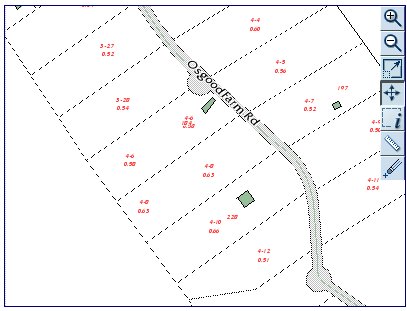
Flanders is the first to admit that he had to pay his dues learning MapServer. He estimates putting in about 1,000 hours to learn, use, and develop his applications for MapServer. While pleased with his applications, he looks forward to working closely with his clients to extend functionality and enhance the end-users' ability to leverage GIS data on the Internet. Flanders uses MapServer as the backend of his online mapping service, MapsOnline. He hosts Web mapping applications for small towns (that's a bit of Littleton, New Hampshire above), non-profits, and government agencies, mostly in the Northeast, and is pleased to be able to provide "what they need" for the "right price." MapsOnline is a custom, hosted, online GIS, complete with regular data updates. PeopleGIS offers the service for less than half the price of software alone from some proprietary vendors. Client bills include all necessary consulting services, but the actual software cost is zero. "That," Flanders explains, "means that they can get a lot more application for their money. The technology is invisible on the bill and once clients understand the open source model, it's rarely discussed a second time. What we do discuss is how they are using the maps and tools and what they want to do next. It's great when a client realizes that the work is not about the technology, but about them. That is when real progress is made."

OPEN SOURCE POINTS OF INTEREST � nearly every geospatial technology vendor uses open source libraries in its code (Frank has written some of them) � open source desktop GIS may be appropriate for "technically astute users" or those who are "are very price sensitive" but for the most part there's no solid movement for a broadly-based end-user product � open source databases that support spatial features (PostGIS, built on the open source database PostGreSQL and MySQL) may play a key role in challenging Oracle Spatial in that space. For now, however, there is limited support for them, based (not surprisingly) in the open source community (in MapServer, for example) NIMA and Open Source. An article at NewsForge explains that NIMA has been spending money trying to figure out if it can use open source software. The agency, thought its National Technology Alliance (NTA), commissioned ImageLinks, an open-source-using company in Florida, to work on new open source geospatial software. The project also revealed how the "spontaneous, idea- rather than manager-driven, and fast-moving" open source development model would fit into the straight-laced government. The conclusion was that it wouldn't fit well at all. But NIMA would not give up on the idea of using open source, and therefore contracted with ImageLinks for $250,000 to figure out how to make the two cultures "match." The solution suggested involves tasking NTA to act as a middleman to shield the agency from the chaos of the open source process. 3D World on the Web. Australia's The Age reports that Australian developer Ping Interactive will use a $250,000 grant from Telstra to model the earth online using virtual reality markup language (VRML). While I recall quite a bit of hype around VRML a few years ago, I've not seen it mentioned lately. The model will include 3D visualization and add in "time," allowing visitors with fast Internet access to find a location and look back in time there. The article explains that this type of product requires three key things: effective rendering technology, less expensive geodata, and appropriate Internet access for clients. Telstra is a telecommunications firm that provides, among other things, broadband. Chris Thorne wrote to add a few important details including the fact that Ping owns the intellectual property and plans to release it under GNU Public License. A short paper is available from the Ping website. Showing off Technology with Open Source. Imagine you are developing a new technology related to mapping, for example, a new add-on for geocoding or routing. How could you show it off? You could join the developer program of a commercial vendor and use its Web solution to illustrate your new tool. Or you could use an open source solution for free. When On Time Systems wanted to show off its new intelligent traffic sensor and routing technology, it chose MapServer. This is interesting for two reasons: First it saves the company money so it can focus on using resources to develop its own technology. Second, it means that the first time potential buyers see it, they know it works with this platform, which may encourage future use of open source technologies. Open Source GIS Paired with Commercial GIS. Terrestris in Germany offers an ArcView add-on that allows projects to be easily hosted on MapServer. More Open Source Tools for Open Source Software. DM Solutions Group Inc., has announced Chameleon, a technology developed to easily create highly customizable Web mapping applications. Chameleon technology allows an organization's IT Web infrastructure to seamlessly integrate mapping content with standard Web development tools. Chameleon technology will be released under an open source license, and was developed in PHP with the University of Minnesota's MapServer as the backend technology. Safe Supports Open Source. Safe Software has added MapServer support to its web-based data delivery product SpatialDirect. This solution enables users to download data viewed with MapServer directly to their desktops in any format and projection. Dale Lutz, VP at Safe put it this way, "Why did we do it? Well, in the end it came down to this - customers asked for it." The company's FME supports PostGIS, built on the open source PostgreSQL database. Safe is also looking into supporting MySQL, another database with spatial support and further work with MapServer.
Second, I believe open source GIS will become mainstream as it is used alongside commercial solutions. The work noted above by open source and non-open source vendors to link open source and commercial products, an updated PostgreSQL/PostGIS combination that rival's Oracle Spatial, and MySQL heading toward spatial support, all combine to open doors to mixed environments. I think it's important to note, too that these and many other GIS solutions run on "traditional platforms" like UNIX and Windows along with open source Linux. If I were managing a commercially-based GIS implementation, I'd look at how open source can enhance my existing software. Third, one key aspect of open source software that's often overshadowed is licensing. Some organizations have one or more individuals on staff simply to manage software licensing with commercial providers. This involves cost, and each additional license typically adds cost. With open source software an organization can have as many developer and user seats as needed. (For MIT's Athena, a campus-wide platform, licensing 1000 copies of a commercial package can be prohibitively expensive, so only those commercial applications are purchased that are absolutely required. They include, interestingly, ESRI and Autodesk products. Nearly everything else must have an approved open source license.) These costs are particularly significant with high-priced Web server applications. What if your town wants to duplicate its Internet or intranet Web mapping application in a kiosk at City Hall? A commercial solution would typically require a second license; an open source solution would not. For example, MapsOnline clients often replicate their online mapping applications on computers that are set up at their town halls for just the cost of the computer and consulting. There's an added benefit: end-users that receive assistance from town staff actually become better end-users on the Internet version. Finally, I think there's great energy in open source software in general, and open source GIS in particular. The fact that open source is "keeping up" at some level with commercial vendors who have been in the business for more than 30 years is very interesting. This should give potential users a good reason not to ignore its potential.

OVERSIGHT HEARING ON GEOSPATIAL TOPICS Less than a week later there was an oversight hearing on "Geospatial Information: A Progress Report on Improving Our Nation�s Map-Related Data Infrastructure" by the House Government Reform Committee's Subcommittee on Technology, Information Policy, Intergovernmental Relations and the Census. Mark Forman, OMB administrator of the office of electronic government and information technology, spoke. He noted how lack of standards hampered efforts to find and use spatial data. Ironically, in the context of the duplicate portals, Rep. Adam Putnam of Florida argued that the lack of standards "results in wasteful redundancies and a reduced ability to perform critical intergovernmental functions." Forman himself suggested that some 50% of geospatial spending was duplicative. Linda Koontz, director of information management issues at the General Accounting Office, also focused on standards as a key element in solving geosptial data problems, and referred to OMB's efforts as "not new." Specifically, she noted, "While Geospatial One-Stop's objectives are important, they do not represent a significantly new or different approach to the GIS integration problem that the government has been struggling with for more than a decade." What was new in the effort, that she did not point out, was the OGC team-a multi-vendor team-tasked to produce an open interoperable prototype. Having ESRI build a portal was not new, as the company has already built one (GeoCommunicator), for the Bureau of Land Management. In fact, it was an extension of that contract that funded ESRI to develop its GOS portal. Koontz's testimony includes some interesting points: � One risk factor for GOS is the likelihood that many government agencies will not accept FGDC created standards (the underpinnings of GOS) since they were not involved in their development and may not meet their needs (p. 11) � "Despite the creation of the Board of Directors, questions have been raised about the breadth of participation in Geospatial One-Stop"(p 15) Management Association for Private Photogrammetric Surveyors (MAPPS) President Mike Ritchie testified, too. His testimony is online. Of interest in his testimony are these points: � "We support the use of an open system approach, with standards to assure interoperability, that are not dependent on a single or particular provider. We support the use of full and open competition, via the qualifications-based selection process, for contracts for geospatial services." � "By omitting access to private sector data, Geospatial One-Stop falls far short of offering one-stop shopping�" � "If it continues on its current path, there is a significant risk that Geospatial One-Stop would compete with private offerings." Also testifying were the Spatial Technology Industry Association, Preetha Pulusani of Intergraph, and Jack Dangermond of ESRI.

LETTERS "�there is one suggestion that I wanted to share and that's regarding some enhancements in the newsletter. You have provided quick links to different sections of the newsletter at the top of the letter under the contents. I think it is a very good idea and I would like to see it with all the other sections such as Products, Letters, Points of Interest, Week in Review, Contracts and Sales and Events etc. Just like a quick link to different topics. The reason is that when I forward a specific news item, it may be a little hard to locate it for some of the people, and I wouldn't want them to waste time on that! "I am aware of the great work you and everyone at the GIS Monitor are doing, but this little enhancement will make this even more appealing for people like me to forward and spread the news." The editor replies: That was a great suggestion, and as you can see it's been implemented in today's issue. I'm pleased to hear GIS Monitor is forwarded so widely. � Last week's data model piece prompted this from Julie Maitra, Vice-Chair, INCITS Technical Committee L1, Geographic Information Systems, also known as INCITS L1: "Your article on data models was an excellent effort at explaining the concept to the layperson. "INCITS, the InterNational Committee on Information Technology Standards is an ANSI-accredited standards development organization. INCITS L1 serves as the U.S. Technical Advisory Group (TAG) to ISO Technical Committee 211, Geographic information/Geomatics. OGC is an advisory member of INCITS L1. "I would like to make a few comments: "Tri-Services, which maintains the SDSFIE, is now called the CADD/GIS "The project to develop the data content standards through the Geospatial One-Stop initiative is a standards project approved by INCITS. Eventually, these will be approved as American National Standards. "On the next issue, please keep in mind that I am not the U.S. Technical Expert on this topic, and my understanding might be incomplete or even inaccurate. I have cc'ed Dr. Charles Roswell, who is the technical expert (and also INCITS L1 International Representative), so that he might provide clarifications or corrections to my comments. Your article cited ISO 19107, Geographic information - Spatial Schema, which provides a conceptual schema for geometry and topology of geospatial information. "ISO 19109, Geographic information - Rules for applications schema covers conceptual modeling of features and their properties, use of conceptual schema language (for example, UML) for applications schema; transition from the concepts in the conceptual model to data types (such as UML data types) in the application schema; and integration of standardized schemas (spatial, temporal, metadata, quality, and gazetteer) from other ISO geographic information standards with the application schema. ISO 19109 therefore provides guidance on building a complete data model - Spatial Schema is but one component." The editor replies: I'm hoping to contact one of the experts on this matter to get it straight. Dr. Roswell and Kurt Buehler at OGC were both unavailable this week. � I requested some feedback on the use of data models by end-users. While I received several positive responses to the article, I only received one response about the use of data models, from Greg Bury, GIS Manager at the Naval Air Engineering Station in Lakehurst, NJ. "Very good info on data models. In recent years, I've heard more & more about the importance of standards, and their advantages are clear to anyone who has done any large data modeling effort. Still, the "real work" (data & product development) always seems to fill up the available time & attention. So at Lakehurst, we continue to use the ad hoc model we developed years ago. "We're beginning to incorporate translation to SDS [SDSFIE] in our services contacts, so that what we get back moves us closer to that model. On that note, I'd very much like to see a discussion of SDS, and how it fits in with industry. As a Navy base, we're required to use SDS. The existence of other partnership and vendor-developed models is another reason why we've waited to convert our data." The editor responds: That's a good question. I'll see what I can dig up.
Quote of the Week. John D'Agostino, Town Manager of Mansfield, Massachusetts, comments on the value of the town's new GIS system: "It's a value that really doesn't have a value attached." Huh? New Geospatial Billionaires. Shares of Garmin Ltd. passed the $49 mark on last week, making Garmin Co-Chairmen Gary Burrell and Min Kao billionaires on paper. The company held its stockholder meeting during that week to a happy crowd. One tidbit of interest: Garmin is looking to acquire companies in the $20 million to $60 million range that could accent its technology or product line, according to chief executive Min Kao. GPS Games. It seems that Garmin's latest group of GPS devices has built-in games. These are real life "hide and seek" games, but the seeking is "virtual" in that there are no hidden objects-you need only reach the correct position to "tag" or "hit" the target, depending on the game. There are four games with differing levels of difficulty. I suppose they are sort of like geocaching without the physical "finding." Tales of the Weird. Apparently there's a cable TV show called "It's Good to Be�" on ETV, a cable channel. The show (subtitled "A Cash Course on the Lifestyles of the Filthy Rich & Famous") is about how much money the rich and famous spend. An upcoming episode features Madonna. I'm getting to the geospatial part. E! Online notes that one can view the imagery like that which appears in the episode at www.earthviewer.com. That's Keyhole, the folks who provided much of the "fly around" imagery used by the news media during the war with Iraq. Thanks to Ann Kasunich for that odd connection. Men, Women and Directions. MSNBC reports on a Canadian study, published in the most recent issue of Annals of the American Association of Geographers, that explores wayfinding in men and women. Bottom line, both are equally good at getting around, but use different techniques. Nothing too earth shattering according to the article, but it does highlight the public interest in the topic. ROWing. I'll be speaking at the International Right of Way Association Conference next Wednesday in Kansas City, Missouri. Until recently I didn't know such an organization existed, but it's "a natural fit" for GIS. Beacons for Safety. Officials from NOAA and the U.S. Air Force announced the authorization of a new, digitally encoded distress device called the Personal Locator Beacon (PLB), which will become available for nationwide use beginning July 1, 2003. Users are required by law to register the beacons, which use a variety of satellites to track and identify those in trouble. The system has been tested since 1995 with users in Alaska, and has saved some 400 lives with only a few false alarms. More on Geography and Breast Cancer. Geographers and epidemiologists from the University at Buffalo used GIS to examine breast cancer patients in that area of the country. The results show that women who developed breast cancer before menopause can be grouped based on where they were born and where they lived during maturation. The clustering suggests these women may have been exposed to something in the environment during those key times in their lives. Daikwon Han, Ph.D., postdoctoral fellow in the UB Department of Social and Preventive Medicine and first author on the study, will present the findings today at the annual meeting of the Society for Epidemiologic Research. Geographers Making "Piles of Money." That's how SUNY Buffalo geography professor Alan MacPherson describes his six recent doctoral students who chose not to go into academia. All May graduates holding masters degrees or PhDs have found employment, the university reports. Many are in industry and government, and many use GIS. URISA Summit Update. URISA has posted many comments provided by attendees on its website. Most are very positive and call for the event to be repeated. An article by Paul Tolme covers some material I was asked not to cover. Next Week. Due to the length of today's issue, we've saved coverage of last week's OGC/GITA Emerging Technology Summit for next week's edition. It will include a recap of Tim Berners-Lee's presentation and other highlights of what I'm told was a very exciting event.
� Announcements ImageLinks Inc. has entered into a long-term business relationship with CAE Inc. of Montreal, Canada, as CAE's preferred provider of imagery databases. CAE provides advanced simulation/controls equipment and integrated training solutions for customers in the civil aviation, military, and marine markets worldwide. 3Di Technologies, Inc. (3Di) entered into an exclusive agreement with Schafer Corporation to license its LiDAR processing software for two- and three-dimensional building modeling and vegetation removal. Laser-Scan released a white paper for professionals in the telecommunications industry. Laser-Scan's paper "Enhancing the Customer Experience Using Location Data" is available at for download in PDF format. ASPRS announced the approval and official release of the ASPRS LiDAR Data Exchange Format Standard at its recent 69th Annual ASPRS Conference and Exhibition held in Anchorage, Alaska, in May. This new binary data exchange format is intended to serve as an industry standard for the exchange of LiDAR data between various hardware manufacturers, software developers, data providers, and end users. It was originally developed by a consortium of industry partners (Z/I Imaging, EnerQuest, Sanborn, US Army Corps of Engineers, Optech and Leica GeoSystems) and is intended to make the exchange, manipulation, analysis and storage of LiDAR data faster and easier. (As we go to press the standard is still not available on the organization's website.) Laser-Scan has been awarded an S-CAT framework agreement for category 15, GIS software. S-CAT is a catalogue-based procurement scheme to provide public sector organizations with a simplified means of procuring, and contracting for a wide range of consultancy and specialist services from a variety of service providers. The Open GIS Consortium, Inc. (OGC) announced that its Board of Directors voted on May 27, 2003 to reaffirm OGC's intellectual property rights (IPR) policy. OGC's IPR policy is designed to protect the Consortium's standards framework from patents that would impede development of open infrastructure for interoperable geoprocessing. Definiens Imaging GmbH, Munich, Germany and GTT NetCorp have signed an agreement, which allows GTT NetCorp to distribute Definiens' object-oriented image analysis and feature extraction software, eCognition, to the Mexico, Central America, Colombia, Venezuela, and Caribbean markets. MapInfo announced its e-Government Grant Program. The company will award a suite of its location-based software and data, powered by Geographic Data Technology, Inc., to 50 municipalities and government agencies in the United States for the development and deployment of e-government initiatives. Municipalities with populations of 150,000 or less are given preference for MapInfo's e-Government Grant Program, which runs through December 15, 2003. MapInfo will offer three additional grants for the use of MapInfo MapXtreme, its mapping application server, but municipalities must be able to allocate funding for the custom development needed for that solution. To qualify, applicants must submit an e-government plan for the use of MapInfo software and data. Send an email for more information. � Contracts and Sales 3Di Technologies, Inc., was awarded a contract to provide LiDAR and 3-D city modeling services for the greater Boston metropolitan area by the Massachusetts Executive Office of Environmental Affairs (through MassGIS). Partial funding for the project was also provided by the U.S. Geological Survey. Monitoring Automation Systems (MAS) and GeoMicro, Inc., announced a partnership to integrate GeoMicro's AltaMap product into MASterMind Monitoring and Business products. This development expands MASterMind's capabilities to include location intelligence. Intergraph Mapping and Geospatial Solutions announced that Intergraph UK has been chosen to develop and implement Plymouth Informed, the City of Plymouth's Web-based spatial visualization and analysis system. Full Circle Technologies announced that the town of Hillsborough, New Hampshire, has signed a contract to Web-enable the town's GIS by using the company's VectorEyes product. Space Imaging has won a contract from the National Imagery and Mapping Agency (NIMA) to evaluate a new technology enabling the rapid search of large imagery databases for specific elements such as vehicles, buildings, weapon systems, and geographical landmarks. The technology, created by Look Dynamics of Longmont, Colorado, combines optical and digital processing to build intelligent shape- and pattern-based databases. Montezuma County, Colorado, contracted with Sanborn to provide aerial photography and topographic mapping for the Dolores River, located in the southwest corner of the state. � Products Metropolis New Media, Inc., a provider of managed hosting services for ESRI server products, announced that it has enhanced its Managed Security service with proprietary Intrusion Prevention technology. The Intrusion Prevention System, or IPS, scans all traffic on the Metropolis network at wire speed and eliminates any malicious traffic. In addition, the IPS is able to filter traffic for ESRI-specific content, and control the flow of that information into or out of the network. Autodesk Location Services, a division of Autodesk, Inc. has provided Fiat division Targa Infomobility with the technology behind the location services available via the first commercially available wireless car navigation system now being offered with the latest Fiat Punto model. This integrated GPS/GSM system is the first device that does not use CD-ROM maps for navigation because all of the information is sent out by a centralized system at the Targa Infomobility Milan Service Centre, adding convenience and lowering costs to consumers. This centralized set up also enables the information to be offered in 12 different languages. Safe Software Inc. announced availability of FME Suite 2003 X2. FME Suite 2003 X2 is a Spatial ETL (Extract, Transform, Load) tool that makes it easy for organizations to translate, transform, share and enhance their data between over 100 GIS, CAD, and database formats. Key new enhancements in FME 2003 X2 include powerful additions to the Workbench graphical transformation editor for handling large data models and data volumes, expanded format support, and batch deploy capabilities. Format support has been expanded to include MicroStation Design File Version 8 reading, GeoMedia SQL Server Warehouse reading/writing, PostGIS/PostgreSQL reading/writing, ArcGIS Binary Grid reading, ESRI ASCII Grid reading/writing, and CDED DEM writing. ESRI announced availability of a new version of its collection of ArcWeb Services for developers. This suite of Web services, called ArcWeb for Developers, was previously known as ArcWeb USA. ArcWeb for Developers is a suite of data and functionality that can be published and accessed over the Web. When users subscribe to ArcWeb for Developers, they can include geographic functionality in their applications without having to host the data or develop any GIS applications themselves. These services use Simple Object Access Protocol (SOAP), which means they can easily be integrated into any Web page or custom-built Internet application. DM Solutions Group Inc., a Web-mapping solutions company, today announced Chameleon, a technology developed to easily create highly customizable Web-mapping applications. Chameleon technology allows an organization's IT Web infrastructure to seamlessly integrate mapping content with standard Web development tools. Safe Software Inc. has added MapServer support to its web-based data delivery product SpatialDirect. This solution enables users to download data viewed with MapServer directly to their desktops in any format and projection. Spatial Insights, Inc. released "ProximityDemographics," a new data product designed to facilitate market studies. Unlike traditional demographic data, which provides individual counts and tabulations for each specific unit of geography, ProximityDemographics provides a measure of cumulative demographic data within a specified radius or drive time of each geography. ObjectFX is now delivering version 3.3 of its flagship software platform SpatialFX. The updated product adds new features targeting government customers along with advanced web capabilities and advanced J2EE capabilities and conformance. Cadcorp announced integrated support for Safe Software's Feature Manipulation Engine (FME) Objects within Cadcorp SIS V6.0. � Hires and New Offices Corbley Communications Inc., a public relations and advertising firm serving the international geotechnologies industry, has opened its office in Fort Collins, Colorado. � Events Peter Batty will present a luncheon address at the 16th Annual GIS in the Rockies Conference scheduled for October 1-3, 2003 in Denver.
ADVERTISE WITH US
CONTACT
SUBSCRIBE/UNSUBSCRIBE |