Letters, Points of Interest, Kudos and Conundrums, Week in Review (Announcements, Contracts, Products, Events, Training, Hires) Back Issues, Advertise, Contact, Subscribe/Unsubscribe If, for some reason you cannot read this document, visit: http://www.gismonitor.com/news/newsletter/archive/100704.php
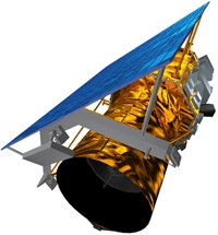
Orbimage will build and fly OrbView-5 (right) which will collect .41 meter (panchromatic, aka black and white) imagery. The bird should be in orbit by 2007 and the company has already begun plans for its financing. The rest of the team includes General Dynamics, Kodak/ITT Industries, and Boeing Launch Services for the satellite andas well as IBM and MacDonald, Dettwiler Associates of Canada for the ground segment. Orbimage was the last of the three commercial companies to get its 1-meter (or higher resolution, DigitalGlobe's .61 meter) satellite, OrbView-3, up and running last June. The 115-person company emerged from bankruptcy within the last year. With this contract Orbimage is back in the game heading in the right direction, both for its investors and employees. Company shares were up 71% last Thursday at $13.50 and jumped up to $17 last week before closing at $15.50 yesterday. While the award means lots of parties in Dulles, Virginia, where Orbimage is based, it means many long faces in Thornton, Colorado, home of Space Imaging. In fact, the real story here may be the fate of that company and its 260 employees. Recall that just two weeks ago Space Imaging sold its Federal Civil/Commercial Solutions (once Pacific Meridian) to Geo360. The Rocky Mountain News reported last week that L3 Communications had an agreement in place to buy Space Imaging, should it win the contract. That's not the way things played out. Who is L3 Communications? I'd not heard of it until last week. It's been described to me as a collector of small technology companies (and their contracts) which serves the defense and intelligence community. Profit is made by trimming down bloated organizations and retaining those long-term contracts. Based in New York City, it owns an array of companies, worldwide. I've heard it speculated the company might be interested in purchasing Orbimage, too, though at this point that company is rather lean. Space Imaging representatives suggested that the short term future is good and that the company expects a good year-end revenue. After that, it's not clear. Layoffs are possible, as is winding down operations or the outright sale of the company. The company's Mark Brender, quoted in the Denver Post, noted that "without a NextView contract it's going to be much harder to raise capital to build a next-generation imaging system to replace Ikonos." Lockheed Martin, one of Space Imaging's largest owners has said it will not make any further investments in the company.

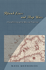
Book Review: Rhumb Lines and Map Wars So, I figured, this book has a lot going for it and sat down and read it. I wasn't disappointed. Rhumb Lines and Map Wars is subtitled A Social History of the Mercator Projection. And, that's really what it's about: how and why the projection came to be, how it was toppled as the projection in atlases and some but not all wall maps, and most interestingly perhaps, how social forces made it the scapegoat for many to explain why some parts of the world don't get the respect they deserve. Underlying the discussion is a critical look at what becomes its "chief" rival, the Peters Projection, and the suggestion that many other fine projections might have served its backers even better. The good news about the book is that the introductory chapters do take you through a history of the Mercator projection. That's always valuable to us in the GIS arena who often get so wrapped up in our specific mapping that the stories and rational behind our key tools get pushed away. The discussions are not too technical (Monmonier makes it clear in the introduction that there will be only two formulae included) and nearly all technical discussions are accompanied by illustrations. For me it was a nice visit back to my cartography class in college (where Monmonier's How to Lie with Maps was required reading) to recall that a rhumb line was a line of constant compass bearing and that the big deal about the Mercator projection was that rhumb lines on such a projection were straight lines. If a sailor used a Mercator with a map that wangled great circle routes to be straight lines, he could approximate a great circle (the shortest path) with several segments of constant compass bearing (easy to sail!). That explains part of the fame of the projection, but there are other quirks of history that enhance that legacy. If you like James Burke type connect-the-dots stories, this book will suit you fine. Monmonier traces the impetus for several projections to the needs of the military (transverse Mercator, from the long range field gun in France) long distance flying (oblique Mercator), and satellite remote sensing (Space Oblique Mercator). There's appropriate homage to John Snyder, who until reading this book, in my mind was just the fellow who wrote that big red book of math for projections. (My copy was passed on to a more appropriate user, one who always borrowed it from me, when I left my first real GIS job.) The climax of the book is the detailed examination of the Peters projection and how Arno Peters and his supporters made the "big flap" they did. (The discussion was even covered in GIS Monitor when the TV show The West Wing raised the issue and later, when a company put out a press release alleging its appearance behind Jimmy Carter when he was given the Nobel Peace Prize.) My favorite part of the Mercator vs. Peters story, being an editor, involves publishing. The American Congress on Surveying and Mapping's (ACSM) Bulletin at one point printed a West German government press release about the Peters projection. The publication of the piece was later read as an endorsement of the projection by ACSM, instead of what it was, reporting of news. (Interestingly, I still see companies in the geospatial industry note that their press release was picked up by such and such publication, as though that gives the content credibility!) To close, Monmonier shares his opinion on map wars, which was clear to me at least, from the start: "I feel like a heretic to say it, but cartographic scholars engrossed in ideology and empowerment have vastly inflated the importance of maps, and with it the significance of their scholarship." Basically, he concludes, projections are here to stay: they have history and baggage and branding and we need to deal with that. More importantly, perhaps, he subtly weaves in this advice: the novice and experienced cartographer must be vigilant to choose an appropriate projection for their products.

Visiting The Mathworks The company was good enough to host a meeting of the New England Region chapter of the American Society for Photogrammetry and Remote Sensing, ASPRS. And, the staff involved in mapping and imagery gave us an introduction to how MATLAB serves those involved with geospatial challenges. First off, what is technical computing software? Here's what I came away with: it's not exactly a development platform for a programmer (you don't need to be a programmer to use it) but it's not an end user application, either. After a few demos I'd describe it as an environment in which to build models. MATLAB was conceived as a set of tools to develop mathematical models. And, in the company's 20-year history, toolboxes have been added to serve different needs, including those of mapping/imaging modelers. There are three toolboxes related to mapping and imagery (Image Processing Toolbox, Image Acquisition Toolbox, and Mapping Toolbox), each with many tools (think really focused tools, such as one that just brings in a shape file or resamples an image) that users can build up to make a program (model) to run. Then, of course, the user can tweak the model as needed, and optionally, turn it into a stand-alone program someone else might use. Says a press release about the latest version of the Mapping Toolbox: "With the combined powers of MATLAB and the Mapping Toolbox, engineers and scientists can perform original research and develop innovative analysis techniques for mapping and geospatial analysis applications." To be fair, you can do some of that sort of work within many GIS packages, even if you are not a programmer. And, you can update your scripts/models as needed. So what's different here? First off, the range of core mathematical tools outshines most, if not all, GIS packages. Second, if you already work in the Matlab environment, adding GIS visualization or analysis is a piece of cake. Third, it's a "technical computing" way of coming at geospatial. The company boasts geospatial users in earth and ocean science, communications, insurance, deforestation, and environmental monitoring. Those are just the places you'd expect to see traditional GIS, too. I suppose The Mathworks' tools are simply the reflection of the intersection of GIS with technical computing, just as recent spatial data storage solutions are simply the result of the intersection of GIS and IT/database computing. Expect more of these sorts of "intersection" products to appear and grow in the coming years.
Localism In any case, the piece goes on to note a few applications of localism that have recently appeared. Plazes connects your location to an IP address (it appears) then allows searching and connecting with others. Yahoo Local officially launched this week. Yes, it's basically a local search, but the great thinkers (ok, contributors to Poynter.org, a site for journalists) believe it may kill the local Yellow Pages, if only due to its reviews of businesses. I appreciate that point. It's not just that the material is online, and its not just that its geographically searchable, it's also that it offers more than a traditional Yellow Pages.
"Good discussion on the media's take on imagery use. It is usually easier and more typical for law enforcement to find out about the presence of a truck in a certain place at a certain time by asking people who live in the area! These are the 'spies' that are used most often by law enforcement, people who look out their windows. "Also, in comment to the part about security cameras, it was recently reported that the City of Chicago is installing a system that pulls together real-time data from security cameras all over the city, including those watching streets, parks, and stairwells in public housing. The article said that 'special software' would be used to detect suspicious behavior such as 'someone leaving a bag in a stairwell.' Sorry I don't remember the source on this one!" � Two weeks ago I wrote about MapInfo Exponare. I received this correction from the Exponare Product Manager, Damien Cassin based in Australia, via MapInfo's press staff here in the U.S. "In your news brief, you described Exponare as a Rapid Application Development tool (RAD). Damien believes the partner was actually trying to communicate that Exponare is a 'Rapid' tool to deploy. In summary, Exponare could be described as a server product, that is extremely quick to deploy throughout the enterprise, to configure through its generic configuration tool and to integrate with other corporate applications."

Points of Interest BE Magazine Launched. Bentley has launched a new electronic publication, BE Magazine. Subscriptions are free. The first 82-page issue (vol. 1, number 2) covers this past spring's BE Conference. It uses the NXTbook technology that makes it look as though you are reading a real magazine online. The company is re-branding its conference, newsletter, and magazine and has a central website for it all at Be.org. On the Move. Mobility Technologies announced the appointment of Michael F. Nappi as Senior Vice President of Business Development. Mobility Technologies is a traffic information provider. Nappi, only months ago (July), took the position as president of GeoVantage, a digital sensor developer and service provider just north of Boston. The Mobility Technologies press release notes his previous positions at Webraska and MapQuest. Go Fish! A new location-based game is available for those with Bell Mobility service (Canada). Blister Entertainment Inc., a division of KnowledgeWhere Corp., launched Swordfish, which uses the phone's GPS and a proprietary development platform to allow subscribers (fisherman) to move to locations of fish, and catch them. The company says this is North America's first GPS-based cell phone game. PDF for NGA. I've gone on about Layton-Graphics' mapping "enhancements" to PDF several times (1, 2). But now the company has made the big time with a contract from the National Geospatial-Intelligence Agency (NGA). NGA will be distributing GeoPDF, in addition to milspec maps, to its customers in the military and intelligence communities. NGA will use MAP2PDF on Panasonic Toughbooks to make the georeferenced PDFs and distribute them for use with the Adobe Reader/Acrobat. This suggests to me that other formats vying to beat PDF have an uphill battle. The other big news from Layton? There's now a free trial of its tools available for download. Hunters and Inertia. The York Daily Record reports on a Penn State study of hunters tracked with GPS devices. A few findings: Hunters in the park in question rarely travel more than 1/3 mile from the road. They avoid steep slopes. In fact, the study suggests that the pressure created by hunters on the deer populations may not be as high as expected. No Killer LBS App. "'There are no killer applications that are driving this technology today.' [�]Aside from GPS navigational systems for cars and asset tracking, there are no 'must-have' location-aware services." Mark Jacobstein, president of Digital Chocolate, a developer of software for mobile phones in an article in PC World highlighting the Emerging Technology Conference at MIT last week. Other "big news": privacy is not a big deal, devices should have "on/off" buttons for tracking, and security is the killer app for LBS. On the other hand, there is this development: LBS in art in Canada. GAO Questions Coast Guard GIS Plan. The Government Accountability Office has dinged the Coast Guard about its plans to move forward with a GIS for the county's ports without a plan for its management, knowing its expected cost, or detailing a timeline. The Coast Guard agreed with the assessment. Eye Catching Headline. This headline appeared in the online edition of the New York Post on Tuesday. NOT ENOUGH GIS: BREMER. Thanks to reader Paul, who saw how it might apply to our industry. He described it as the "untold story of Iraq." New Orleans Bound. Next week I'll be at the GEOINT Conference in New Orleans. I look forward to meeting with readers who will be attending.
Kudos and Conundrums Kudos (concepts we applaud) More Geo for Oregon. A $2.5 million gift from University of Oregon alumnus Dave Petrone and his wife, Nancy, will provide student scholarships, new classrooms and laboratories, an endowed librarian position, and funds for sports marketing and a new health research center. Among the list of things to do: "Provide initial funding for an expansion of Condon Hall that will include new laboratories and classrooms for geography and anthropology and a new facility for the university's map and aerial photograph collections. Fund an endowed faculty position for a Map/Geographic Information Systems (GIS) librarian."
MapMemo. What if you wanted to organize your documents by geography? How would you do it? With MapMemo you simply drag the file onto a map of your choosing and it puts a "pin" in the location on the map. Double click the pin, and the document opens in its original app. Cool, eh? Even better? It's free. Conundrums (concepts we question/give us pause) Area Codes with No Area. Reader Don pointed out this article in the New York Times (free registration required) that highlights how are codes now have very little to do with a particular geography. One example: 212, an area code in Westchester County, New York, now hosts phone numbers in Iraq.
Please note: Material used herein is often supplied by external sources and used as is. � Announcements Applied Geographics, Inc. (AppGeo) and Joan N. Gardner announce that after 13 years of service with the firm, Ms. Gardner, the founding president and majority shareholder, has sold her ownership interest to a group of current officers. Under the terms of the transaction, Ms. Gardner has retired from her current posts as Treasurer and Chairman of the Board and she has sold her entire interest in the company. The current President, Richard Grady, leads the management buyout team that also includes Michael Terner, Executive Vice President and a founding partner; David Weaver, Vice President and a founding partner; Peter Girard, Vice President; and Steven Anderson, Vice President. DMTI Spatial announced the winners of its 2004 Great Canadian Mapping Challenge. Origin GeoSystems, Inc. (a subsidiary of PDA Holdings, Inc.) announced that Origin GIS Water is now available in beta with general availability scheduled for November 2004. This software application is targeted at water and wastewater utilities that need a simple and easy to use automated mapping/facilities management (AM/FM) map editing solution to help them manage their water and/or wastewater networks. TM Property Service Ltd in partnership with Laser-Scan, Attenda, Intergraph, Ordnance Survey GB (O.S) and Oracle, will launch YourMap, the first commercial service using OS MasterMap topographic layer in Oracle 9i. (Conveyancing is the branch of law in the UK that deals with the transfer of ownership of property.) The new product will provide information that will make conveyancing even safer, faster, and more cost effective than before. The official launch will be held at the AGI2004 Conference at Chelsea Village on October 12th. Clark Labs has recently been awarded additional funding by Conservation International for the development of modeling and simulation tools to aid in their analyses and simulation of land-cover change scenarios and their effect on biodiversity. The tools will be developed within the IDRISI Kilimanjaro GIS and image processing software. MapText and KOREM - MapInfo's master distributor for the province of Quebec - signed a software reseller agreement that allows KOREM to distribute MapText's Label-EZ automated cartographic text placement product in Canada. Technology Investment Capital Corp. completed a $13 million investment in 3001, Inc., a provider of geospatial information solutions to U.S. federal, state, and local governments, and commercial clients. The investment supports the recapitalization of 3001 by company management and CM Equity Partners. Geometria and Intergraph signed an agreement last month such that Geometria becomes an Intergraph Register Solution Provider, supporting the implementation of "G/Solutions Technology" products in Hungary. A $50,000 grant awaits the U.S. state, regional, or local government agency that plans to develop the most innovative multi-departmental Mobile Asset Tracking project involving GPS and GIS technology. Eligible agencies include public works, public utilities, and related departments. The grant is being offered by CompassCom Inc., a provider of Mobile Resource Management software solutions, along with Sierra Wireless, a global wireless communication solutions provider, and AT&T; Wireless, a developer of advanced voice and data solutions. The grant winner will receive $50,000 in software, hardware, wireless data plans, and training from the three grant sponsors. Tele Atlas announced the company will team with ProMiles to bring the power of ProMiles XF and TruckMiles truck routing applications and Tele Atlas' turn-by-turn map data to trucking and logistics companies. LandVoyage.com, an online mapping and imagery company, and RealGo, Inc., a provider of MLS solutions to the real estate industry, have announced a strategic partnership to provide high quality aerial imagery in support of the IRES, LLC Regional Multiple Listing Service (MLS). � Contracts and Sales Commercial mapmaker Karttakone of Helsinki, Finland selected MapText's Label-EZ automated label placement product for its mapping operations. The Library of Congress selected Stanford and the University of California-Santa Barbara to develop one of eight national initiatives for digital information preservation. The Stanford/UCSB team will form a National Geospatial Federated Digital Repository to design an infrastructure and collect materials across the spectrum of geographic formats. The digitally manufactured materials to be collected and preserved will range from earth images taken from satellites (LANDSAT), to other cartographic content from university, corporate, and government resources, as well as websites. The repository will preserve content vital for the study of history, science, environmental policy, urban and population studies, census construction and analysis, and other fields requiring U.S. geospatial information. The University of Victoria's Geography Department has entered into a multi-year agreement with ESRI Canada to provide the university with a full Site License for ESRI's software. The United States Department of Agriculture (USDA) Natural Resources Conservation Service (NRCS) has chosen Leica Photogrammetry Suite (LPS) as a resource to support and streamline the National Resources Inventory. Maptuit Corporation, a provider of transportation optimization solutions for the trucking industry, announced J.B. Hunt Transport Services, Inc. has chosen to deploy Maptuit's FleetNav across its truck and dedicated fleets. RADARSAT International has signed four contracts, worth a total of $2.35 million US, with three long-standing defense clients. The contracts include RADARSAT-1 network station downlink renewals and a large-volume RADARSAT-1 data sale. � Products Aerodata Int. Surveys has a new service: aeroGRID on-line aerial photography. The name aeroGRID stands for "aerodata Geo Referenced Image Database." AeroGRID NL2003 product, a detailed digital aerial photo dataset of the entire territory of the Netherlands. GeoFields, Inc. announced a new high consequence area (HCA) analysis tool for pipelines transporting gases, called RiskFrame HCA Analyst. ESRI announced version 2.1 of Job Tracking for ArcGIS (JTX) is now shipping. JTX improves job tracking and work flow management in ArcGIS 9. JTX is a solution-based extension that provides an integration framework for ArcGIS multiuser geodatabase environments. Also, INLINE Corporation has been selected by ESRI to manufacture the first ArcGIS Enterprise GIS In-A-Box (EGIS). EGIS is an immediately deployable system for enterprise GIS applications, all in one cabinet and from one source. Under this agreement, INLINE Corporation, a quality manufacturer of advanced storage systems and storage appliances for more than 10 years, will manufacturer and support complete one cabinet, enterprise level GIS systems. MWH Soft, Inc., a provider of water resources applications software, announced the worldwide availability of InfoSewer for ArcGIS 9. CSI Wireless is shipping its Fleet-Link product for remotely tracking truck trailers and cargo containers. There's even a solar-powered version that will run indefinitely! Bentley Systems released Bentley Geo Web Publisher 2004 Edition, an Internet server that enables local or regional governments, utilities, communications providers, and other organizations to develop and deploy customized Internet sites offering public access to spatially indexed content. RealBird released RealBird 2.0, a fully Web-based mapping and GIS tool targeted for real estate agents and brokers. RealBird 2.0 costs $150/year and is very simple to use. � Events � Training The Science and Technology Ministry of India has requested the Ministry of Human Resource Development add mapping the neighborhood as part of school curriculum in 30,000 schools in the country. � Hires MapInfo Corporation announced the appointment of Gavin Lennox to Vice President and General Manager for MapInfo Asia Pacific. He's famous in my world for having the most "out of the office" replies to GIS Monitor. TruePosition, Inc., a provider of location-based technologies and solutions, announced the appointment of Kenneth Young as Senior Vice President of Marketing and Business Development.
Advertise With Us
Contact GIS Monitor is published by: GITC America, Inc.
Subscribe/Unsubscribe |