Letters, Points of Interest, Week in Review (Announcements, Contracts, Products, Hires) Back Issues, Advertise, Contact, Subscribe/Unsubscribe If, for some reason you cannot read this document, visit: http://www.gismonitor.com/news/newsletter/archive/120403.php
The Monday before Autodesk University (AU), company staff gave the press a preview of things to come and updates of what's going on now. The things to come are under a non-disclosure agreement (NDA, that is, I signed something that says I can't discuss them until a future date) so they'll have to wait. The material that wasn't under NDA included a presentation from Chris Bradshaw, the VP of the Infrastructure Solutions Division (ISD), who outlined the division's "sales pitch" to potential customers. Bradshaw spoke of current trends (updating infrastructure, infrastructure management, the recent blackouts, and the development of new infrastructure, especially in China). The most interesting part of his discussion highlighted the margins on traditional design, construction, and operation of infrastructure. They are very low. He showed numbers just around 3% profit. To show greater profit, he noted, some companies, like one in Japan, not only design, construct, and operate facilities, but also operate concessions in them, too. For example, one company sells beer and souvenirs in a stadium that it designed and built. Not all big companies see that as an option, Bradshaw suggested, so they must be more clever and trim costs internally, ideally by getting more efficiency from their technology and data. A recent study supports this idea. What followed were slides I've seen several times highlighting how money and data are lost each time data is moved (or recreated) in each phase of a project. ("It's like making $5 and throwing out $2," said Bradshaw.) Another slide illustrated how the integration of CAD and GIS provided one firm a 50% increase in productivity. That was their measure, Bradshaw noted, so he could not elaborate on its meaning. Bradshaw also spoke to the Division's move into emergency response solutions, a new market. He argued that this was a place where integrating CAD, GIS, and domain expertise in one seamless solution could really pay off. He wrapped up by pointing to the latest civil engineering offering, Civil 3D, that has been in preview mode for some months. The "big idea" here is that the civil engineering design is not stored in a drawing, but rather in a model. He also described earthmoving equipment (bulldozers) that is guided by accurate GPS positioning and an accurate 3D model. This technology is quite expensive, but he noted, its cost is often recouped in just two to three months. How? The technique replaces expensive surveyors who must re-stake the area each day. My sense from this talk is that ISD is trying to be all things to all people. How does enhancing revenue from design/construction/operation, tie into emergency response and 3D civil engineering models? It's a bit of a stretch for me at this time. While the press got the heads up on Monday, the attendees had to wait until Thursday to hear from the senior staff of their respective divisions. On Wednesday, two senior executives spoke in broad stroke about the future. I have a suggestion on scheduling industry sessions: they might be better scheduled at the beginning of the conference as they help users identify which areas to explore. Last year, for example, most ISD users went through the four-day conference without seeing the then new Onsite Desktop, now called Envision.

GOING TO CLASS I joined a packed class called "Hands-on GPS and GIS" early Tuesday morning. Since I came in a bit late I expected the class to be downloading data from their GPSs by then. I was surprised to find that I had walked into the ""Introduction to GIS" part of the class, and thus learned about points, arcs, and polygons. (I've not heard anyone say "arcs" for some time, even the folks who use ArcInfo.) After about 45 minutes, the students got their first hands-on assignment: to look at a drawing of the U.S. state plane coordinate system boundaries and determine the lat/lon of Las Vegas. Then they brought in a digital raster graphic (DRG) and explored the most common occurrence in GIS: bringing in data that doesn't fall in the right place. That led to a discussion of metadata. "On a scale of one to ten, how important is metadata?" asked the instructor. "Twelve" called out a student. After using Autodesk Map to attach a drawing from one projection to a master drawing of another, and have it projected on-the-fly, we learned a bit about projections. Next we learned about where to find data - a slide that had everyone in the room madly copying URLs. That surprised me as I thought that information widely known by now. (My favorite way to find GIS data is to use Google.) Next the students took a slight diversion and installed a free GIS data viewer and looked at DEMs. While I didn't stay for the entire class, the handouts suggested that the students wouldn't be connecting GPSs to the computers, but importing local data on the hard drive via a free utility. My sense was that while the class was covering the basics nicely, the real question was one of integration. How will using GPS enhance my GIS? How do I get the data from the unit the GPS? (I had a challenging time doing that in my first attempts.) Overview of Oracle 10g Integration with Autodesk Software This session by Jim Farley of Oracle and a representative from Autodesk was really about Oracle 10g's spatial side. I've covered that a bit in the past and promise more in the coming weeks, but here are a few points that I took away from this short session. First off, the release of 10g is planned for the end of the year. The main goals of the release in general were to make Oracle easier to use, manage, and scale. All Oracle databases have been location-enabled since 9i ("You can't get an Oracle database that is not spatial-enabled"). That is, Oracle users from 9i forward have had the basic "locator" level of tools. The role of the spatial group was to "put just enough into the database" to make spatial data treatable like any other type. Farley compared this process to the addition of text data types and date data types. One of the big changes in 10g is a new kind of indexing for spatial data: R-tree indexing. Until now, quadtree indexing was the norm. (Quadtree indexing is still offered, but it's clear that R-trees are the preferred way forward, at least from Oracle's standpoint.) Farley went through each of the new goodies in Oracle Spatial at 10g (this is an additional cost add-on; and no, Farley, from development could not speak to a price when the question was raised). He talked about the network model and the geocoding schema. Many of the big data providers are promising to deliver data in that schema (GDT, TeleAtlas, and Navtech). Geocoding has six level match, meaning if it can't find a building, it'll move up to tract, then up to a town, then up to a county, then up to a state, etc. Different schemas for different countries will be defined via XML. Farley spoke about georaster and explained that raster data is divided into layers by band. The graphic showed a kind of "rubix cube" for storage, which makes sense: it's a few grids, laid one on top of the other. One student asked if Oracle will provide rudimentary tools for working with raster data, as it has for vector data. The answer, noted as "pure speculation" was "Probably." One of the most interesting parts of 10g is the addition of persistent topology in the database. Just as Oracle has a field called SDO_geometry, where geometry lives, there's now an SDO_topology field, where topology lives. The idea is that for some applications it may make sense to store topology in the database to limit the work on the client. Farley was quick to point out there may be situations where its quicker to work with topology on the client-side, it just depends on the application. The final goody in 10g is spatial analytics, which I don't exactly understand, but it seems to be some of the things you do before you feed data into a system like SAS, for data mining. One of the points Farley made several times was that Oracle develops infrastructure, not applications. I think part of that statement was to help reassure partners (like Autodesk) that even if more functionality is moving to the database, Oracle doesn't intend to work in the space they typically occupy, developing applications. A representative from Autodesk made it clear that the company "believes this [10g] is revolutionary" while noting that he was not trying to sell Oracle. He continued to note how Oracle's solution is open, explaining that you don't need an API, but can use Java, JDBC, OBDC, etc. One attendee asked if playing in this "open arena" might cause clients to pick other, non-Autodesk, "best of breed" applications that work with 10g. The reply was that Autodesk sees supporting Oracle as a way to bring its applications to other users who might be locked into one system or another. A bottom line question came next: When will Autodesk products support 10g? The answer was, "Within the next year." The reaction to the discussion of 10g in the room was quite positive. And, these were all database savvy folks - nearly all had worked with Oracle Spatial and a few were database administrators. What I took away from the session was this: Oracle is providing an "open" solution essentially by deciding on a data model for all of the "goodies" noted above (topology, raster data, etc.). If vendors want to choose to use it, they can. If not, they can make up their own models. This is basically what happened before Oracle Spatial came around. Many developers had their own ways of putting spatial data into Oracle. Using ESRI Data with Autodesk GIS Software This final session on Monday was packed. I heard later it was the most "signed up for" GIS class. And it's no wonder, nearly everyone not only had Autodesk Map and "ArcSomething," they had them both on the same machine! The instructor reviewed the existing tools in AutoCAD Map to import ESRI data types, then demonstrated Haestad Methods' GISConnect (I wrote about that here.) Then he moved on to MapGuide and showed its native tools and Safe Software's FME SDP (I wrote about that here.) He also mentioned a free download from MapGuide.com of GeoMap, a wizard to build MapGuide websites. One of the products not mentioned in the session, that might have fit, was Hitachi's Any*GIS. Next up was Envision, which I think reads the most data formats natively of any of Autodesk's products. But, the instructor couldn't help using the data from shape files and coverages to demonstrate Envision's draping and 3D capabilities. We even flooded the city of Sheboygan, Wisconsin. Students also got a look at some new technology from Autodesk: a prototype implementation of the OpenGIS Web Map Service (WMS) Specification in Envision. Data from TerraServer USA was draped over a digital elevation model (DEM), as was a digital orthoquad. MapGuide supports WMS on the server side with a special add-on and a lightweight client package called MapGuide LiteView. The client is delivered automatically to those who visit a MapGuide website that is so enabled. My thought after watching all the different ways to access foreign data sets was simply that there's a mind-boggling array of options. I suppose at one point we couldn't get enough data from other sources; now we have perhaps too many ways to access it. Autodesk Envision Tips and Tricks One big topic was performance. That doesn't surprise me since Envision is a 3D product, more like a video game than a desktop GIS in some ways. We learned about RAM, VRAM, using different drivers (OpenGL vs. DirectX), and some of the oddities. For example, while DirectX may work great onscreen, printing to older printers requires moving to OpenGL. OpenGL is also required if you show Envision using NetMeeting. The "cool" tips included instruction on how to build layered line symbols (like roads with yellow lines down the middle) and how to find and use 3D symbols. We saw 3D trees, houses, and cars during an animation. It was very impressive and very easy to do. The questions afterward revealed that there were some very serious users. One big question from several of us: why did animations require an "alignment" - a civil engineering object? Why couldn't we run an animation that travels down just a regular line, say from a shape file? The answer is that the alignment has more information. Alignments are typically brought into Envision from a LandXML file. An attendee noted that a LandXML file is just a text file and it'd be fairly easy to write such a file for a simple line or set of line segments. There were also questions about saving out symbol sets and saving complex redlines, things that are not currently available.

The second, which came in at 3:30 am was worse: they'd found a virus in the hotel's network. The message explained that if you were running anti-virus software you were probably not affected, but you should run a complete scan as soon as possible. The virus was not an e-mail virus, the message continued. As a precaution, Autodesk decided to shut down the wireless network until further notice. When I reached the press room on Wednesday I was told the wired network was off limits as well. As we go to press, the networks are back up.

Lynn Allen opened the proceedings. Actually, a clip from Monty Python and the Holy Grail opened the session. It was the part where Lancelot was asked his favorite color. The answer, "Blue." It then cut to the white Autodesk logo on its traditional blue background. Allen outlined what students asked for in a recent survey about Autodesk University and how Autodesk responded. Her responses were intertwined with more clips from the film, which is part of the Thursday night event featuring John Cleese. Per requests from previous Autodesk University attendees, Autodesk has: Added 50 more classes Carol Bartz, CEO We saw a short video of Bartz welcoming us and telling us how proud the company is to help users in their work. This is a time, she noted, when the "weak get weaker and the strong get stronger." Autodesk, she made it clear, is getting stronger. Bartz was at an investor conference the day of the keynote. Carl Bass, Senior Executive Vice President, Design Solutions Group Bass thanked the sponsors and spoke to the importance of opening the lines of communication. Bass promised to explain how and why the company designs software. He noted three key ideas: power, simplicity, and community. Power refers to what you can do with the software. Software now, he noted, is too "in your face;" it should follow the principle of "least astonishment," meaning it should work as you expect. Simplicity ties to reliability and the invisibility of software. He highlighted the recent addition of error reporting in Autodesk products. That is, when there's an error message, it's possible to send it directly to Autodesk via the Internet. In the future, Autodesk will allow users to track further information on the error. Community refers to the sharing of these error messages as well as participation in newsgroups. Two Users Speak Russ Lepisto, from 3M, shared his company's success stories, challenges, and collaborations. He shared five innovation vignettes (3M's term for successful projects) and used a clip from Field of Dreams to end his presentation. The themes we were challenged to see in the five stories: Innovation: get ahead, stay ahead. Collaboration: work together, work better. Oculus Inc.'s founder, Ron Reim, spoke about some of the things that helped the architectural firm achieve 90% growth this year. Scott Borduin, Chief Technology Officer Borduin's talk was preceded by a video to the music of Devo's "Whip It" filked (rewritten with clever new words) as "DWFit." Borduin addressed life cycle management. At Autodesk that means PLM, BLM, ILM (product, building, and infrastructure lifecycle management, respectively). He argued that lifecycle management is about turning data (raw facts about the world) into information (facts in use). To illustrate the need to start and stay digital he used an effective story: if you get a check from payroll that's only half what it should be, would you (1) call payroll, (2) e-mail payroll (3) write a letter to payroll. Think about it. To make data useful, he explained, you need: to trust the data, find the data, review the data, comment on it, track it in the process, and update the data. Autodesk's products allow those things. In broad stroke that means technology to create data, manage data in the design process, communicate data to users, and collaborate on data across companies. Borduin introduced three demos to illustrate these. Jon Hansen, a new Autodesk employee, gave the first demo highlighting Autodesk's (ISD's, actually) Emergency Response solution. Hanson is the former fire chief of Oklahoma City. Hansen spoke to the Murrah Building disaster, the tornados that hit the city, and 9/11 in New York City. He showed a solution "he wished he would've had" during these emergencies. It was the same demo I've written about several times, built on MapGuide, but with more bells and whistles. One part, video of the inside of the building, was from iMove, a company about which I wrote earlier this year. Hanson's parting message, "This technology saves lives." Next we saw an engineering change order scenario. That illustrated Streamline, a collaboration environment for manufacturing and the new Vault tool, a kind of data management system. Inventor was part of the scenario, too. Finally, we looked at the future of DWF. Borduin make it clear that he couldn't tell us when we might see the technology shown in production. We did see: - Autodesk ExpressView on Mac OS X. To close, Borduin posed the rhetorical question, "How is Autodesk going to compete [in this new complex marketplace]?" He answered by noting that Autodesk has a strong user community (6 million users, worldwide) that, along with the company's technology, can help turn data into information. Design Awards The presentation ended with the Autodesk Design Awards (and more clips from The Holy Grail.) The awards were presented by the VPs of each of the divisions. The winners in ISD were Seattle Public Utilities and Pima County Arizona. Wrapping Up Allen brought Geoff Rowsell on stage to model the AU T-shirt. A member of the Army National Guard, Rowsell had just returned from 10 months in Kuwait. He described it as "hot" and noted that the thing he missed most were his express tools (short cuts that Allen is famous for promoting). Rowsell works for Surveying and Mapping Consultants outside of Boston and is a member of the local Autodesk User Group.

Subscriber Alert. Autodesk is clearly excited about the growth in its subscription program. This year, one of the ribbons on badges stated proudly "I subscribe." Free Registration. A fellow behind me in one class noted to another student that his colleague had won a free registration from one of the GIS magazines. I asked which one, and the only thing he could recall was that it was an electronic one. I asked if it was GIS Monitor and he said he didn't think so. By the end of the class he noted that in fact it was GIS Monitor. Congrats to Kim Woynowskie from Grand Junction, Colorado. To be clear, GIS Monitor did not provide that free registration, Autodesk's Infrastructure Solutions Division did. Since his employer was paying for his visit to AU, Woynowskie basically made a contribution to his city by entering the drawing. We at GIS Monitor want to acknowledge that contribution and in turn will send him a prize: a copy of MapPoint 2004. DWF Is in the Air. DWF is everywhere at AU. It's on the wallpaper of presenters' computers. It's on pins handed out at sessions that have nothing to do with DWF. It's on CDs that have no label text save "DWFit." DWF sponsored AUGI's giveaway beer mugs. It seems to come up in nearly every session. Do you think that means something? On Cuts. I noted last week that Autodesk has committed to cutting up to 650 employees over the next year. One person in corporate marketing noted that they'd been warned that some of them might be on the list. The folks in the Autodesk Developer Network group (ADN) noted that they had so few people, it would be quite difficult to cut any. Professional Services in Force. I've seen several Professional Services staff here. One of them, the managing principal consultant, Cathy Wagenaar noted over lunch, that the group has a bit of leg up in GIS since many of them, including herself, came from SHL Systemhouse, back when Autodesk bought Vision some years ago. Ch..ch..changes. I do a lot of double takes at AU as I try to place familiar faces. In one day I ran into three people I'm used to seeing at the ESRI Conference. Their respective fortunes have them working primarily with Autodesk software, working for the company, or working for a reseller. Irony. One of the stories I've heard several times this week is about how once GIS (or any design) information is printed, much of its value is lost. It must then be redigitized or scanned, etc. to be used in the next phase of a project. If that is true, why does Autodesk provide hard copy handouts? Nearly all of the course materials I received were out of sync with the presenters' materials. Instructors pointed us to an internal server at AU where we could find them, and promised they'd be available via a password protected website after AU. Bentley Visits. I met several members of Bentley's staff at Autodesk University. These people were not skulking around with hoods and dark glasses. One had on a MicroStation V8 dress shirt and badge noting his employer. I applaud Autodesk's openness in this matter. In the past I've been asked to leave competitor's events, even after I'd registered and been accepted to attend. Shhhh! I was asked to stop typing during the awards presentation as my laptop keys were "making too much noise."

"The Anacapa GIS homepage [mentioned last week] shows a pen-and-ink line drawing of Anacapa, the island. "This drawing is actually an excerpt from an 1854 official U.S. Coastal Survey chart sketch, engraved by one James Abbott McNeill Whistler. Working for the Coast Survey was his first 'real' job after he was thrown out of West Point for bad habits and poor behavior. He became an accomplished engraver (the way they used to make maps) but despite his abilities, the USCS felt official charts were no place for a flock of birds. The second time he added a few, on a sketch of Anacapa, they fired him. "So he went to Europe, became an artist, and among other works painted a nice picture of his Mother."
POINTS OF INTEREST A Double Oops on GIS Day. A small, local paper discussed a GIS Day event this way: ""Its [sic] not listed on the desk calendars bought at stationery stores and a vast majority of people probably don't realize that it has come and gone, but Wednesday was National Global Information Systems (GIS) Day. " I e-mailed the author to clarify and received this response: "Oops is right. Wow. I know that I just zoned. In my mind I must have been thinking of global positioning satalite [sic] (GPS)." Standards Organizations: Looking Back. A few publications have recently included articles and editorials raising pointed question about the Open GIS Consortium, Inc. (I consult to that organization.) I won't be piling on, but do want to point those interested to a piece from 1993 which sheds quite a lot of light on the success and failure of such organizations. Tiny Sensors in the Toxic Air. A new research project at Cornell University brings together molecular biologists, device physicists, telecommunications engineers, information and game theorists, and civil engineers with the goal of developing a self-configuring sensor network for disaster recovery. The idea is to distribute tiny sensors, equipped with radio transmitters that can capture data about the environment, and their location, then report back to a base outside the area of concern. The project is funded by a $2.5 million grant from the National Science Foundation. The locational information most likely will not be developed from GPS receivers (too bulky), rather by the relative strength and direction of local radio signals. Kids LBS Gift for the Holidays. After the success of the Spy Kids movies (ask my niece and nephews who loved them), savvy toy companies are offering high tech spy toys for the holidays. Enter Action Tracker System from Wild Planet Toys. Three sensors are located inside or out and the spy can keep tabs on any motion near them. There are no wires, but batteries (8 AAA) are not included. One clever website compared this to the Marauder's Map in Harry Potter. Adult LBS for the Holidays. One of adults' favorite LBS goodies is roadside assistance. The car dies and we need help here and now! There are lots of auto clubs that'll come to your rescue. But, how many are pro-environment? And how many provide roadside assistance for bicycles? Better World does. Open Source for the Commonwealth? Massachusetts made its Enterprise Open Standards and Open Source Policy available for public review last week. The Policy Statement is worth sharing: "All prospective IT investments will comply with open standards referenced in the current version of the Enterprise Technology Reference Model. "Existing IT systems will be reviewed for open standards compatibility and will be enhanced to achieve open standards compatibility where appropriate. Open standards solutions will be selected when these systems need major enhancements or retirement. "All prospective IT investments will consider both open standards compliant open source and proprietary software as part of a best value evaluation of potential solutions. A best value evaluation should consider at a minimum total cost of ownership, fit with identified business requirements, reliability, performance, scalability, security, maintenance requirements, legal risks, and ease of customization. "For existing proprietary IT systems, open source alternatives will be considered as part of a best value evaluation of potential solutions when these systems need major enhancements or retirement." Foot and Mouth RFP. Ministry of Agriculture & Forestry, New Zealand is seeking a GIS system that fits in with ministry's own GIS infrastructure and a web-based application interface to act as a response management system for animal disease events, including threats such as foot and mouth. Up to 90 reports will be required, using Crystal Reports and interoperability with other related government databases such as AgriBase and LINZ. Tenders close on December 19. Galileo Jammable. Under pressure from the U.S., the European Union has agreed to make its satellite navigation constellation jammable. The idea is to let the U.S. military make it ineffective during times of challenging security. Slashdot references an article in German.
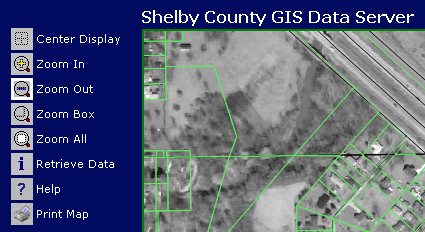
Shelby County Online. I wrote a while back about Shelby County Indiana's choice of one consultant, and one technology, over another to put together its Web mapping solution. Well, the website is up, and is now hosted locally, which should allow for timely updates. (Free registration required.) It's a pretty nice Manifold.net implementation complete with imagery of each township. Map Critique. Reader Matt pointed out this article at Style.org that highlights some problems with election maps made for the recent California recall election. Jonathan Corum points out several flaws including misleading use of areas.
� Announcements Intergraph Mapping and Geospatial Solutions announced its first Intergraph Registered Solutions Provider (RSP) Moroccan-based member: Tele Ressource Controlle (TRC). CubeWerx appointed an authorized distributor in Australia: MapWerks Pty Ltd. KOREM was awarded "MapInfo Canadian Partner of the Year" for the third year in a row. IBM and ESRI are building an integrated technology stack packaging ESRI technology with IBM's DB2 database and WebSphere Everyplace Access Server middleware, according to ESRI officials. The result of the collaboration will be Mobile Task Manager, or MTM. MTM is the prototype of a mobile dispatching, tracking, and response application that uses WebSphere Everyplace Access in a Java 2 Platform, Enterprise Edition environment for intelligent notification services, and location-based services. According to Spinney, the software could be used to accept input from a variety of business applications to deploy appropriate employees and other resources to a specified location with exact geographic details in tow. Intel Corp. encountered skepticism from a U.S. appellate judge who questioned the company's claim that its high-speed Itanium computer chips don't use technology invented by Intergraph Corp. Sanborn has purchased a state-of-the-art LiDAR (light detection and ranging) system with a pulse rate of 50kHz. It's an Optech ALTM 2050. San Francisco recently unveiled a crime mapping analysis tool called the Crime Mapping and Analysis for Public Safety (CrimeMAPS) tool. It was developed with $1.5 million in federal assistance and runs with Microsoft Corp.'s Widows 2000 servers running Microsoft Active Directory, IBM Corp.'s DB2 database technology, and ESRI's GIS. � Contracts and Sales The City of Sheridan, Wyoming has selected Contact One to perform mapping services and ContactMAP mapped ALI software for the implementation of E9-1-1 caller location mapping in their Public Safety Answering Points (PSAPs). ImageLinks has been selected by Lockheed Martin Corporation to provide high-resolution satellite imagery products that will be used in engineering development simulators for the F-35 Joint Strike Fighter (JSF) and flight training simulators for the F/A-22 Raptor. Leica Geosystems has been selected to supply a GPS Continuously Operating Reference Station (CORS) network for the Dallas District of the Texas Department of Transportation. Navigation Technologies is integrating NAVTECH maps in Garmin's newest U.S. and European mobile turn-by-turn mapping products, the StreetPilot 2610/2650 and the iQue 3600. � Products Group 1 Software announced significant enhancements to all of the products in its Centrus business geographics suite. LizardTech's GeoExpress with MrSID 4.0, featuring powerful new tools for image re-sampling on-the-fly, easier mosaicking, even with tiles at different resolutions, improved visual cropping, and more was shown for the first time at Autodesk University. � Hires and New Offices Geographic Data Technology, Inc. hired experienced software and GIS professional Tony Lupien as Managing Director, Federal Government. Haestad Methods announced the opening of a new office in Mexico.
ADVERTISE WITH US
CONTACT
SUBSCRIBE/UNSUBSCRIBE |