Letters, Points of Interest, Week in Review, Back Issues, Advertise, Contact, Subscribe/Unsubscribe If, for some reason you cannot read this document, visit: http://www.gismonitor.com/news/newsletter/archive/041703.php
FOIA and GIS What is the Freedom of Information Act? Let's start with the laws in questions. There are basically four that are relevant: The Freedom of Information Act (FOIA) was passed in 1966 and basically says that federal government agencies must make their information available to the public. However, agencies may withhold information based on nine exemptions and three exclusions contained in the statute. The exemptions include: (1) national security, (2) internal agency rules, (3) material governed by other laws, (4) business information (trade secrets, for example), (5) internal government memos, (6) private matters (health records), (7) law enforcement investigations, (8) information on financial information subject to federal regulation, and (9) information on oil wells. The exclusions are for material (1) being used in a criminal investigation, (2) specific informant records and (3) FBI records involving foreign intelligence, counterintelligence, or international terrorism. This discussion from the Society of Professional Journalists answers some questions. To flesh out those exemptions, the third in the list above speaks to documents covered by other legislation. LANDSAT data falls into that category and was thus sold at far higher rates than FOIA would allow. (LANDSAT move from governmental control to the private sector and back again, making this situation very complicated.) According to Harlan Onsrud writing in GIS Law, legislation to make such data available to non-profit and domestic government organizations was in the works in 1992. As I understand it, LANDSAT data is now available at rates more comparable to cost of duplication. Onsrud's article also raises a question that underlies the Whittaker case mentioned above. Can an individual request an entire database? The courts generally say "yes," though the format of delivery (electronic vs. print) was still up in the air. Another attempted use of FOIA was to push NIMA to release the high resolution VMAP-1 world dataset, the replacement for VMAP-0, an enhanced version of the Digital Chart of the World. VMAP-0 was made public, but NIMA argued that VMAP-1 included material from other governments, which would take it out of FOIA's reach. A group called The Free World Map Data Project hoped to bring together a group of FOIA activists to potentially mount a class action suit against NIMA. Based on e-mail discussions as recent as August 2002 (including input from Ian Thomas, remember him?) NIMA has not changed its tactics. Also interesting, the only article I found on the Free World Map Data Project was in GeoEurope, which has since ceased publication. One supporter of the Free World Map Data Project is Manifold.net. The second piece of legislation, the Federal Information Reform Act (FIRA), passed in 1986 and aimed to update FOIA in particular with regard to electronic information. It allowed differing fees for non-commercial and commercial users, required some information be provided for free, and stipulated that prices could not be assigned to the information itself. The third part of FOIA is the Electronic Freedom of Information Act Amendments, signed by President Clinton in 1996. The goal was to use technology to speed the distribution of FOIA-requested data to its requesters. Writing in 2000, Caron Golden didn't see a lot of success on the E-FOIA front. In 2001, the General Accounting Office reported roughly the same thing. The fourth set of legislation includes individual state laws that essentially parallel the federal FOIA. These are sometimes called State Open Records Laws, state FOIAs, or "Sunshine Laws." These do vary from state to state. Pennsylvania's public-records law was recently updated to set a time frame for responses to queries, but has a limited definition of public records that some feel is too restrictive. Iowa's law seemed to be widely misunderstood by local law enforcement and was the subject an education campaign after journalists pointed out the situation. Journalists, it seems, are some of the most active users of FOIA at all levels. I learned that pretty much every federal agency devotes a part of its website for dealing with FOIA. The USGS FOIA website has material on the Act, and a discussion of how to request materials from the agency. This is pretty much standard across the agencies. That of course means that the first thing someone interested in records has to figure out is which agency holds the information of interest. Another key point on FOIA: the information has to exist for it to be requested. That is, if the agency has to create information to answer your question, it does not fall under FOIA. Use of FOIA FOIA is widely used: The Justice Department reported federal agencies received about 2.24 million FOIA requests in fiscal 2001, up about 11,000 from the prior year. Agencies reported that they filled more than half of the requests made. Some agencies, notably the departments of justice, labor, treasury and state had lower reply rates. Lately FOIA has had some of the wind knocked out of its sails by The Homeland Security Act which states information on public infrastructure should be "protected from unauthorized disclosure" and "used only for the performance of official duties." FOIA and Geospatial DataI searched the Web for tales of FOIA and GIS and came up with some interesting tidbits: � A memo from the California Office of the Bureau of Land Management from 1998 explains that the Southwest Center for Biodiversity requested all of the GIS data from the California Agricultural Field Offices (AFOs). The Center sued BLM when a reply was not returned within the requisite 20 days. That set up a bit of a scramble to assemble the data. � In Michigan, two counties felt that setting up GIS to comply with the state's FOIA was impossible since cost recovery was not possible. Oakland and Wayne counties worked to have the state's access laws amended to allow for cost recovery. This is not an uncommon concern. There was a general feeling, according to Onsrud, that state open records laws could take away quite a bit of potential income for agencies responsible for creating and maintaining spatial data. In the same article he presents arguments in favor of keeping such laws as they are. A second part of the article presents the other side, but I was unable to find it on the Web. � FOIA has also made industry groups wary of GIS and where GIS data is held. At the 2002 Poultry Health Conference, discussions highlighted that GIS data held by the Virginia Department of Agriculture and Consumer Services was subject to FOIA. The data in question, which related to poultry health, was ultimately shared with USDA, but only under a special memorandum of understanding that included rules of further dissemination. The report goes on to say, "Many poultry states have yet to develop GIS databases because of FOIA concerns, yet the power of GIS in managing diseases like AI is undeniable." � Each year The Alliance for the Wild Rockies submits FOIA requests to public land managers in the bioregion to determine incursions into roadless areas. These are incorporated into a roadless area database. � I found less use of FOIA with regard to imagery. Still, I did find reference to Defence Intelligence Agency images acquired via FOIA from Burgundy, France, during World War II that are now in use for archeological research. Back to Connecticut Stephen Whitaker has been trying to gain access to high-resolution imagery and vector data from Greenwich, CT for about two years. He argues that it's available to him under the state's open records law. After losing in an appeal to the state Freedom of Information Commission last fall, Greenwich has offered an amendment to the state's law to exclude the images from public records on the grounds of security. Those on the other side argue that the exemption would weaken the law and prevent citizens from accessing the same data that decision makers use. The exemption is unlikely to pass, but a state GIS council has been suggested to firm up how such data is delivered. Whitaker hopes to sell property and tax assessments to homeowners. This brief overview does not raise all the issues involved with federal or state FOIA legislation nor offer all the pros and cons for data availability, privacy concerns or stifling of GIS implementations. What I hope to have done is to bring the legislation to light and illustrate some of the ways its been used.

BETWEEN A PRODUCT AND A SERVICE PlanGraphics, a services company, has an offering in this continuum between product and service, called STEPs (Spatial Templates for Emergency Management). I interviewed Rich Goodden, Vice President, Eastern Region, about how technology moves into this role as a basis for consulting and how end-users can benefit. An expanded version of this review is available. I understand that STEPs was built on your experience in New York City after 9/11. How do you move technology from "project work" like this to a more general solution? Not all project work can be moved successfully to broader offerings. But if the work fits into a larger strategy that is in line with market direction, and the firm has the experience and methodologies to make that transition, then such a transition is possible. The experience we had in New York City required us to apply the knowledge gained over 22 years of local government consulting to the task of saving lives and helping the City recover. The key to STEPs is really the application of lessons learned not only from 9/11, but also through the cumulative experience of our consulting staff. 9/11 clearly demonstrated the value of GIS in emergency situations, but it also demonstrated the value of integrating GIS data with other systems. The IT/GIS industry has reached a point where enterprise approaches and interoperability standards are making it possible to develop solutions such as STEPs that offer "total situational awareness" in a real-time environment for operational emergency response. At the same time, constrained budgets make it necessary to develop solutions that maximize return on investment. One element of achieving this is to create a solution that is as widely applicable as possible, thereby reducing implementation costs on a per-user basis. This isn't an off-the-shelf product, nor is it a "from scratch" consulting project. Where does it fit on the continuum in between a product and consulting services? In that continuum, STEPs would fall more toward the services end and involves both system and data integration activities. At the heart of STEPs is a web portal, a database and a metadata manager that allows the user to view and manipulate graphic data from the various GIS vendors along with tabular data and unstructured rich content data from other databases and services available over the Internet, as described under the OGC model. For Oracle-based implementations, we utilize Xmarc technology for this portal, so part of the solution can in fact be "off-the-shelf." I mentioned Oracle there and I wanted to make sure the readers understand that STEPs does not strictly require Oracle. It can be implemented with other database programs as well. The Xmarc technology is also not strictly required, but it does provide an advantage when GIS data resides in multiple vendor formats. [Editor's note: PlanGraphics acquired the rights to Xmarc's technology in early 2002. The FAQ on the arrangement, as well as an interview I did with PlanGraphics CEO John C. Antenucci on the matter are on the PlanGraphics website.] How do you "package" STEPs? STEPs is sold in phases. The first phase involves a situation assessment and preliminary design. The second phase is the building of a prototype using rapid prototyping methodologies. The third phase is deployment, which may occur iteratively throughout. Costs for the second and third phases are calculated at the completion of the previous phase. Does the renewed interest in these types of solutions indicate GIS is maturing? Perhaps, but it depends upon one's point of view. In one sense, GIS matured long ago. The basic functions required of GIS are well established and most vendor products are focused on enhancing those functions and/or taking them to the web. STEPs is more accurately described as the expansion of traditional IT to exploit the product of GIS, i.e., the data. In that sense, it really represents a maturing of traditional IT. These types of solutions are offered both by vendors (MapInfo recently announced CARM, for example) and by consulting organizations. How should interested organizations approach selecting one or the other team? The key questions that organizations have to ask themselves are: Do I understand clearly what I am trying to accomplish? Have I dispassionately evaluated the alternatives? Does the firm I have selected understand my requirements and will they work in my best interest? Will there be a time when the configuration and customization of this type of solution does not require extensive services? For now the services portion of a STEPs implementation is reduced if: � The number of proprietary systems is minimal� The communications network has ample bandwidth and reliability � There is a mature GIS capable of providing reliable spatial data � There is a cooperative working relationship between the IT group and the Emergency Management group � The organization has staff with the mandate, expertise and available time to assist in the implementation

MAPINFO'S NEW LOOK I will not pretend to be a graphics expert, but my first thought on seeing the new logo was that it's easier and cheaper to reproduce a black and white or two-tone logo than a color one, on letterhead and other materials. My other thought was that the logo had a nostalgic, old-fashioned look to it. For the life of me I can't recall the logo on the first box of MapInfo I saw in 1989. I do recall it was DOS and I believe the box was red. If nothing else, perhaps the new logo is designed to remind everyone of MapInfo's prosperous days in the past to fuel motion in that direction again. As for the tagline, I'm not clear on the importance of a tagline unless it states what the company does, especially if that that something is even a little esoteric. I mentioned some years ago, when Intergraph rolled out IntelliWhere, that I liked the tagline, "Intelligence about where you are." I thought that was a very succinct definition of location-based services. MapInfo's new tag doesn't exactly state what the company offers, but does connect two key ideas, opportunity and location, which based on MapInfo's continued focus on the business sector, makes sense.

APRIL: A MONTH FOR ACQUISITIONS I read about EarthData purchasing ISTAR Americas in March. Last week I contacted EarthData and received confirmation of the acquisition. A press release this week provided the details, though no price was provided. EarthData is a company that provides aerial imagery, remote sensing and GIS services. ISTAR Americas, based in Herndon, Virginia, is the U.S. subsidiary of ISTAR S.A. of France. ISTAR has specialized technology to produce "TrueOrthos," orthophotographs without shadows or building lean. (I explored the technology and products last year.) The whole imagery marketplace seems to be redefining itself. Space Imaging, which focuses on satellite imagery but also provides aerial imagery, has had its challenges. GlobeXplorer recently found a new home at Stewart. There's word of layoffs and realignments at some of the smaller aerial firms. EarthData, already one of the larger companies in this arena, now has a unique process and product offering. On Tuesday of this week Intergraph announced the acquisition of a German company, Terra Map Server GmbH. The price was not disclosed. Terra Map Server, as I understand it from a tour of its website, provides webhosting (have them host your geospatial application), data sales (imagery, topos, navigation), and geospatial Web services (.NET based). The company can be thought of as part GIS Data Depot, part MapPoint Web Service, and part MapCiti. I understand all of these offerings are built on Intergraph's GeoMedia platform. The release explains that "Intergraph and Terra Map Server GmbH will provide geo-data and hosting services for Intergraph's Web mapping solutions, enabling European customers to set up highly reliable geospatial solutions that eliminate maintenance and management issues and reduce up-front technology investments." Two things about this acquisition are interesting. First off, though I've seen many companies make a go of hosting GIS websites, notably using ESRI products here in the U.S., I can't say I've run into any for Intergraph products. Second, I understand that German innovation is highly regarded in Germany, such that local companies and products typically have an edge over foreign ones. That may be part of the impetus for this acquisition. Note, too, ESRI's recent relationship with SICAD, also German. The latest in the trio of acquisitions crossed my desk on Wednesday. Group 1 Software Inc. will pay $17 million in cash and debt forgiveness to buy technology assets from Sagent Technology Inc. Group 1 specializes in data cleaning and tools for marketing and lives on the edge of GIS technology. Sagent provides enterprise information integration. One key part of the deal is Group 1 access to Sagent's extract, transformation and load technology. The release states that this technology will be marketed as a standalone offering and integrated with Group 1's products. Also coming over to Group 1 is Sagent's Centrus, a customer satisfaction tool built on address-level geographic analysis, real-time customer matching, and name and address data-quality functions. Sagent has had money problems recently. In March, CDC Software demanded full payment on a loan, claiming that Sagent had defaulted. Sagent contested the demand, and at that time was looking for a buyer, among other possible solutions. Part of the deal with Group 1 provides Sagent an immediate loan. This acquisition, in my mind, falls squarely into the enterprise resource planning (ERP) and customer relationship management (CRM) side of GIS, the side I most associate with business geographics. I can't help but reference an article I read the same day I read the announcement. David Goldstein, President of CMC International, writing at Directions Magazine states, "The true weakness of the GIS industry is that it has been driven by technology and not customers' needs." Could that be part of the story of this acquisition?
� Anthony Quartararo had comments on several of last week's pieces: "Appreciate the piece on mapping services in the real estate domain. � It may be required by corporate attorneys to put disclosure statements on websites, whether privacy, SLA's, etc., but I don't know of a single person who has read even one (aside from attorneys) in it's entirety, let alone each and every one that a consumer is presented with in a daily basis. � I mean, what exactly is the definition of 'general informational purposes only' anyway if it is not for mass consumption. Most consumers would not make the distinction between 'almost' legal and 'legal' if the price tag that goes along with 'legal' is $300 or higher vs. 'free' for 'almost' legal. When it comes to general public consumption, lowest common denominators must be factored into the matrix. "On the AAG piece; how quaint and utterly pointless. The 'Council' issues a resolution that's not representative of the membership and staff, but yet, they get to toss the AAG 'brand' around in such a manner. Why is there a compelling need to have a political agenda and a 'policy' statement by an organization that purports to uphold the high ground of academia? By taking sides and issuing resolution, the AAG Council has taken the stance of being decidedly un-objective in the matter. If it cannot and does not desire to be objective, that's fine, pass another resolution �, but stop claiming to be the collective conscience of geography professionals around the world, and by all means, stop pretending to be an objective academic institution. "On Thuraya's claims that its system cannot be compromised. Who are they kidding? I suppose AMEX, VISA, MC, Amazon.com, Ebay, etc. or any other major international corporation at one point said something foolish like that, but one casual read through security press releases over the past 5 years would give the consumer something else to consider." The editor responds: I am not aware of the AAG ever claiming objectivity or to be the "collective conscience of geography professionals around the world." � Bruce Westcott had some ideas on protecting the public from mapping services: "Your April 10 article describing concerns about the Express Map and ArcWeb Flood Map Report illustrated many reasons why 'the buyer must beware.' A particular problem, in my opinion, is that - even why data integrators, users and map server providers have detailed and clear information about precision and accuracy, and even when they provide elaborate disclaimers - consumers are at risk. "Why? In part, because such 'metadata' is available only in secondary documents, and is useful only to the already-overworked eyeball. The GIS community has largely come to understand and use basic metadata 'content' elements, but we have no standard that makes most metadata useable by hardware and software. "The ISO-19139 Metadata Implementation Schema (based on the new ISO-19115 Metadata content standard) should provide an XML schema by which metadata content and format can be standardized. Two great opportunities this presents will be the ability to integrate metadata content directly with the spatial data, and allow developers to create intelligent applications which are actually metadata-aware. "How about providing 'Newbie Wizards' in map-making tools that actually call the attention of novice users to discrepancies in scale, precision, timeframe, projection, or other technical aspects of the data they might otherwise misuse? "How about the ability to build enterprise business rules into spatial applications that indicate or even "enforce" metadata-driven limitations on the integration of unlike datasets."Until we get there, how about the commitment to making your metadata as current, detailed, and useful as your most clueless newbie customer/partner needs it to be?" � Alvin L. Hanks, Principal at Chesapeake Analytics Corp. wrote about the AAG's choice to pass a resolution regarding the then "potential" war with Iraq: "I agree with your comments with regard to the AAG Council's statement of opposition to the war in Iraq. The council and Association is much better advised to stick to the terms of reference and by-laws of the association related to its mission. To use the rubric of the association for the expression of the personal political views of its leadership is inappropriate, and probably violates the conditions of their not for profit IRS status." � Elizabeth A. Roach of the U.S. General Accounting Office found an incorrectly expanded acronym: "I ... wanted to mention that [last] week's Monitor includes a description of a GAO report on critical infrastructures--and it refers to GAO as the Government Accounting Office (as does the Wired article that it refers to) ...it should be the General Accounting Office." � Learon Dalby, GIS Program Manager at the Arkansas Geographic Information Office highlights how services like that of First American can strain relations between GIS people and surveyors: "I believe you hit the nail right on the head in your article "BEWARE THE MAPPING SERVICES!" last week. It is critical that as GIS users make sure we know and represent what GIS can and cannot do. I believe it is sites like the ones you referenced that continue to cause a rub between surveyors and GIS professional. We must continue to educate GIS folks on the need for surveyors to practice surveying." � Curt Sumner, LS, executive director at ACSM provided this update on that organization's queries to First American. "I have just recently received a response from an attorney representing First American, and with his permission, will post it on the ACSM website. The attorney's response prompts another letter from us. I will be drafting that letter soon."
� Elizabeth A. Roach of the U.S. General Accounting Office contributed this item at my request. "The General Accounting Office is conducting a review focusing on interagency/intergovernment collaboration on federal e-government initiatives, and one of the initiatives being reviewed is Geospatial One-Stop. Specifically, GAO plans to report on the extent to which the federal government is collaborating on One-Stop, and to identify concerns or issues that either hinder or facilitate such collaboration. The study is expected to be completed late this summer." � Interested in what your state is doing with remote sensing in forestry? A report funded by NASA and prepared Dr. Lisa Warnecke of GeoManagement Associates, Inc. (Syracuse, New York), Dr. Zorica Nedovic-Budic of the University of Illinois, and others at the State University of New York's College of Environmental Science and Forestry in Syracuse details just that. An application allows you to just look at your own state. The entire report is 11 Mb. � Wireless Newsfactor reports that PanGo Networks is focusing on making spaces into "smart spaces" by providing different services at different locations. Based on Wi-Fi, the solution has been used in museums and is aimed at theme parks and colleges. � Research supported by NCR (that's National Cash Register in the old days) has produced a prototype grocery store navigation system built on a PDA. The test customers would bring a list from home on the PDA or use one connected with their frequent shopper card. Wireless NewsFactor reports the application reorders the list and guides the shopper to the items using a wireless network for location information. The system highlights specials along the way. While some shoppers appreciated the ease of finding what they were looking for, which they say helped limit impulse buys, many were uncomfortable carrying the PDA while shopping. The article suggests that such systems may be particularly useful in home improvement stores, which are larger, less frequently visited, and appear to have many more items. � The remote Australian township of Gununa, population 1114, was overlooked during the 1996 census and has been forgotten since then. The township, which is located on an island off the coast of northern Queenland, was put back on the map when officials visited it to study adding mobile phone coverage. Most of the population is aboriginal. � The San Francisco Chronicle reports that the California Supreme Court upheld a ruling providing $1.6 million verdict for a woman injured by a car while heading for a bus stop. That means that transportation agencies are considered liable for the locations of such stops. � Online Casino News reports that mobile gambling may be the way the U.S. solves the online geography question for gambling. Since gambling is only legal in some geographies, the challenge is to make sure those online are in legal areas. While solutions such as Quova's do a reasonable job of locating wired machines, the article suggest that GPS-enabled phones will do an even better job. Of course GPS information can be "spoofed," so it's not a perfect solution. � Federal Computer Week reports that vendors and the Open GIS Consortium (OGC) are concerned about the two Geospatial One-Stop (GOS) portals now in development. The latest work from ESRI stemmed from an unsolicited proposal, which the GOS board approved for $375,000. OGC's original proposal for a prototype portal and architecture cost $450,000. Said an OGC spokesperson, "If this had been set up as a competition for the prototype, then OGC would not have bid." � SARS is getting the geographic treatment. Singapore's Health Minister outlines the spread as paralleling the airline route maps in the back of the in-flight magazines. This is a classic case of hierarchical diffusion. � In other SARS-related news, CORDA Technologies, Inc., developer of interactive data visualization solutions, used its technology to create a webpage with an up-to-date map displaying the worldwide occurrences and deaths due to Severe Acute Respiratory Syndrome (SARS). CORDA furnishes the map with data gathered from the Centers for Disease Control and the World Health Organization. � I wrote quite a bit about a company that hoped to push location-based services by setting up a network that only located mobile devices. Cell-Loc had quite a bit of trouble. Perhaps the scale was wrong? QuikTrak has set up a network like that in and around London and another in Sydney. The networks work indoors - which SOS Response hopes to leverage by offering child-tracking products. The QuikTrak system in Sydney, Melbourne, and Brisbane is used for fleet management applications. The BBC reports that the networks function similarly to cell phone towers, but fewer towers are needed to cover the same area. I'm not sure of the benefit over GPS for vehicles. GPS is free, though of course not guaranteed. � The San Bernardino County Sun reports that ESRI is growing again. The Redlands City Council approved a 42,592-square-foot addition to an existing three-story office building. It will accommodate 200 new employees. � A new device created by and for United Parcel Service (UPS) demonstrates the complexity of our wireless communications here in the U.S. The handheld, described in Business Week with a laptop battery which runs a full day, includes support for "infrared, Wi-Fi, Bluetooth, satellite-based Global Positioning System (GPS) and two cell networks: CDMA1x and GSM/GPRS." The article suggests a consumer product is not in the works, but that UPS competitors will likely try to build their own. � Quote of the Week: Doug Millroy comments on a Ontario Hockey League's not so victorious team, the Greyhounds, "I'm not sure a Geographic Information System (GIS) would have shown the Hounds' defencemen how to get the puck out of their own end." It's a big day when GIS appears in sports stories.
� Announcements ESRI and Citrix Systems, Inc. have partnered such that ESRI can sell the Citrix MetaFrame XP Presentation Server. This is a way to put GIS on the network. Space Imaging restructured its regional sales channel in Brazil, signing contracts with four Brazilian companies - Engesat, GisPlan, Infostrata and Threetek. Spatial Insights, Inc. will resell MapBridge developed by Mapping Analytics. The product is an add-on to Microsoft's MapPoint 2002 that seamlessly integrates demographic report generation and data vending from SRC's flagship Allocate product into MapPoint. Safe Software announces it is proud to be a sponsor of the Open Data Consortium (ODC), an initiative adopted by the GeoData Alliance. The ODC's objective is to formulate a model data distribution policy to be used to guide local governments that make digital geographic information available to the public. South Central Los Angeles with all its connotations has been wiped off the map in favor of South Los Angeles. Exor Corporation was presented with ESRI's Foundation Partner of the Year award the recent Business Partner Conference. International Data Corporation (IDC) has determined Oracle is the world's leader in what's predicted to be the rapidly growing geospatial database management market. The report predicts that basic spatial information management capabilities -- such as those already provided by Oracle -- will be ubiquitous in database, application server, and data access technology within two to three years, and praised Oracle's innovative move to build Spatial Information Management (SIM) capabilities directly into the relational database. IDC based its findings on analysis of vendor financial statements, census interviews, public information and demand-side research. Intergraph Mapping and Geospatial Solutions announced the availability of its new GeoMedia Software Subscription Program. Through the program, customers may purchase one-year subscriptions to run one or multiple licenses of desktop and Web products in the GeoMedia family suite. I believe Intergraph is the last of the major GIS vendors to begin a subscription program. Analytical Surveys, Inc. received notice from the Nasdaq Stock Market that the company has regained compliance with Marketplace Rules 4310(c)(7) and 4310(c)(4). That means the stock has been at or above the minimum requirements of $1,000,000 and $1.00, respectively, for at least 10 consecutive trading days and can go back on the Nasdaq. Zekiah Technologies, Inc. is pleased to announce it has been named ESRI's New Business Partner of the Year for 2003 in the Washington, D.C. region. Zekiah provides on-site services support and application development for several noteworthy Department of Defense clients and brought more than $250,000 to ESRI in software sales. GlobeXplorer's Image Server and ESRI's ArcIMS platform have been integrated to deliver nationwide aerial and satellite images. The release speaks of the solution being in "compliance with OGC's Open Web Services specifications."
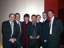
GeoDecisions was recently presented with the New Technology Product of the Year award at the 11th annual Technology Awards Gala. The event was sponsored by the Technology Council of Central Pennsylvania. GeoDecisions received the award for its Intelligent Road/Rail Information Server (IRRIS) application. The IRRIS team is at left. On April 9, 2003, the URISA Board of Directors unanimously approved a "GIS Code of Ethics" proposed by the URISA Ethics Task Force. The Code of Ethics is intended to provide guidelines for GIS professionals. It should help professionals make appropriate and ethical choices. Laser-Scan has joined the Intergraph Mapping and Geospatial Solutions Team GeoMedia Registered Solutions Center (RSC) programme. The aim of this programme is to help non-reselling partners build long-term relationships with Intergraph customers.
� Contracts Merrick & Company announced a new $500,000 contract to update the 1998 GIS basemap data of Henrico County, Virginia. MacDonald, Dettwiler and Associates Ltd. announced that the company has entered into an agreement with the Canadian Space Agency (CSA) to undertake a study which evaluates an innovative, low-cost tandem topographic mission with RADARSAT-2. The total value of the contract is $300,000 (CDN). EarthData Holdings, Inc. (Washington, D.C.), and its affiliate, Horizons, Inc. (Rapid City, South Dakota), leaders in the airborne imaging, mapping, and Geographic Information Systems (GIS) industries, each purchased a Leica ADS40 Airborne Digital Sensor from Tadpole-Cartesia, Inc. announced a contract win for its ESRI-based GO!Sync mapping software from Burbank, California. The software is now being deployed by the Electric Division of the City of Burbank's Water and Power utility. Newbury Networks Inc., a supplier of 802.11-based Location-Enabled Network solutions announced that Dartmouth College has standardized on the use of its LocaleServer software platform and specialized location-based applications campus-wide. This will allow class content to be pushed to students based on location. The Corporation of the District of Saanich has selected ESRI's ArcGIS software and ESRI Canada to implement and support the GIS. Intermap and RapidEye signed a contract to support expansion of their business strategies in Europe and around the world. Sanborn announced that the company has been contracted to perform update mapping services for New York City's GIS landbase, referred to as "NYCMap." Also, the company was contracted to provide high-resolution digital orthophoto imagery of the World Trade Center site, and was hired to perform precision surveying to support two NYC tunneling projects. � Products TIG Centre Holdings Limited has released its we 2.0 software, an extension to ESRI's ArcIMS software. The tools allow snapping between different layers and zooming to selected features by either graphical selection or attribute query. Vexcel Corporation announced the immediate availability of accurate 3D models for virtually any city in the world. This includes all locations where traditional mapping products are either outdated or not available for reasons such as restrictions imposed by local governments. Such locations include South America, Africa, India, China and many Asian nations. ESRI announced that Job Tracking for ArcGIS (JTX) is now shipping. Job Tracking for ArcGIS is a solution-based extension to ArcGIS that provides an integration framework for ArcGIS multiuser geodatabase environments. Visual Learning Systems (VLS) released Feature Analyst for ERDAS IMAGINE. The new extension is available for version 8.x of ERDAS IMAGINE and works seamlessly within the IMAGINE environment. Feature Analyst for ERDAS IMAGINE is available in both Standard as well as Professional versions and is available for shipping immediately.

� Events NovaLIS Technologies will hold its second annual user conference at the Hilton Oceanfront Resort, Hilton Head Island, South Carolina this November 3-7. The theme of this year's conference is "inform, integrate, relate." Rambus v. Infineon has become one of the most important legal cases in history for standard-setting organizations and thousands of technology companies. On January 29, 2003, the United States Court of Appeals of the Federal Circuit overturned the fraud conviction of Rambus, potentially casting into doubt hundreds of technology standards, developed over decades. Andrew Updegrove, partner in the Boston law firm of Lucash, Gesmer and Updegrove (LGU) will host a free webinar on Tuesday, April 29, 2003 at 3:00 to 4:00 pm EDT to discuss the implications of Rambus v. Infineon, the standards case I've mentioned several times lately. I've heard Updegrove speak before and he's very good. The AGI Conference at GeoSolutions 2003 will take place at Earls Court 1, London, UK, September 16-18. Thales Navigation and Groundspeak, developer of the geocaching.com website, have teamed up to sponsor the first Cache In Trash Out Day, on Saturday, April 26. The event will bring together geocaching enthusiasts and Magellan GPS users from as many as 160 countries to pickup trash during their high-tech treasure hunts and hikes. GeoSpatial World 2003, the annual international training and management conference of the Intergraph GeoSpatial Users Community (IGUC), will be held May 19 -21 in New Orleans, Louisiana. Discounts are available until April 30. Leica Geosystems GIS & Mapping's Annual User Group Meeting and Airborne Sensor Workshop will be held August 18-21 at the Denver Marriott Tech Center, Denver, Colorado. The 2003 Cityworks User Conference will be held June 4-6, 2003, at Yarrow Resort in Park City, Utah. Ordnance Survey and Laser-Scan will host a free seminar for transport industry professionals and system integrators and independent consultants working in the transport sector. The seminar will take place on Friday, May 16th at the Ordnance Survey Business Centre in Southampton, UK. � Hires and New Offices � Positions Open
ADVERTISE WITH US
CONTACT
SUBSCRIBE/UNSUBSCRIBE |