Letters, Points of Interest, Kudos and Conundrums, Week in Review (Announcements, Contracts, Products, Events, Training, Hires) Back Issues, Advertise, Contact, Subscribe/Unsubscribe If, for some reason you cannot read this document, visit: http://www.gismonitor.com/news/newsletter/archive/052004.php
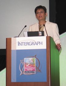
A New Brand Intergraph Mapping and Geospatial Solutions President, Preetha Pulusani, outlined the division's plans while Halsey Wise, Intergraph CEO and President, introduced Intergraph's new branding initiative, one that among other things re-launches the company as "ready for life after litigation." There are a few parts to that initiative, including a new logo. The new Intergraph logo which adorned the conference brief cases and staff polo shirts changes the "old" boxy font into a slightly more modern one and adds a "swoop" above it in silver. A few comments I heard regarding the logo included "Well it brings them out of the 1970s," and "It reminds me of a pharmaceutical company." One note about the new business cards: they include the company's stock symbol, something I do not find on older cards. A second part of the new branding is a newly articulated vision and mission. "Intergraph's vision is to help organizations see the world clearly. Intergraph's mission is to empower governments and businesses around the world to make better, faster operational decisions. Through superior software and services, we enable our customers to organize vast amounts of complex data into understandable visual representations."
GeoVantage delivers georegistered, orthorectified aerial imagery in full color and near infrared. Twenty-two 4-band sensors enable rapid response and nationwide coverage. Visit Booth 507 at ASPRS!
In fact, at that time only the federal government "got it" and the remote sensing industry remained fairly small. There were limitations, of course, in hardware, processing, acquisition, and the imagery had nothing like the resolutions of today. The 1980s therefore, were the heyday of vector GIS. Organizations were building their landbases and learning the ins and outs of GIS. In the 1990s the technologies for scanning grew to meet the demands of imagery, slowly moving it back into GIS and mapping. And, today, in the new century with digital acquisition growing (both on satellites and aerial platforms), processing techniques maturing, hardware and storage both ubiquitous and inexpensive, Keating explains that "images are back." To support that conviction he noted that 24 new imaging satellites are expected to launch internationally in the next 24 months. Some are commercial ventures and many are products of government efforts. I raised the question, based on comments I've heard in recent months, including on the panel at NEGIS just the day before, of why we geospatial technology users are not taking full advantage of imagery these days. "Packaging" was Keating's response. Most potential users are not interested in a 500 GB repository in a form that they cannot easily access. Users need files that are not overwhelming in size and that can be put to immediate use in their systems. And, of course, the images must be current. That, Keating went on, means that imagery companies need to tease out effective business models to offer their wares. He cited Aerials Express' work in packaging its images (captured speculatively) for use in real estate as one example. VARGIS uses a unique partnering methodology to work with states to cut initial costs of capture, and makes money selling the imagery elsewhere. Garland noted that there is still room for enhanced use of imagery. Most uses of hyper-spectral and multi-spectral imagery are in research and development. And, he noted, most imagery is used "raw," that is with limited enhancement or processing. Both men agreed that work on "mobilizing imagery," that is getting it out into the field, would help drive its use. As for Intergraph, its goal in the imagery arena is to continue to offer a solution that begins with a sensor for capture (its Digital Mapping Camera) and provides all the tools necessary to bring the data through production and into enterprise and Web distribution.
Intergraph Mapping and Geospatial Solutions (IMGS) president, Preetha Pulusani (left), and Director of Worldwide Product Strategy, David Holmes, are clearly looking forward while they are being watched within the company. IMGS is the largest division within the company and has the largest market potential. With a focus on applications, Pulusani and Holmes are confident about a bright future. The past years, Pulusani noted, were about building a foundation of technology, teasing out the basics of desktop GIS, Web mapping, wireless, and other areas. Now "it's time for applications." IMGS will go both deep and broad, she explained. Deep, in the sense that the company will provide all the tools necessary to say, transportation agencies, and broad in that the solutions will integrate with enterprise systems such as enterprise resource management and work force management. IMGS' organization will change a bit to help serve the new focus on applications. A single group owns responsibility for all horizontal and vertical applications, while a second (Solutions Centers) pulls them together for particular industries. The solutions are then further tuned for different geographies by local staff and partners. The vision is that the interactions between the groups will serve all three groups, and the customer in particular. Holmes explained that while some custom connections or special tools ("Projectware") may be created in Solutions Centers, these tools may or may not eventually end up in the core products. One of the keys to the "broad" vision of IMGS includes Web services. Holmes explained that such services, from the division's perspective, open up the "ability to get to geospatial services." That might mean integrating a map into a Hansen management application or ensuring that a traditional GeoMedia user is "only a URL away from a world of data sources."

A session on municipal Web mapping highlighted that while it's relatively easy to get maps on the Web these days, those who host them are still running into traditional challenges. One presenter from Portugal explained that the download of the CGM (the default vector format for GeoMedia Web Map) plug-in was rather large and he was considering switching to SVG (Scalable Vector Graphics, an ISO standard) which also has a plug-in, but a smaller one. I participated in two sessions. I presented a paper on "Communicating About Geospatial Technology" where we looked at tools for making complex ideas clear to the person who needs to write or speak about them, and hopefully to their intended audience. That paper will be online soon. I also was a panelist for a discussion titled "What Interoperability Means for Your Enterprise." There were supposed to be a total of eight panelists, including two Intergraph partners, one Intergraph staffer, one Open GIS Consortium (OGC) staffer, one National Geospatial-Intelligence Agency (NGA) staffer, one city GIS manager, and one academic with a role in GSDI, but the latter could not make it. While the session covered many topics, I'm not sure it illustrated what interoperability means to the enterprise. An attendee later told me that while the session was informative, the topic really had nothing to do with his day-to-day work managing GIS for a town of 70,000. (I consult to OGC.)
The Trimble booth had both the Recon and GeoExplorer units on hand. I'd never seen the Recon up close, so I happily took hold of it. It lives up to its promise of a tough personal digital assistant (PDA). Running Windows Mobile you can put your favorite field mapping software on it, and go. It does not have the "I don't want to put it down" feel of the GeoExplorer Series (which has GPS built in), but it's certainly more "grabbable" than an iPaq. The screen is made for use outdoors, so the glare problem is lessened. In addition to outdoor field use, Trimble is selling units to those who work indoors but need a tougher PDA, such as warehouse managers and building inspectors. I spoke to a user not too long ago who described his iPaqs as "cheap and disposable." The idea of the Recon is to make sure roughly handled PDAs actually last. Just this week, Trimble announced the GPS version of the Recon. (See Week in Review.) I took a short tour of GeoMedia WebMap Publisher, a tool that allows maps to be authored in GeoMedia and published directly into GeoMedia WebMap. (I believe every major vendor now has a Web map authoring environment in its desktop GIS product.) In the next release GeoMedia WebMap Publisher will be included with GeoMedia WebMap. The big news for GeoMedia WebMap users, however, is support for SVG. It turns out that SVG (text) files are just about the same size as CGM (binary) files, so there is no "hit" for using the format. The "bad news" is that a plug-in is still required for most, if not all, browsers. There is hope that a Java-based solution for SVG may appear soon and negate the need for the download/install experience.
Developers and end-users will find a few interesting capabilities when using SVG. First off, developers can package JavaScript and other code within an SVG file such that it delivers its "own" interface to the user. That is, the "buttons" to run the map, need not be coded in HTML, but can be delivered inside the SVG window. For the end-user, SVG provides support for differential opacity, that is, it's possible to include tools to change the solid fills so that you can see through them to whatever degree you like. A sample I saw used a slider bar to give the user full control of specific layers. There has not been a lot of support by the major GIS vendors for SVG, so I'm curious about how it will be used here. Clearly, Intergraph is anxious to get it out; in the next release SVG, not CGM, will be the default vector publishing format. I also had a chance to have a look at the technology that Intergraph has developed to support national intelligence agencies. Most of what analysts do is, well, look at imagery. They look at the same locations regularly to see if things have changed, and generally keep an eye out for interesting "targets." "Target" in this context does not necessarily mean something to be blown up, but something to be watched. That means that analysts need to be able to spend as much time looking at imagery and not searching for it, or even panning around within an image. The tools Intergraph provides are designed to make the analyst more productive. Using TerraShare to organize files, the analyst need not worry too much about where individual files are, the system does that. The system can also keep "bookmarks" so the analyst can quickly jump to targets that need to be explored regularly. But, perhaps the coolest part of the system is the tool to be sure an analyst looks over every corner of an image or a selected area on it. The system will move through the image at a speed comfortable for the analyst. The demo I saw had it going so fast I got a bit woozy. The demo person explained that one of the government's requirements was fast, but very clear, automated panning. In point of fact, he noted, most people would likely run it slower. While I did get woozy, the image was very sharp indeed, even as it whizzed by. Once the analyst finds a target of interest, it's possible to bring up stereo imagery, and see 3D with the funny glasses. I'm pleased to report that I could see 3D far better on this system than I could in grad school with printed images.

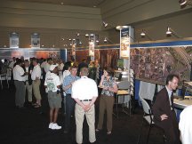
Best Guerilla Marketing. The best guerilla marketing at the conference was from Laser-Scan. Small signs with pictures of a bar of soap were set near the restroom sinks asking attendees how clean their data is. Of course, these days all public facilities use liquid soap, but the idea was a clever one. The Floor. There were 22 exhibitors (excluding Intergraph) including two magazine publishers, one professional organization (URISA), and one educational organization (UNIGIS). Daniel Burrus Keynote. I missed the keynote from Daniel Burrus, but have heard him before. He was impressive then; I even bought his book, TechnoTrends, which sits next to Crossing the Chasm on my bookshelf. Attendees universally gave Burrus a positive review. One attendee in particular picked up on Burrus' comments on data sharing challenges "being about egos." Said the attendee, "we have that exact problem at work." More Coverage. The team from GISDevelopment.net provided daily updates from the conference including particularly good coverage of Burrus' presentation.
NEGIS 2004
Keynote Barb Ryan from the United States Geological Survey used her time to highlight The National Map, its history from the days of William Powell, and the process of partnering that will make it happen. Perhaps more importantly, Ryan challenged those in the community to help communicate its importance, and that of geospatial information in general, to policy makers. As I attended sessions, I tried to imagine bringing policy makers to the sessions. Would they "get it?" Would they understand the broader context of the technology? Its implications? I'm not sure. And, that's no slight against the presenters or their topics, but rather a recognition that at these (and other events) we speak "to ourselves." The way we present our work to each other in the discipline (GIS, remote sensing, LBS, and others) tends to "assume" everyone grasps the underlying context. While we who work in these areas might understand the perspective and appreciate the work, could we all, for example, understand why one presenter is exploring the importance of digital elevation models on classifying imagery? Do we know why better damage assessment after ice storms matters? I'll suggest that Ryan is asking those in our field to, in addition highlighting what they do and why it's "cool," also consider "Why should I care?" or as my population geography instructor put it, "So what?" That part of the story, I'll suggest, will draw in the general public's interest and that of policy makers. There were two other keynotes, from Jim Geringer of ESRI and David Schell of OGC on the second day, which I did not attend. Sessions I attended a session on remote sensing. The first paper discussed damage assessment using imagery. One of the more interesting points was that much of this work is done "the old fashioned way" with acetate sheets and grease pencils tracing over images to delineate the areas of damage. Those areas are then digitized into a GIS. When I asked why, the response included the clarity of the hard copy image and the idea that sometimes there's no reason to change a process that works. I suppose that's the geospatial equivalent of Ann Landers' choice phrase: "If it ain't broke, don't fix it." The second paper from a faculty member at Salem State College highlighted the value of DEMs in classifying imagery. Some of the work is for the Department of Defense, so we heard only the unclassified parts. I found the comparison of the different tools currently available to create effective DEMs particularly valuable. The final paper basically asked the question, can you use publicly available data (not necessarily free) to create basemaps of any value? The answer is yes, as was illustrated by some 2' data obtained for a county in Vermont. After lunch I attended a session about a topic near and dear to many local governments: Do we map at 100 scale or 40 scale? First, the GIS Manager from the town of Franklin, Massachusetts shared that town's experience with 40 scale mapping. Then representatives from two firms that provide such mapping services gave their take on the options. Unfortunately, there's no firm guidance, as the decision depends quite a lot on the goal of the effort. One topic that came up throughout the presentations was the "capture rate," that is, how many features could be identified from the imagery. It's important to note that on the day of the flight many manhole covers and other features may be obscured by cars parked over them. Everyone agreed that some type of field effort was generally needed to augment data drawn from the imagery. The final session of the day was a panel discussion that I moderated titled "GIS Technology: What's Ahead?" Instead of the traditional software vendor representatives, this panel included three consultants and an end-user. My personal thanks to panelists Peter, Kevin, Brent and Beth for their participation. On the Floor My short time at the conference meant I had but a few moments to visit the vendors. Full Circle Technologies , who offers a lost-cost Web mapping solution, has found a new niche providing its VectorEyes to police departments, who use it, complete with a browser interface, on a laptop. Caliper Corporation was showing off its Maptitude for the Web, another lower cost Web mapping option. I ran into Will Mitchell, a long-time reader who pointed me to a curious, new-to-me exhibitor, National Geomatica, a company offering free municipal GIS.
ECO Internship Opportunity for California Resident
The Environmental Careers Organization (ECO) seeks a Fellow with GIS skills for its Sustainable Communities Leadership Program (SCLP) in California. SCLP builds communities in California by developing the next generation of diverse leaders. Fellows work from three to six months on innovative projects with private, public, and non-profit agencies while receiving leadership training and building a learning community. Applicants Must Meet the Following Minimum Requirements: The Fellow will work with the California Center for Land Recycling in San Francisco on a project titled "Creating Vibrant Communities: Assessing California's Infill Potential." Summary: California Center for Land Recycling is a statewide, nonprofit agency working to create vibrant, sustainable communities and discourage sprawl by facilitating brownfield redevelopment in existing urban and suburban communities. The ECO SCLP Fellow will use GIS technology to identify, map, and catalogue potential infill opportunities throughout the state of California. Applications can be found here and should be sent to [email protected] as soon as possible.
Letters
� Gary at ResourceShelf.com shared the details of the May 2004 issue of D-Lib (that's Digital Libraries). "It's a special issue on georeferencing and geospatial data. "Articles include: "Much more here."
Points of Interest Freebie. GeoSearch will run "Entry Level" positions free for the remainder of May and the month of June to assist new college graduates in finding their first job in the industry. Carol Bartz to Join the Government? Business Week contains a lengthy article highlighting Carol Bartz's tenure at Autodesk through her own and the company's ups and downs. With the company on target to hit the magic $1 billion mark this year, there is speculation of Bartz taking on a high level government position. Quote of the Week. "In LA, it's called 'putting cops on dots.'" Those are the words (registration required) of Redlands, California police Chief James Bueermann on using GIS to highlight crime hotspots. Technology, of course, is from ESRI, based in Redlands. Outsourcing Discouraged in Tennessee. Gov. Phil Bredesen of Tennessee has signed a law to discourage businesses with government contracts from outsourcing work to cheaper offshore service providers. While the business that may be the most noticeable to the public is the state health insurance claims processor (which has since been brought back into the U.S.), there's concern about the statewide mapping program, undertaken by Smart Data Solutions, SDS, with overseas partners. The law, which was watered down, does not affect existing contracts (which I believe is the state of the SDS work) and simply gives preference "in bids for data-entry and call-center services to contractors employing workers only in the United States." Tennessee may be the first state to enact such legislation, though similar laws have been introduced in 35 states. Heavy lobbying has kept most from passing. Killer LBS App? Not Yet. After a discussion with an location-based services (LBS) vendor a few weeks ago, I echoed his suggestion that TeleNav, navigation via a GPS-enabled phone, might be the killer app. Not so, at least not yet, suggests Walter Mossberg writing in the Wall Street Journal. "Overall, TeleNav's setup is simple and its directions are easy to read and understand. But it's too slow, and it doesn't always work, which is a big problem considering that this product is designed to keep people from getting lost. Putting navigation into a cell phone is a good idea, but this service needs improvement. For now, I cannot recommend TeleNav." Autodesk Looks Good in Q1. Autodesk announced its first fiscal quarter results for the period ending April 30, 2004. For the first quarter, Autodesk reported net revenues of $298 million, a 41 percent increase over $211 million reported in the first quarter of the prior year. That handily beat expectations. The numbers were explained as coming from new seats, upgrades, and subscriptions. No word on the effectiveness of the latest GIS ad campaign. The company expects year-end numbers for 2005 to the range of $1.1 billion to $1.125 billion. That will finally give Carol Bartz, CEO, her $1 billion year and perhaps a ticket out. Denver Bound. I'll be at ASPRS next week and look forward to visiting with GIS Monitor and EOM readers.
Kudos and Conundrums Kudos (concepts we applaud) Integrating Amber Alerts. State Amber Alerts (child abduction notifications) may soon be a thing of the past. Technology companies are donating products to help unify the systems via a website. Using GIS, the system can predict how far an abductor might have traveled since the time of the abduction and broadcast only to those in that geography. This prevents "all points" bulletins that notify even those far outside such an area. Conundrums (concepts we question) AAA to Take on MapQuest and Microsoft? Not to be outdone by MapQuest or Microsoft, AAA has launched a new website called AAAMaps.com. As you might expect it provides maps and directions to all, but triptiks and other goodies are for members only. The website uses pop-ups, so be sure to disable blockers. I attempted a route, but alas ran into an "error." I think AAA is a bit late to steal people away from their favorite routing website.
Please note: Material used herein is often supplied by external sources and used as is. � Announcements IMPRESS Software AG and ESRI announced a strategic alliance to develop a pre-packaged integration solution that integrates ESRI's enterprise GIS software suite with mySAP PLM. The United States Geospatial Intelligence Foundation (USGIF) formally announced its formation as a non-profit organization that "brings together the key players involved in the geospatial intelligence sector to promote the tradecraft and to collaborate on the execution of a national geospatial intelligence agenda." IDELIX Software Inc. and Intelligence Data Systems have partnered to incorporate Pliable Display Technology (PDT), into Intelligence Data Systems' customized technology solutions for the Intelligence Community, Department of Defense, and related Federal Civilian Agencies.
Visual Learning Systems, Inc. (VLS) announced the Feature Analyst State and Local Government Grant Program. VLS expects to award up to $5 million dollars in software grants in 2004. Qualified state, city, and local government agencies can apply online. MapInfo announced the signing of an exclusive two-year distributor agreement with Beijing Jade Bird Commerce Technology Co. Ltd., an independent software vendor and systems integrator in the People's Republic of China (PRC). Also, MapInfo formally announced Beijing as its North Asian headquarters and will be hiring additional employees in marketing, product management, technical support, and business development. NovaLIS Technologies announced an annual awards program that recognizes superior service from our business partners. Telcontar announced that its Telcontar Mobile Location Server has been nominated as a Horizon Award finalist at the upcoming Telematics Detroit Conference May 25, 2004, presented by Telematics Update. The company also has signed a Value-Added Reseller (VAR) agreement with Swedish navigation solution provider Appello Systems AB. � Contracts and Sales PCI Geomatics will be providing GTZ with Geomatica software for geospatial processing of ASTER (Advanced Spaceborne Thermal Emission and Reflection Radiometer) data. Geomatica geospatial software is helping GTZ consultants develop a new geo-database for hydrologic and hydro-geologic resource assessment in Eritrea (Horn of Africa). Intergraph Mapping and Geospatial Solutions announced Gaz Metro has chosen to upgrade its existing FRAMME-based AM/FM/GIS application to G/Gas, Intergraph's geofacilities management solution based on gas distribution industry best practices. A leading Quebec energy company and one of Canada's largest natural gas distributors, Gaz Metro provides gas and services to more than 150,000 customers and has an underground distribution and transmission system of almost 10,000 kilometers. Also, the company will provide Canadian data services firm, Teranet, with mapping software that will help it provide information about Ontario's four million parcels of land to government agencies and corporations. And, Jihoceska plynarenska, a.s. (JCP, a.s.), has awarded Intergraph a contract to upgrade its existing FRAMME-based AM/FM/GIS application to G/Gas, Intergraph's G/Technology-based suite of geofacilities management solution applications based on gas industry best practices. In litigation news, Intergraph made a deal with Gateway to settle a patent suit. Gateway will pay a one-time $10m fee and future royalty payments of $1.25 on select PCs sold by Gateway until February 2009. ACD Systems International Inc. released Canvas 9 Advanced GIS Mapping Edition, a powerful program that blends native support for Geographic Information System (GIS) data with Canvas' full range of award-winning vector illustration, image editing, page layout, Web graphics, and desktop presentation features. The City Council of Logro�o (Ayuntamiento de Logro�o) recently purchased GE Energy's Smallworld Internet Application Server (SIAS) software. British Columbia's Digital Image Management (DIM) Program has selected Earth Resource Mapping's Image Web Server 2.0 for their catalog of more than 2,000,000 air photos, air photo orthos, and satellite images. � Products The deegree project has added ECW (Enhanced Compression Wavelet) support to its Web Coverage Service. Intergraph Mapping and Geospatial Solutions announced that its GeoMedia Version 5.2 suite of geospatial products, designed to maximize the management, analysis, and distribution of geospatial data and business information throughout the enterprise, delivers 200 new and improved functions to increase user productivity. The suite consists of 17 existing maintenance, visualization, distribution, and analysis products tailored for the regional and local government, national and federal government, military and intelligence, utilities, communications, photogrammetry, and transportation markets. Safe Software Inc. announced that the upcoming FME 2004 ICE release will ship with a dramatically enhanced version of the FME Data Server for GeoMedia. AlphaPixel LLC, a new software developer, introduced PixelSense, a tool for point and click processing of remote-sensed imagery bands into GeoTIFF images. Apparently, you feed in the input images bands (in GeoTIFF form) and viola, a detailed and realistic output image. The brains behind this tool? Chris "Xenon" Hanson, a co-founder of 3D Nature.
Europa Technologies has released a major new version of its extensive range of world map data products. Version 4.0 includes a number of updates and enhancements that extend across the global product family. The product support for ESRI ArcGlobe and may well be the first data set to do so. Trimble introduced a new addition to its mobile Geographic Information System (GIS) product line-the Trimble Recon GPS system priced at US $1,495. The system consists of the rugged Trimble Recon data collector complete with Microsoft Windows Mobile 2003 software for Pocket PCs, a GPS receiver, antenna, and navigation software. The system is aimed at field workers needing computing and GPS technology for mobile mapping and GIS applications. Applanix introduced the latest version of its industry-leading DSS Digital Sensor System. The new system incorporates a next-generation CCD, and single-axis azimuth mount, both designed to maximize the DSS system's capabilities in generating highquality digital imagery for the aerial survey and remote sensing industry. Luciad released Version 4 of its flagship product LuciadMap, a suite of customizable software components for spatial data handling. Version 4 ships with new map controls, a new set of 3D geometries, extra support for geo-referencing, new projections, new vector and raster formats, and extensions of its optional packages: 3D View, OpenGIS Web Map Server (WMS), Real-time, Terrain Analysis, and the Lucy� application framework. @Road introduced three new GPS-based services for the waste industry. The Bar Code Wand, CoverSheet, and Roll-off Routing mobile resource management services from @Road let workers in the field automatically record, transmit, and report on real-time, location-based information to streamline operations, reduce paperwork, and dynamically route mobile workers and resources. � Events The last chance to submit a paper for GITA's Annual Conference 28, March 6-9, 2005 in Denver, Colorado is Monday May 24, 2004. You can submit your abstract via e-mail or our online form. � Training � Hires In July, Kurt Buehler, long-time technical lead for the Open GIS Consortium, will assume the role of President of Image Matters.
Advertise With Us
Contact GIS Monitor is published by: GITC America, Inc.
Subscribe/Unsubscribe |