Letters, Points of Interest, Kudos and Conundrums, Week in Review (Announcements, Contracts, Products, Events, Training, Hires) Back Issues, Advertise, Contact, Subscribe/Unsubscribe If, for some reason you cannot read this document, visit: http://www.gismonitor.com/news/newsletter/archive/052704.php
Revisiting ASPRS Just to give you a sense of the size of the event, the final program is 92 pages long! The events take a full week, and there are more than 60 papers on LiDAR alone! I already received a concerned note from a reader when GIS Monitor didn't appear earlier in the day. Late night flights to the east coast for the GITC America staff meant we all needed naps before tackling today's issue. Thanks for you patience.
Surveying puzzle you? Get unpuzzled. Sign up for a free subscription to Professional Surveyor Magazine. (U.S. residents only; postal fees apply for international subscribers.)
On the Floor DigitalGlobe. DigitalGlobe was focusing on new products it was creating from its high resolution satellite imagery. Since ASPRS was held in Denver, the company was sharing the story of a pilot program recently completed by Denver's Wastewater Management Division to use the imagery to determine the amount of impervious surface for each property owner. That information is used to bill residents for service. The pilot used a DigitalGlobe-developed algorithm to tease out impervious surfaces from multi-spectral imagery. The pilot was a success and the Division hopes to include use of the lower-cost 2' satellite imagery along with standard aerial fly-overs with a higher, 6" resolution. As I've noted in the past, DigitalGlobe is moving from offering "raw data" to "end user information." Look for more such products in the coming months. Applanix Corporation. Applanix was showing off the latest version of its Digital Sensor System. The medium format digital camera is appropriate for smaller jobs and is finding an appreciative audience in forestry and pipeline uses, among others. The sensor has a lower price tag than large format devices and can cut the time required to "pay for itself" to six months depending on use. Nine sensors are currently flying. ESRI. ESRI had its imagery team, right down to some of the programmers, at the conference. They were highlighting ArcGIS 9 and the new imaging "goodies" in particular. (ArcGIS began shipping in the last two weeks.) Of particular interest are new features allowing the storage of imagery in geodatabases, both personal and enterprise. That means that instead of using image files as "external" to the system, such files are now "full fledged" members of the ArcGIS environment. Interestingly, users have the choice of incorporating imagery so that it's managed like other data or "leaving it outside" so that it's not managed by ArcGIS. That terminology reminded me of Bentley's vision of a managed geospatial environment -- work it's currently doing with ESRI. The new raster transformation engine (called XE) allows images to be projected on the fly. In the past, a multi-step process brought images into grids to be transformed, then back out to images. This enhancement also makes images behave far more like "other kinds of data" in the geodatabase. ArcCatalog treats raster catalogs in several ways: as individual units and as a hierarchical listing of individual components. And, it's possible to view just one component of a catalog in the visualization pane. Another enhancement requested by others, including the United State Geological Survey, is the ability to update a small area of an image and not have to update the entire image pyramid, a technique for quickly displaying imagery at different scales. Now, users can simply update just that small part of the pyramid, saving significant processing time. Users should also look for performance enhancements and user interface updates that enhance productivity. GeoTango International Corp. I mentioned GeoTango's SilverEye, a tool to extract and use 3D information from a single image, a few months ago. I'm pleased to report that I saw it in action and it does do what's promised. I watched a representative load in a single image, its "metadata" (either from a standard file from a satellite or a derived one from comparable data from aerial flight) and voila, the user can build a 3D model of a building, measure heights, and more. I confirmed, this time with one of the developers, that all of the data required is in the image, and the metadata. The derived model and measurement are all derived from "the math." From a practical standpoint, the process is quite simple (I figure I could do it with just a bit of training) and cuts the cost of buying stereo imagery. Accuracy? There's a slight drop using one image rather than two, but for many purposes, that decrease is not significant. Another benefit, is that it's now possible to work from old, single images that may not have ever had a stereo pair, or to save time, say in the case of an emergency, to work directly with a single, quickly captured image. HAS Images, Inc. Guess what? There are still companies that process aerial film. Why? Because there are still plenty of film cameras on duty in planes across the United States and the world. And, those large spools of film need cleaning. So, necessity being the mother of invention, HAS Images designed and sells its own film cleaner. It's a manual tool complete with a handle to wind the film against two sticky roles that grab the dust and other materials to make the film clean for printing or scanning. It's a sort of lint brush for large format film. And, it's far less costly than other tools for the same job. I got a sense of the micro-scale of business in photogrammetry when I learned that HAS develops imagery for a small but well-known firm in Philadelphia, Keystone Aerial Surveys. The rep from HAS took me across the aisle to show off Keystone's imagery hanging in the Kodak booth. Leica Geosystems GIS & Mapping. Leica had a large crew on hand showing off its sensor, photogrammetry, and image processing solutions. The group's five-red-ball logo highlights its offerings from data capture to georeferencing to measuring to analysis to presentation. In short, Leica offers the "soup to nuts" solution. NIIRS10, Inc. I couldn't figure out the name on shirts of the staff from this company, so of course, I asked about pronunciation and etymology. The firm's name is said "nearas10." It refers to the National Image Interpretability Rating Scales, NIIRS, which are used to define and measure the quality of images and performance of imaging systems. That scale runs from 1 to 9, with 9 being the best. So, NIIRS10 must be even better! (That reminded me of course, of the amp in the film Spinal Tap that had a dial that went to 11.) When the company, founded by Intergraph founder Jim Meadlock and Z/I Imaging founder Lewis Graham, planned to build sensors, the name was a good one. The company now is focused on workflow management for geospatial tasks, but kept the name. The workflow management tool is fairly generic and built on MapObjects and other technologies. Users customize the interface for their specific workflow, plug-in their tools of choice (usually it's a mix of different off-the-shelf products from different vendors), and the system manages and tracks each user, each step of the way. The example workflow I saw followed LiDAR processing. When one user was working on a file it was locked to others. When the user left for lunch the file was saved automatically and its "status" held at "in process." Each step "passed" yielded a "green light" to go on to the next. Managers can view the state of a project tasked to many analysts via an automatically created and updated webpage. That view reveals errors (for example if a task did not pass quality control), tracks time spent on each task, and more. Graham suggested that manager might carry a wireless tablet PC to keep an eye on progress as he or she strolled the floor of a production shop. About the only thing the system didn't do, so far as I could see, was yell at employees when they screwed up! (NIIRS10 was using a wireless Internet connection to power its demos and generously shared its connection with visitors to the booth. I did not have a chance to tap into the company's access point but as a big fan of wireless, appreciate the gesture, nonetheless.) Geographic Resource Solutions. If you look at Geographic Resource Solutions thematic maps of vegetation in Alaska, they look pretty. But if you speak to the foresters who are involved with the work you hear a very interesting story. One of the challenges of this type of work, especially in remote areas, is ground truthing. To save time, energy, and money, many firms use only existing remotely sensed imagery to tease out species distribution. GRS maintains that to get a really good map, you need to send out survey crews. In Alaska that meant traveling into the bush via helicopter, checking ground cover, mid-level and top-level vegetation. Taking that detailed data and combining it with sensor signatures makes for a far more accurate map than extra processing of imagery by those who have never been on the ground. All of GRS' staff who do analysis also spend time in the field. The description I took away of GRS vision is that you build a solid base of observation (the base of a pyramid) and use it to draw an effective map (the top of a pyramid). If you do it the other way round, that is, building your broad conclusion from what might be shaky data in the first place, you are essentially trying to balance the pyramid on its point, a dangerous place to be. GRS' work has gained notoriety in Alaska, and the company hopes to spread the word.

Keynotes
Noor briefly looked at the opportunities for photogrammetry and remote sensing in this future world and gave examples of how distant sensors in orbit could provide data to handhelds, which, via wireless, could also access basemaps. Other directions for these arenas would grow from research going on today including developments in proactive sensors and automatic feature extraction.
Finally, Noor got to the "meat" of the talk: future research. Much of it tied together the ideas introduced in the first part of the talk. Of particular interest to the audience, I believe, were the new interfaces for technologies. These were simulated people that could guide new users through computer or maintenance type tasks. These guides got "annoyed" when users did not pay attention, and in one example, via sensors, tracked biofeedback via a sensor-enhanced mouse. The simulated guide commented, "You are getting upset, calm down!" Everyone laughed. Despite some trepidation with such a new system and a new simulated person to kick around, I think most of us secretly loved the idea of not having to use a manual. To sum up Noor put it this way: future activities will have high levels of internal intelligence, very large scale integration and high end interfaces. If not, he argued, we have stagnation and evaporation instead. I confess that at first I was amused that Noor did not use good old PowerPoint slides, but rather a far more interactive, colorful software program to organize and illustrate his ideas. The "slides" blended seamlessly with videos and other graphic depictions of his examples. After a while I found the presentation medium itself distracting from the presentation. Several times he used a triangle to illustrate ideas and I did not quite understand how the "sides" were related to one another. Perhaps my publisher Neil Sandler put it the best, "I was confused about what was the future, and what was happening now." I think that may have been part of the underlying message: we are already part way into this new world. The second keynote opened with remarks from incoming ASPRS president Russ Congalton, a name I know well since he's from the University of New Hampshire. The invited presentation was from Keith Lenard of the Rocky Mountain Elk Foundation. We learned quite a bit about elk, their habitats, and efforts to protect their habitats. I confess to being taken aback when Lenard referred to how he uses GIS technology. He used the term "your technology" when speaking to the audience of GIS and remote sensing attendees. If he uses the technology as part of his work, and clearly understands its potential and limitations based on his discussions, this is "his" technology, too. Among thematic maps and other visualizations, Lenard used ArcGlobe to illustrate elk habitats. Had he not narrated our tour of the west, I'd most certainly have gotten lost. I've noted in the past I have trouble making sense of 3D weather forecasts used on TV where the viewer "flies over" landscapes. I had the same trouble getting my bearings in this presentation. I'm sure as I become a more experienced watcher of such presentations, I'll get lost less often. I'll make a plea to creators of such presentations to help those of us still learning to appreciate these visualizations. One tidbit I did pick out: there are elk habitats within 30 or so miles of Los Angeles. One attendee noticed that some habitats clearly followed political boundaries and asked Lenard to explain this apparent anomaly. Lenard explained that, of course, elk have no respect for such boundaries between states, say, but notes that much of his work depends on observations of state and local wildlife authorities and that sometimes, that information is incomplete.
MAPPS continues to monitor adoption of a "flawed" NCEES model law that restricts GIS work to certified land surveyors. The group has worked with several states to amend it to allow grandfathering of practicing professionals, but still has much work to do. The analogy of the states "all doing their own thing" was compared to the current debate regarding same sex marriage in the U.S. and whether it's a state or federal decision. MAPPS is also formulating a statement regarding its position on the Landsat Data Continuity Mission and the role of the private sector on such work. ASPRS submitted a statement regarding Landsat last fall. I raised the question about professional organization working together (see article below regarding a meeting of several organizations called by URISA). It seems the same discussion came up recently when the executive directors of several organizations were brought together for another purpose. One of the ideas floated: rekindling GIS/LIS, a show that ran until 1998 and pulled together a number of geospatial professional organizations. One of the problems such an event might solve: "stove piping of the professional organizations."

The Big 70! It's ASPRS' 70 anniversary this year. The Rocky Mountain Chapter had a flag flown over the capital to commemorate the event and gave it to Executive Director, James Plasker, to hang at headquarters. That building, by the way, no longer has a mortgage, thanks to donations from companies and individuals. Representatives helped celebrate a "simulated" burning of the mortgage during Tuesday's keynote session. (The burning was simulated for safety sake, but a cool "flame" did rise from a bowl on stage.) Later in the day attendees shared an anniversary cake and celebratory champagne punch.

I asked Parr why this meeting happened now, in 2004. "We were taking advantage of an opportunity. 9/11 was a 'teaching moment' for our industry. We learned that we are more connected than perhaps we thought, but are not connected as much as we could be." All of the organizations could see that they were not "taking advantage of their collective power" because of their "stove-pipe way" of tackling the various technologies and issues across the industry. Parr pointed out that the last event where six professional organizations came together was GIS/LIS, the last iteration of which was held in 1998. Further, he noted, few organizations have been effective lobbyists. In part, Parr notes, that's because most of the organizations are educationally focused. The benefits for coming together are many, according to Parr. "We can help the industry and the organizations by providing a common perspective and message. Further, we can introduce our 'corner' [of geospatial technologies] in the context of others." He suggests that, to date, having so many organizations and perspectives on geospatial technologies may have confused people "on the outside." While some of the organizations that participated are at some level "competitors" when it comes to members, the reality, Parr offers, is that each group "needs to serve the others as a resource." URISA took the lead but he noted, "any of the organizations might have called the meeting." The meeting itself yielded many ideas. Attendees learned about the newly formed Australian Spatial Sciences Institute that weaves together its many geospatial professionals into one whole. Attendees also discussed a less formal option, a federation of sorts, as well as opportunities for joint conferences, publications, and workshops. Such efforts, Parr envisions, will help educate our members and "make the organizations more attractive to their members." That first meeting yielded not a plan, but a realization of the potential of coming together. A follow-up meeting is planned for June. What does Parr see for the future? In five years his hope is that there is "a visible, effective, intentional network of organizations speaking with one voice about the effectiveness and necessity of geotechnology in government and industry." How likely is that? "It's more than possible, it's inevitable." And, while Parr is realistic that it won't happen tomorrow, he hopes to "make people impatient so they act now to get things started."
Department of Corrections
"A small correction - our official name is Smart Data Strategies and we are a joint venture partner on the TN Base Map Project with EarthData. The state contract is actually with the joint venture, TGI Tennessee Geographic Information which is jointly owned by SDS and ED." A reader also noted I got John Wesley Powell mixed up with William Powell (The Thin Man). "I wonder: was "William Powell" the 350-pound Samoan attorney for the famous explorer John Wesley Powell? :}" David Kimball, GIS Specialist, at the Massachusetts Department of Conservation and Recreation found a "typo" as he generously called it. "You used 'viola' (a string instrument or flower) instead of 'voila' (a French word that means 'look!' or 'tah-dah!') in this week's newsletter. This seems to be a very popular misspelling, as judged by its frequent appearance on the ESRI forums." Robert Fowler wrote to correct my usage of "data." "A small note - in the GIS Monitor this week in Guerilla Marketing you use data as a singular noun. Probably a slip - I've done it myself on occasion. Data are, like media, phenomena, criteria and other derivatives from Latin, plural. The singular being datum, medium, phenomenon etc. " The editor replies: I take full responsibility for these errors and am privileged to have readers that digest this publication so carefully. I will point out a usage note on "data" here.
"I wanted to let you know about our website and what the GIS initiative at NITLE is all about. We're the National Institute for Technology & Liberal Education, a Mellon Foundation-funded entity. We currently work only with a particular group of 81+ private, liberal arts colleges for our programs and workshops, but our online resources are increasingly helpful for all, and our membership structure may change in the future. "The GIS initiative provides resources, curriculum development, and support for faculty at these schools who are interested in incorporating GIS into their research and/or teaching, but are at places where there is usually not a geography department, or overall awareness of GIS at all. Most of the GIS in academia occurs at the larger, research-oriented schools and it's just beginning to break ground in other areas of higher education. Plus these aren't schools that ever do much with teaching 'about' GIS, so the emphasis is primarily on teaching/researching 'with' GIS. One thing in particular we've developed is a searchable database of articles from disciplines that have used GIS in some way (but may be coming from their discipline-specific journals, not the GIS journals)."
Points of Interest Enterprise for All? Readers might be interested in reading Joe Francica's recap of What We Learned at the Location Technology & Business Intelligence Symposium. The event brought together vendors and users to look at geospatial technologies' role in the business world. Francica introduces the idea of a continuum that runs from spotty implementation to enterprise implementations in part based on the inherent "geographicalness" of the industry. There may yet be a place for those "silos" of information we so often disdain in this industry. Interesting reading. Telematics Growth Slow. Telematics growth has been sluggish according to a report from ABI Research. The report suggests producers are not offering compelling content, but notes that retention of services in high-end vehicles is significantly higher than in lower-end ones. One threat: the potential that such services will eventually be offered via cell phone. Canada Up, US Down. No, that's not stock's to which I refer, but the height of these locations. By combining 10 years of data from the U.S. and Canada researchers have determined that Canada is "bouncing back" as the ice shield melts. Other coverage of the same story explains that Chicago is sinking. I suppose they are trying to keep the story local. Bye Cometa. Wi-Fi wholesaler Cometa Networks, which said it would deploy 20,000 hotspots across the U.S. in just two years, has plans to shut its doors in the coming weeks. The idea was to make a paid wireless system pretty much ubiquitous, but according to a statement on the website return on investment was not sufficient to maintain investor interest. Part of the problem, perhaps is that hotels are offering free Wi-Fi. Pyramid Research reports that 6,000 hotels around the world provide wireless Internet access, compared to 2,500 last year. By 2007, they expect 25,000 hotels to offer Wi-Fi. To gauge the pull of Wi-Fi note that in a survey of more than 1,600 business travelers, 78% said they would use Wi-Fi if it was available on trains. Quote of the Week: "I've never seen a terrorist with a map of a cornfield in his pocket." That was Mayor of New York, Michael Bloomberg, charging that Washington is steering vital anti-terrorism funds away from New York to low-priority areas in the nation's hinterlands.
Kudos and Conundrums Kudos (concepts we applaud) Those Kids! The students in Lewiston ID are continuing their geographic inquiry in a cemetery study I mentioned two years ago. The update on the 5th Street Cemetery Necrogeographical Study is here.
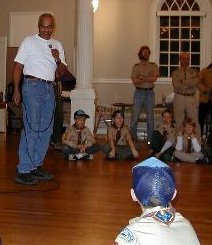
Those Kites! Another way to introduce kids to geography? Kites. My good friend Archie Stewart (left) uses kites to introduce math, physics, art, and geography to kids. By tracing the history kites from 2000 B.C. China and tracing how they looked and what they were used for, Stewart gets kids thinking globally. Oh, and the kids typically get to make kites, too. Those Bikes! In the corner of my back yard there's a bike rack. In it are all sorts of unhappy bikes of all sizes and shapes. They are destined for a non-profit here in Boston, Bikes Not Bombs, that uses bikes as a teaching tool for kids here in the city, and as a development tool for communities overseas. It's the kids program, Earn a Bike, I want to highlight here. The deal is simple: any kid over 12 who makes the 6 week commitment to the program can refurbish a bike and keep it for his or her own. Along the way the kids learn about bike safety, math, and I learned recently, geography. Here's what was written up in the latest newsletter: The Earn-a-Bike kids were split into teams for the Great Commuter Race. They had to find the fastest route to a destination of choice, an ice cream store. One team traveled by subway, a second by car, and the third by bike. Any bets as to who made it first? Yep, the bikes made the three-mile journey the fastest. That led to a discussion of the cost of transportation, the impact on the environment, and other things over ice cream at the destination. Conundrums (concepts we question) Ever Wonder Where People Receive E-mail? No need to wonder any longer. DidTheyReadIt.com a service that launched May 24, for a $50/year fee will track sent mail and what's done with it. E-mail that's to be tracked gets a .didtheyreadit addition to the outbound address. Then the sender can visit a website and find out if the message was read, for how long, if it was forwarded and where the recipient was during receipt. I'm guessing that last part uses one of the many geotargeting tools. While many may cry "invasion of privacy" I would love to know how many of you read GIS Monitor each week and how long it takes you do so. I'm sure my potential advertisers would like to know that, too. I wonder if there's a way to do this for print publications?
Please note: Material used herein is often supplied by external sources and used as is. � Announcements Frost & Sullivan awarded DigitalGlobe its 2004 Aerospace & Defense Product of the Year distinction. The Geospatial Information & Technology Association (GITA) held its 27th Annual Conference and Exhibition in Seattle, Wash., April 25-28, 2004, attracting 2,112 attendees. That total reflects a 3.5 percent increase in paid attendance from the previous year's event. Space Imaging will market to the world, spatial images captured by the indigenous remote sensing satellites RESOURCESAT-1 and CARTOSAT-1. Antrix Corporation, the commercial arm of Indian Space Research Organisation (ISRO) signed an agreement with U.S.-based Space Imaging early this year, which gives the American firm rights to market, worldwide, the data from RESOURCESAT-1, that was put into orbit in October 2003 and CARTOSAT-1, which ISRO plans to launch later this year. MapInfo offered a "sneak preview" of its AnySite Gravity Model. The model will enable supermarkets and other convenience goods retailers to automatically define trade areas, forecast sales, and estimate transfer for all existing stores, competitors, and potential locations within a defined market. The AnySite Gravity Model is the first self-balancing solution of its kind, delivering more insightful marketing data in a fraction of the time and cost of traditional gravity models. The final release of the AnySite Gravity Model is expected to be this fall. Also, the company is working with IBM to develop Web-based portal applications on Envinsa, MapInfo's unified location platform designed to help organizations derive the greatest value from location across business requirements, and IBM's WebSphere, a Web Services-enabled, Java-based application server. Insurance organizations are turning to location technology and Web Services for integrated claims management, more efficient underwriting, improved policy management, and better customer insight. Intergraph announced the formation of its Earth Imaging Solutions Center (EISC) to consolidate global pre- and post-sales support for the complete Z/I Imaging product line. Vexcel Corporation, announced that Vexcel has acquired the assets of International Systemap Corporation (ISM), a Vancouver-based mapping software vendor specializing in digital photogrammetry. Tele Atlas announced a partnership with Metrocommute that expands Tele Atlas' speed and traffic flow data coverage to 21 major U.S. metropolitan areas. Tactician Corporation and Keyhole Corporation jointly announced that they have integrated the award-winning Tactician Online marketing portal with Keyhole 2 PRO, the new release of Keyhole Corporation's pioneering Internet 3D earth visualization solution. The Open GIS Consortium Inc. (OGC) invites participation in an "Interoperability Experiment" that will result in a proposed XML schema for encoding OGC Web Services Context documents (OWS Context). Cadcorp, DM Solutions, GeoConnections/Natural Resources Canada, and IONIC Software have initiated the "OGC Web Services Context Document Schema Interoperability Experiment." Laser-Scan announced that MapInfo Corporation has signed an agreement enabling their Europe, Middle East, and Africa operation to resell Laser-Scan's Radius Topology. � Contracts and Sales ESRI, along with partners, won the cadastre and land registration portion of the Agricultural Development and Credit Project in the Republic of Azerbaijan, tendered by the World Bank. The consortium members included R.I.S.K. Company, a subdistributor of ESRI's Russian distributor DATA+; Lantmateriet; and International Land Systems (ILS). Optimal Geomatics Inc. announced that it has been awarded a contract valued at $448,000 US by new client Kansas Gas Service Company (KGS). The contract involves a pipeline corridor survey and a class location study. Northrop Grumman Corporation has been awarded a contract by the Department of Homeland Security (DHS) to develop and implement a situational awareness capability that provides location information enabled by secure wireless connectivity. Sanborn Mapping Company announced that Sanborn has taken delivery of the UltraCam large-format digital camera from Vexcel. � Products PromptServer is the client-server based image management, processing, and distribution solution for fast access to huge and complex geo-image datasets. It was released this week. Earth Satellite announces that it has begun delivery of a global mosaic of Landsat imagery to ESRI. The mosaic is natural colored and is derived from EarthSat's global Landsat mapping product Geocover-Ortho undertaken for NASA. It'll be part of one or more ESRI products. MapInfo Corporation introduced MapXtreme 2004, the next generation of its location-based technology platform. Built on Microsoft .NET, MapXtreme 2004 enables users to develop custom mapping applications that can be deployed both on the desktop and the Web using the same core engine. GeoLeaders announced the availability of an emergency mapping solution that enables organizations to rapidly communicate and easily understand complex emergency management situations. The emergency mapping solution is based on CubeWerx software, OGC standards, and implements the U.S. Federal Geographic Data Committee's (FGDC) emerging standard for emergency mapping. Haestad Methods announced that its world-class suite of hydraulic modeling products for the water, storm, and wastewater industries now provides full support for AutoCAD 2005. ESRI Business Information Solutions (ESRI BIS), a division of ESRI, announced that Community Tapestry segmentation is now available at the ZIP + 4 geography level. Tele Atlas announced that its map voice data for the entire United States, available immediately. PhonoMultiNe brings to the U.S. market a solution that combines Tele Atlas map data with its phoneme data to drive speech-enabled map data products. MapText, Inc. announced the availability of its Label-911 software package specifically aimed at placing text and symbols on emergency / E911 maps. DDTI announced that it has created a global positioning system (GPS) plug-in for the free AccuGlobe 2004 GIS software. The plug-in allows NEMA standard GPS receivers to integrate with AccuGlobe and can be easily set-up and configured. The plug-in is capable of on-the-fly latitude and longitude transformation to all U.S. state plane zones, enabling the user to display their location, speed, and direction in real-time using available GIS data for their area. The plug-in supports connection to COM port and USB devices, seamlessly integrating with most GPS receivers and computers that have AccuGlobe 2004 installed. Keyhole Corporation announced the preview release of Keyhole 2 Pro, an enhancement of Keyhole's flagship professional client software. Users can add their own data on top of visualizations and collaborate. Orange, a UK mobile phone service, announced that its customers can now use SMS messages to locate businesses or services, with the launch of the Orange "Find Nearest" service, powered by Webraska Mobile Technologies. MapInfo Corporation announced that it is now offering its customers databases from Chain Store Guide (CSG), the most comprehensive source of retail and food service data. Leica Geosystems GIS & Mapping announced its ADS40 digital sensor's capability to acquire 5 cm spatial resolution imagery. This capability enables users to achieve higher accuracy in large-scale mapping applications, extract more detailed information, and digitally match the best resolution possible with film. � Events � Training � Hires John-Henry Gross is now public-sector product manager at geographic information systems applications provider MetaCarta Inc. The Cambridge, Mass., company also named two new partner managers: Stephen Zeoli, charged with new and ongoing business for civilian federal agencies, and Wayne Dickson, who will handle those duties for federal intelligence agency customers. MetaCarta supplies search software that bridges GIS and document-retrieval applications.
Advertise With Us
Contact GIS Monitor is published by: GITC America, Inc.
Subscribe/Unsubscribe |