Letters, Points of Interest, Kudos and Conundrums, Week in Review (Announcements, Contracts, Products, Events, Hires) Back Issues, Advertise, Contact, Subscribe/Unsubscribe If, for some reason you cannot read this document, visit: http://www.gismonitor.com/news/newsletter/archive/072204.php
Telemorphic Wins Frost and Sullivan Customer Value Enhancement Award
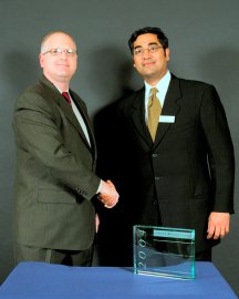
I received an invitation to attend the Frost and Sullivan Customer Value Enhancement Awards held in Boston last week. The invitation came from Telemorphic, the company best-known for its Web mapping technology, which lies behind David Rumsey's website. Telemorphic received the award in the geotechnologies industry in recognition of its product MultiViewer, an extension for ArcGIS. I'm confident Telemorphic, was the smallest company to receive an award among the 28 winners representing industries as varied as digital asset management, pharmaceuticals, and telecommunications. The evening started out with an introduction from Frost and Sullivan's President Krishna Srinivasan. To my relief, he explained what customer value enhancement meant. The most valuable way to see it, I think, is in contrast to customer service. Customer service refers to making customers happy, being reactive, but also by preventing potential complaints. Customer value enhancement refers to helping customers reach the highest level of return on investment. It's typically proactive. Srinivasan went on to highlight that analysts within Frost and Sullivan use objective criteria to compare companies within each area to determine the winners. He noted that the award will help companies distinguish themselves from others in their space, enhance employee morale, and increase stock prices. The last one was said a bit tongue-in-cheek (and generated jokes by winners in their speeches, throughout the evening), but it's clear investors do notice these types of awards. Jeff Otten, the president of Stentor, a medical imaging firm also receiving an award, gave the keynote. It turns out he was the president of Brigham and Women's Hospital (B&W;) here in Boston for some time before heading out to find a way to make technology "really work" in the medical arena. In one of his first meetings with the medical staff at B&W; he discussed customer service and a doctor was annoyed. The doctor felt it was not correct to refer to patients as "customers." When Otten explained that patients are required to wear johnnies, wait long hours while others are treated, and receive information only deemed acceptable by the doctor, he suggested that patients clearly were not treated like customers. And, that was a problem. He went on to note that he sought a technology that would be a platform for medical care, much like ATMs are a technology platform for banking. He ended up at Stentor, a company which was trying to bring medical imagery into digital form. While it sounded like an easy and logical step, there was a problem, one we in geospatial technologies can appreciate. When scanned, the medical images lost some of the important subtlety that doctors needed for interpretations. With that problem solved, Stentor developed an enterprise system to distribute the images across a hospital. That meant patients never needed to carry films and that medical personnel personal had access to the files when needed. Stentor now leads its space in customer service among competitors including General Electric, Siemens and Philips. (I think it's interesting to note these companies they also have plays in geotechnologies!) The lessons Otten used to summarize his talk include the fact that disruptive technologies can even impact conservative industries, like medical care, and that keeping a goal of maximizing value to the enterprise will serve a company well. I share this story because I think it bears a striking resemblance to the challenges we have in geospatial businesses: professionals working with customers, enterprise distribution and data integrity. As I listened to introductions of award winners and their brief acceptance speeches, I was amazed that the descriptions of the companies made what they did sound incomprehensible. When Bose Corporation received an award I was pleased that I knew what they did (they are the "speaker people," well known in in this area since the company is Boston-based). I had to work very hard to tease out even a vague idea of what the other companies did. That led me to question how many companies exist which provide products and services about which I know nothing. In fairness, many people don't know what we geospatial professionals do, either. During introductions to the pair from Telemorphic, CEO Todd Helt and CTO Andrew Waxman, my tablemates jumped directly to telematics applications when they heard "GIS and maps." Perhaps that was due to the fact that two people at the table worked in the aftermarket automotive arena. As we flipped through the company summaries as awards were announced, we noticed Extensis. Waxman and Helt recognized the Celartem logo under the company name. Celartem, which owns LizardTech, purchased Extensis, a document asset management technology company, in 2002. Telemorphic was recognized for "its ability to maximize the value of its offerings, and exhibit remarkable growth in a highly-competitive market, and for its successful launch of a new service protocol to improve overall customer ownership experience." Helt accepted the award noting that he had half of his staff on hand (himself and Waxman) and that the company was started four years ago in a basement with money from friends and family. I got the sense that the other winners thought what Telemorphic did was as foreign as I thought their companies' work was. Still, there was a definite sense from the winners, large and small, that the recognition of a job well done and confirmation that they were heading in the right direction with their customers, was most gratifying. And, as Helt noted to me later, being recognized outside of your industry was particularly satisfying.
An article at Tech News World this week took up the issue of cell phone cameras in the workplace. Recall that many gyms have banned such devices to ensure personal privacy is not threatened. In the workplace however, the article notes, disgruntled employees might capture and send information on the locations of security cameras, details of manufacturing layouts, or the specs on new products. Neil Strother, a senior industry analyst at In-Stat/MDR told the magazine he'd found the adoption rate of camera phones far higher than expected. Fifty million camera phones shipped worldwide last year, up from 18.2 million in 2002. So, clearly, I'm in the minority, as many others have found a compelling reason to own the device. Stother notes that the initial response of companies to any type of threat by technology is typically to ban it. I noted a few weeks ago how several military bases screened Coke cans that might have a cell phone/GPS in them as part of promotion. Samsung Electronics, which ironically makes cell phones (including the model I have), has banned camera phones in its workplace. Pharmaceutical and financial companies are making similar moves. What hasn't been brought out in this discussion is that these types of workplaces often have traditional camera (and sometimes recording device) bans in place. I recall visiting workplaces where I was asked to leave cameras at the front desk and pick them up on the way out. So, at one level, the camera phone is but "another camera." The issue of camera phones is more complex since camera phones are smaller and more people carry them everyday to work and everywhere else, in contrast to traditional large or small cameras. Not surprisingly, a few potential new technology fixes have appeared. Here's an easy one: if it's a company phone, "turn off" the imaging completely before assigning it to the employee. In fact, some companies are requesting phones from vendors that are delivered that way. (Why not just select a phone model without a camera?) A more elaborate solution, from Iceberg Systems, puts a hardware/software combo into the camera phones and adds a transmitter that sends a signal to "turn off the imaging system" on the way into a building. On the way out, it's turned on again. I have to believe clever folks could override this, should they want to do so. (This reminds me of the new shopping cart system that locks the wheels when the cart crosses some "magic line." I can't say I've seen anyone try to disable that, at least not in broad daylight.) Moreover, companies have to decide to put Iceberg's technology into the phones, increasing costs. So far, vendors haven't seen the demand. South Korea's government, however, is currently considering a law that would require all phones sold in that country to include such technology. This whole discussion is essentially a location-based question. Some electronic activities, taking digital pictures in this case, are not allowed in some geographies, but are in others. There's ongoing discussion about technologies to "jam" cell phones in specific geographies, such as within a concert hall. Preventing inappropriate picture taking is the imagery equivalent.

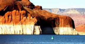
Lake Powell: Name Confusion?
Member of the Arizona Board on Geographic and Historic Names, and geography professor Robert Altschul, says the two arguments "don't hold any water, so to speak." The Board took no action on the proposal at a recent meeting and is looking for input from the Navajo Nation, a neighbor of the lake, on this matter and one other. Others suggest the action is really aimed at lowering the level of water or perhaps ultimately, taking down the dam. They point to a political aim. Still with no members of the Board supporting the change, and the ultimate decision lying with the U.S. Board of Geographic Names, a change does not appear imminent. Lake Powell is named after John Wesley Powell, who incidentally, named Glen Canyon in the first place.
Letters � John J. Troiano, Senior Account Executive at PlanGraphics, Inc. provided an answer to last week's query for a tool to use cell phones with GPS and cameras to capture and share imagery. "Please direct Eric to Red Hen Systems. They have been providing this tool since at least 1998." The editor notes: I contacted Red Hen Systems and learned its solution was announced in a press release last year. The company also shared some insight into its vision for camera phones. � Reader Peter wrote to correct a geography error I made last week. "Just a correction on the location of Symmetry Systems Inc., Bentley Systems acquired Symmetry Systems Inc. which is located in Clifton Park, New York not New Jersey." � Aaron Roller sent an update on MotionBased, a website for tracking running, biking, and other routes, which received a "kudo" back in March. "We would like to let you know that MotionBased is live and open for public beta registration. We invite you to check it out."
Points of Interest MapXtreme Pricing in Japan. Alps Mapping, the sole distributor of MapInfo products in Japan, will begin selling MapInfo MapXtreme 2004 later this month. A software development kit (SDK) license is available for 400,000 yen ($3,670), while the CPU license costs 2,000,000 yen ($18,349). The Tour in 3D. Space Imaging is releasing an archived, IKONOS satellite "Zoomify" image and 3D fly-through of the cyclists' route. The 3D fly-through was created in-house using Sensor Systems Inc.'s RemoteView software, multiple scenes of IKONOS imagery, and digital elevation data. Space Imaging even provided an IKONOS shot of Wednesday's action in Stage 16. At left, one of the many switchbacks up the mountain. I just got the news that Lance Armstrong had won this stage when the photo advisory e-mail came in. Simpson's Map. Reader Rich sent the URL to, as he puts it, "something this important [that] shouldn't be missed�": a map of the Simpson's Springfield. The family's hometown of Springfield (we never learn what state it's in since there's one in every state) includes many of the businesses and government buildings mentioned in the show. I found the one I was looking for: the Lemon Tree on the border with Shelbyville. While neither accurate (due to inconsistencies in the show) or complete (admit the authors, Jerry Lerma and Terry Hogan, who both work at California Polytechnic in Pamona), the map has been added to the Harvard Map Collection of the Harvard College Library, the nation's oldest map collection. (If you wondered, it's stuff like this that keeps me writing GIS Monitor and I hope, you reading it.) No on ATX. Forbes takes a hard look at an upcoming initial public offering from ATX Group, a telematics provider to "fancy" cars including the Mercedes Benz Tele Aid program in the U.S. and the BMW Assist program in the U.S. and Western Europe, as well as programs for Rolls Royce and Peugeot. The piece highlights this important note hidden deep in the Securities Exchange Commission filing: "As wireless providers in the U.S. market complete their service build out for location-based services, this competition may increase significantly or could jeopardize the commercial viability of our service offering altogether." Tracking Broccoli's History. Veggies from Dole with a special bar code on their packaging now carry information on where they are from and how they got to the store. Cooking tips are also available. The code is read from a cell phone with a camera - it has to "scan" the code. I suppose that's one way to be sure your Granny Smith apples are from South Africa. As a child I was taught to only get the ones with the "Cape" stickers. Now I'll have to teach my niece to scan the fruit� For now Dole only offers broccoli with the tags, but plans to expand it to other produce. Open Source Databases on the Move. Information Week reports on the number of commercial companies supporting MySQL, as part of a longer exploration of open source databases, but calls one big company out on the carpet. Pottawattamie County, Iowa, which is moving much of its data from Microsoft SQL Server to MySQL, has had to leave its ESRI implementation running on Microsoft's database. ESRI has mentioned developing open source database support in the past. Last month Hewlett-Packard began supporting MySQL and certifying it to run on HP servers. MySQL has some 4 million implementations putting it among the most widely used open source databases including PostGresSQL and Berkeley DB. Indoor GPS Chip. Fujitsu Microelectronics Europe (FME) announced a new chipset that, according to the press release, is aimed at "receivers capable of indoors acquisition." Indoor accuracy is estimated at less than 20 meters.
Kudos and Conundrums Kudos (concepts we applaud) GIS and GPS are Fun! Shelby County (Tennessee) Schools Options program is a summer program working to encourage local girls' interest in science and math careers. On Monday about 70 students from the county participated in the "Routes at Rhodes" project hosted at Rhodes College. The group did a bit of GPS scavenger hunting then plotted their routes across campus on aerial photography. Best quote: "Hey, this is actually kind of fun," said one student. Another bonus, local high school science and math teachers were involved. Conundrums (concepts we question/give us pause) Bluespam. Reports are coming in that no less of a publication than The Economist has been found "bluejacking" ads to attendees at a conference in Singapore. Bluejacking is the art of taking advantage of "turned on" Bluetooth access in a phone or handheld device to send an unexpected message. Commentators universally call this tactic Bluespamming and denounce it.
Please note: Material used herein is often supplied by external sources and used as is. � Announcements Cartographic Applications Manager Peter Jolly of ESRI has been appointed to the position of international president for the International Map Trade Association. (IMTA). The U.V. Helava Award, one of the most prestigious ISPRS recognitions sponsored by Leica, was awarded to the paper "Extraction, Modelling and Use of Linear Features for Restitution of Airborne Hyperspectral Imagery," written by Changno Lee and James S. Bethel. Telus Geomatics, a division of Telus Communications Inc., has announced a partnership with Iunctus Geomatics Corp. of Lethbridge, Alta., to procure and process Canada-wide satellite imagery using the SPOT satellite system. Telus Geomatics will be the exclusive marketer and distributor of the imagery in Canada. CompassCom Inc. of Centennial, Colo., announced the creation of CompassData Inc., formerly a CompassCom business unit which specializes in collecting high-quality ground control points (GCPs) for orthorectification of aerial and satellite imagery. In addition, CompassData introduced the availability of the CompassData Ground Control Archive containing more than 6,000 points collected worldwide by CompassData since 1998. Intergraph Mapping and Geospatial Solutions announced Mescioglu Engineering Co. (Mescioglu), Ankara, Turkey, has signed as Intergraph's newest distributor. The Space Foundation has received a number of excellent nominations for "down to Earth" technologies to be considered for induction into the Space Technology Hall of Fame. Organizations and individuals are encouraged to submit nominations prior to the official close of the nomination period on Aug. 16, 2004, to allow for the rigorous due diligence process that leads to the selection of the 2005 class of Hall of Fame technologies. Tadpole-Cartesia announced that it has partnered with VELOCITIE Integration to provide its enterprise ArcGIS data management solution to the utility, municipal government, and communication industries. The intent is to unite Tadpole-Cartesia's Enterprise Data Management system with VELOCITIE's world-class implementation services and for both companies to offer the new solution to existing and prospective clients. The United States Geospatial Intelligence Foundation (USGIF) added seven new member companies: Goodrich Corporation, Imation Corp., Integrity Applications Incorporated, IONIC, Riverside Research Institute, Space Imaging, and Techni Graphic Systems, Inc. The Infocomm Development Authority of Singapore and Oracle have announced a multimillion-dollar investment to bring grid technology to enterprises. Grid computing, which allows networks of PCs and servers to dynamically share processing power, storage, and applications, has, to date, largely been used in academic applications. As a proof of concept, Oracle teamed with Autodesk Asia and Sun Microsystems, IDA, and Oracle on a project with the Singapore Land Authority (SLA). By using grid technology, the SLA, which manages the country's land resources, hopes to provide a single Web-based interface for users to access the databases of various government bodies. The Geospatial Information & Technology Association (GITA) is pleased to announce that it is a recipient of a $7,500 educational grant from the Xcel Energy Foundation (Denver, Colo.). Formed in 2001 as the philanthropic arm of Xcel, the Xcel Energy Foundation oversees the more than $7.5 million-funded charitable activities of Xcel Energy and its subsidiaries. GITA will use the funds to expand and enhance its educational offerings to schoolchildren and young adults in middle school, high school, and undergraduate studies. � Contracts and Sales MapText, Inc. announced that the Georgia Department of Transportation and the Louisiana Department of Transportation have recently procured Label-EZ, the company product for automated cartographic label placement. 3001, Inc. was recently announced as a subcontractor for Ayres Wisconsin Regional in a project for the East Central Wisconsin Regional Planning Commission that will capture imagery of more than 20,000 square miles of Wisconsin. Analytical Surveys, Inc. announced, in cooperation with Intergraph Corporation, that ASI was awarded a $2.9 million contract for the final "roll-out" phase for the Puerto Rico Electric Power Authority (PREPA) AIRe project. RouteMatch Software, Inc. announced that it has won a contract to provide regional and small urban transportation providers in Iowa with its fully automated demand response transit management software and solutions. Lamont-Doherty Earth Observatory of Columbia University has received a grant of $671,200 from NASA to map dissolved organic carbon in Eastern coastal waters by using satellite data to interpret the color of the ocean. Woolpert LLP was recently selected to create field-based tools for the Greater Cincinnati Water Works' (GCWW) field-based GIS initiative. As part of this project, Woolpert will be developing custom applications using ESRI's ArcEngine, reengineering workflow processes, and providing GPS data integration to enable GCWW staff to create as-built drawings in the field. RS Information Systems, Inc. (RSIS) has been awarded a $4.8 million technology conversion contract by the Farm Service Agency of the U.S. Department of Agriculture. The award, made through the RSIS GSA FAST contract held by RSIS, is for technology support to the Aerial Photography Field Office of the Farm Service Agency. RSIS will convert manually delineated farm boundary information into topological, structured data sets of Common Land Unit (CLU) boundaries. The result will be a single data file for each U.S. county used for USDA GIS database-driven application processing. � Products NovaLIS Technologies will release NovaLIS Parcel Editor for ESRI's ArcMap 9 at this year's ESRI User Conference in San Diego. The New Zealand land-cover database, LCD2, the second constructed by the Environment Ministry, was built using images sourced from a Landsat satellite in 2001 and 2002. It is available on CD-Rom along with the first land-cover database which was based on satellite data obtained in 1996, priced at NZ $600. Leica Geosystems GIS & Mapping announced that Leica Geosystems' ERDAS IMAGINE is to support Oracle 10g. GeoLytics released the new CensusCD +Maps 1990-2000, a tool for anyone interested in recent American demographic trends. The product has basic geographies from ZIP code to the national level (nation, state, county, MCD, place, congress, ZIP, MSA/CMSA, PMSA, and American Indian Reservation). It also brings together two datasets: normalized 1990 Long Form data in 2000 Boundaries, as well as 2000 Long Form Data. Caliper Corporation released Maptitude 4.7 with enhanced analysis, reports, editing, integration, and data. Group 1 Software announced the release of the latest version of its CODE-1 Plus address validation software solution. Utilized by more than 1,500 organizations in North America, CODE-1 Plus validates, corrects, and standardizes customer address data. � Events The 2004 Great Lakes Regional Data Exchange Conference will take place October 26-28, 2004, at the Detroit Marriott Renaissance Center. Tuesday, October 26, will consist of eight training sessions followed by a welcome reception. Wednesday, October 27, will feature plenary, breakout, and brainstorming sessions as well as a luncheon with a keynote speaker, and the Night on Greektown event. The final day, Thursday, October 28, will include the final breakout and plenary sessions, followed by conference conclusions. "Free/Libre and Open Source Software (FOSS) for Geoinformatics: GIS-GRASS Users Conference 2004" will be held at Chulalongkorn University, Bangkok, Thailand from September 12th-14th. The international conference will cover all aspects of FOSS for Geoinformatics, in addition to GRASS itself and provide opportunity to learn and exchange experiences between FOSS/GRASS users and developers. A brochure (pdf), call for papers, and details are now available. � Hires, New Offices A 20-year veteran of San Diego State University, John O'Leary, will take on the chairmanship of the Department of Geography in the College of Arts and Letters.
Advertise With Us
Contact GIS Monitor is published by: GITC America, Inc.
Subscribe/Unsubscribe |