Points of Interest, Kudos and Conundrums, Week in Review (Announcements, Contracts, Products, Training, Events, Hires) Back Issues, Advertise, Contact, Subscribe/Unsubscribe If, for some reason you cannot read this document, visit: http://www.gismonitor.com/news/newsletter/archive/072904.php
USGIF on the Fast Track
I spoke with Steven Jacques, the USGIF Vice President of Operations about the organization's current work. One of the big things on the Foundation's plate is certification. The Foundation is working to establish a Geospatial Intelligence Certification Program in coordination with the National Geospatial-Intelligence Agency (NGA) and universities and colleges throughout the country. This certification, like the scholarships, is part of the organization's outreach to "the next generation" of geospatial intelligence professionals. The idea is to define some competency standards, similar to the "colored belts of Karate", as Jacques puts it, to lay out a path for those interested in this area. As Jacques explained the vision, it's about developing a knowledgeable labor pool (and current GI executives) in core geospatial intelligence competencies, which will increase the level of expertise in this area throughout government and the private sector. This core might also be valuable to all of those exploring geotechnologies, even if they don't plan on heading in to the intelligence side of things. Another layer of this focus on education might include a "mentor/prot�g�" program and internships down the road. Says Jacques, "Our members want this." I noted the speed with which USGIF and the scholarship and awards programs appeared, and the momentum of the certification work. Jacques explained that it's the members, volunteering their time, who are making it happen. He cites scores of members and their companies, donating time, resources, and best practices. Last year's GeoIntel was a first attempt to pull together the energies of the people involved in geospatial intelligence and by all accounts, it succeeded beyond everyone's expectations. The expected crowd of 600 turned into 1,400 and several well-plugged-in geospatial people let me know I missed a key event. There's "too much commitment and acknowledgement of purpose" to slow USGIF or the event down" says Jacques. This year 1,500-2000 attendees are expected. And USGIF is being very clear on the event and the organization's focus: addressing its prime customer, NGA. With both Lieutenant General USAF (Ret.) James Clapper, Director of NGA, and Deputy Director Joanne Isham on board as supporters, NGA will be well-represented. Jacques notes, the Department of Homeland Security may well be a "customer" too, but at this point, the event is not trying to be all things to all people. Jacques explains that in time some of the existing borders between agencies may disappear, and this may be something the foundation may encourage. "Information is information" he repeated several times in our conversation, making it clear that boundaries are artificial and may well hamper its best use. Jacques described USGIF as a classic "service foundation," a term with which I'm not familiar. That, he said, means USGIF doesn't lobby, is apolitical, and has furthering its market as its goal. He pointed to the Space Foundation as a comparable example. The big difference: that Foundation serves a variety of players from the defense/intelligence, civil, and commercial side of space. USGIF focuses on the intelligence side of geospatial. That may not really limit USGIF's reach as much as it appears to, as NGA and Homeland Security have civil organizations as their customers. When I asked about what attendees might take away from GEOINT 2004, Jacques identified several things: the opportunity to rub shoulders with 2,000 attendees in this space, insight of executives, a sense of how the latest technology can support intelligence, a sense of "macro policy" on intelligence, as well as an international perspective on geointelligence. The event will also be where NGA announces the recipients of a round of Broad Agency Announcement (BAA) contracts. I asked about that practice as it stuck me as "odd." The BAA awards, typically a few hundred thousand dollars each, will hopefully help introduce smaller players to large ones to find new synergies. NGA is using the event to show its commitment to both the process and to USGIF. Moreover, says Jacques, it helps break the award "away from the norm" enhancing NGA's outreach. As for next year? The 40,000 square feet of exhibits are effectively sold out for this year and Jacques is looking for 80,000 square feet for next year. In the meantime, USGIF boasts 35 members.

How does it work? The bus carries a card reader or other type of ID reader and a Wi-Fi enabled computer. Upon boarding, students swipe their card (or key in some code) to record they "got on." That data is stored locally and tagged with a location acquired from a GPS on the bus. When the students get off at school, they again swipe their cards (or whatever ID mechanism is used). The data is then uploaded, via Wi-Fi, to a database at the school. The same process occurs on the way home, with data being uploaded at the "depot." At that time "exception reports" note who didn't take the bus home, or who might still be on the bus. While it ideally "should work" I am imagining being a student. Would I forget/lose my card? Might I in a rush forget (or consciously choose) not to swipe it? Might I try to pile out of the bus in a group of children and not swipe it? Might I swap cards with a friend? I wonder if schools would deny a ride to a student who forgot their card? There's no mention of Wi-Fi security in the IBUS brochure, thought I have to believe that the data is transferred via secure link. The other challenge, I think, is that for the data to be useful, it must be downloaded at school or at the depot. How long then, will administrators/parents have to wait to learn that Johnny didn't take the bus home? I recall busses in my town did several runs in the afternoon, taking home students, shuttling sports teams, and taking other trips before heading to the depot. How many "false alarms" will be started when Johnny decided to, or had to, stay after school? A competitor of National Scientific, Satellite Security Systems (S3) just signed a contract with the San Francisco Unified School District to use its technology to track 220 school buses and 7,500 students. This solution is a bit different. Using GPS receivers and two-way satellite communication, the S3 system tracks bus location and when and where the school bus doors open and close. This system offers the ability to remotely shut down the bus' engine. The system also allows administrators to set up geofences and to be notified if busses cross them. Besides basic security and "peace of mind" for parents, the marketers of these systems tout their ability to reduce paperwork and make it easier for school systems to obtain reimbursements for Medicaid. Washington, D.C., which uses the S3 solution, expects to collect $10.1 million in federal revenues during the first two years of use.

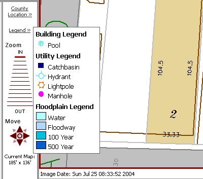
Franklin County, Ohio's Assessor uses a Web mapping backend tool from MetaMap of Frankfurt, Kentucky. You can search for properties in a variety of ways and the maps are provided quickly. Two "nifty" features I want to highlight include legend and locator maps that appear only when you move your mouse over their hotspots, and a hint, below the map that suggests what you might want to do next. The mouse-over maps keep the map area uncluttered while the hint reduces the use of the "help." Two other nice features on the marginalia: the date the map was made and the data of orthos.
MapInfo Continues Strong The company was aiming at reaching an operating margin of more than 10 percent by next quarter. President Mark Cattini was pleased to reach that goal one quarter early. He's also pleased that the third quarter marked the sixth consecutive quarter of year-over-year revenue increases and the fifth consecutive quarter of year-over-year earnings per share gains. MapInfo's head count is down to 715 from 724 last year. That, along with the strong quarter, means the company is hiring. Cattini noted that about 10-15 hires are expected in Ann Arbor, headquarters of recently acquired Thompson. "We actually have more work than we can deliver," Cattini explained. MapInfo's frugal ways are even seeping in the new residents of its former location. WMHT Educational Telecommunications Inc. is moving into MapInfo's old digs in Rensselaer Technology Park next year. The new tenant will keep in place a brass plaque the size of a coffee can lid that documents the coordinates of the spot, along with the MapInfo logo.
First off, ESRI generously provides Wi-Fi access in the San Diego Convention Center. But, as I learned last year, that doesn't necessarily mean you can get your e-mail on your laptop in the "usual way." ESRI has confirmed that "the link will be just as last year's, meaning that [the network will] pass Internet-based traffic and SMTP email applications. Customers should be using 'online' solutions for access." Said another way, the port that traditional mail clients (Outlook, Eudora, etc.) use will NOT be open. That means, to access mail, attendees will need to use Web-based mail. Some readers may already have Web-based mail available from their employer. Others may want to touch base with their IT staff to find a solution, should such access be required. For everyone else, I recommend the free Web2Mail Lite, www.web2mail.com, a service that allows access to mail online. Its only downside? No attachments come through. Still, it worked like a champ for me in the UK last year. Second, ESRI is anxious to receive questions and opinions via its annual survey. The survey input is used to plan out some aspects of the conference and serves as the basis for the long and valuable responses provided by ESRI staff before the conference. Longtime readers know that those responses are my favorite airplane reading as I head to the West Coast. Finally, here are some of the consultants/vendors who want you to know what they are doing at the conference: GeoDecisions staff will be presenting or co-presenting on a variety of topics at the conference. Matrox will be showcasing the Matrox P650 Low-profile PCI multi-display graphics card, designed for small form factor PCs and laptop docking stations, and the Matrox Advanced Synchronization Module (ASM), providing genlock support for multi-board and multi-system display synchronization. There will also be a drawing for a card giveaway. NovaLIS Technologies will release NovaLIS Parcel Editor for ESRI's ArcMap 9 at the event. Aerials Express, a national aerial photography firm, will show off its mascot, a 2004 Lincoln Navigator adorned with aerial photography, to acquaint attendees with its new product, Mobile Aerial Solutions. Xplore Technologies will be exhibiting its laptop Renegade ruggedized computer as well as its iX104 Renegade Dual Mode Tablet PC aimed at law enforcement, firefighting, and EMS responder applications at the conference.
Points of Interest GeoSpatial One-Stop Comments Needed. The folks behind Geospatial One-Stop (GOS) have posted a Request for Comments on the specifications for the next iteration of the portal. There is a 30-day period for comment. This means you, regular GIS people, can say what you like, what you don't, offer suggestions, etc. If you don't use GOS now, have a look and tell them if this version looks better. If you do use it now, have a look and see if you like these enhancements. You can comment through August 15, 2004. The document is available for download here in .DOC format. The document was issued on July 15. LBS for Cheap Gas. Finding cheap gasoline could soon be a cell phone call away. Televigation Inc., a location-based service provider for mobile phones, will launch a feature next month to direct its TeleNav subscribers to the nearest, most affordable gas stations. SRTM Data Easily Accessible. The University of Maryland's Global Land Cover Facility now distributes user-ready editions of land surface topography data from NASA's Shuttle Radar Topography Mission (SRTM). The data is divided to match WRS-2 tiles and thus match Landsat scenes. The data is free. Chipping Portuguese Dogs. Digital Angel won a $600,000 deal to start implanting RFID tags in dogs in Portugal. The country's initiative to control rabies mandates that the estimated 2 million dogs be tagged and listed in a database by 2007. This first phase covers about 200,000 animals. About 6,000 U.S. dogs were returned home last year after being identified by such tags. SOAR. I received a note from Science and Operational Applications Research (SOAR), a joint partnership program between RADARSAT International (RSI) /MacDonald Dettwiler and Associates (MDA) and the Canadian Government through the Canadian Space Agency (CSA) and the Natural Resource Canada's Canada Centre for Remote Sensing (CCRS). SOAR is looking for proposals to gain access to data from RADARSAT-2, scheduled for launch in 2005. It carries a synthetic aperture radar (SAR) sensor. An online letter of intent, due by December 2004, will outline projects and SOAR will respond to these by February 2005. Details are online. The DNC and GIS. I found but one note of GIS in use in managing security for the Democratic National Convention being held this week in Boston. A columnist in the Metro West Daily News reports that the Massachusetts Emergency Management Agency has access to "GIS images [that] � show 3-D layouts of the Boston skyline." Further, "After viewing a demonstration of the GIS capabilities to show all angles of buildings and the array of camera angles in and around Boston, Gov. Mitt Romney, who dropped in for a quick tour yesterday, quipped, 'Good thing I kept my window closed.'" Ads on County GIS Website? Slashdot tipped me off to the growth of the Maricopa County, Arizona GIS website. The county is home to the Phoenix metropolitan area. The heavy use of the website by those in the real estate arena has prompted the county to accept bids for advertising. Good news for users: The Assessor's Office "will not allow any pop-ups or moving ads." The website, by the way, is powered by Autodesk's MapGuide. Kid-friendly Tracking Phone. Korean SK Telecom Co. has introduced an inexpensive phone (US $86) designed specifically for children. With an antenna shaped like little bunny ears, the phone includes just four buttons for saved phone numbers. Reuters reports that the embedded GPS functions when the phone is switched off. Another Legal Win for Intergraph. Upfront.eZine reports that after a year and a half in court Intergraph won a lawsuit against Bentley Systems. After Intergraph sold its civil engineering software to Bentley, there was a dispute about how much maintenance renewal money was to be paid. In the end the judge awarded Intergraph $6.7 million.
Kudos and Conundrums Kudos (concepts we applaud) Maps Beautify Victoria. The City Engineering department in Victoria, BC, Canada has allowed street maps of the city to be pasted on traffic control boxes. Observers say they are far more attractive and useful than the typical painted ones. The maps include a "you are here" arrow, points of interest, and the URL of city, and some hope there'll soon be a way to download the map to a mobile device. It turns out the maps are courtesy of The Rock Solid Foundation, a group of city police officers that provide young people "with positive solutions to violence, threats, intimidation, and aggressive behavior." Wallpaper Keeps Cell Phones Quiet. QuinetiQ, which also has a GIS business, is the company behind some new non-cell phone permeating wallpaper. The company was part of the UK Ministry of Defense before it was privatized and invented a printed paper that will block cell phone and Wi-Fi transmissions, but allows radio and other signals to pass through. It might be used to create or enforce quiet zones, according to the Guardian. Conundrums (concepts we question/give us pause) Track Your Assets. The Personal Locator Beacon Phone (PLBP) is advertised as a "VIP, Hostage & Vehicle Tracking System." It's a cell phone, with GPS, and the ability to send, via analog phone signal, an emergency signal, including location. While analog calls cost more (that horrid "analog roam" fee on your cell phone bill) that band covers areas without cell coverage. Two things struck me as odd, and perhaps, unfortunate, while reading about the device. First off, after speaking of VIPs, the press release began speaking of assets, not people. Second, the device is only available in the United States at this point.
Please note: Material used herein is often supplied by external sources and used as is. � Announcements NGRAIN announced that Image Peak Systems and Aero Geometrics Ltd. have licensed and applied its interactive 3D visualization and simulation technology solution to develop advanced mapping and terrain visualization applications and products, to help address new demands in the geospatial industry for more advanced applications that allow users to better visualize, analyze, and communicate a wide range of information and scenarios. The Geospatial Information & Technology Association (GITA) announced that, for the first time in its history, the government sector represents the largest segment of the association's user base. Government employees make up 29% of GITA's user members, followed by electric utilities at 23%, electric and gas combination at 12%, oil and gas pipeline and gas utilities at 11% each, water/wastewater at 9%, telecom at 4%, and 3% in other industries. GITA also announced that in the first 100 days since its publication in April, sales of its 2003-2004 Geospatial Technology Report are up 180% over sales of the previous year's report during its first three months of release. The 2003-2004 Geospatial Technology Report is available to GITA members for $145 and to nonmembers for $245 from GITA's Web site. At the OGC's 50th Technical Committee meeting this month in Southampton, UK, two new Technical Committee working groups were formed: the Geospatial Digital Rights Management Working Group (GeoDRM WG) and the University Working Group (University WG). CompassCom Inc. has provided key components in a Global Positioning System (GPS)-based mobile resource management solution for the city of Boston's emergency medical service (Boston EMS). The CompassCom technology will help the public-government agency track 40 ambulances around the site of the Democratic National Convention this week and in daily operations thereafter. Trimble announced results for its second fiscal quarter ended July 2, 2004. The Company reported second quarter revenues of approximately $179.5 million, a 30 percent increase over the approximately $138.1 million reported in the second quarter of 2003. The second quarter is typically the Company's strongest due to seasonality in the Engineering and Construction (E&C;) market. Trimble Field Solutions (Agriculture and GIS) also reported record quarterly revenues for the second consecutive quarter, growing by more than 50 percent over the second quarter of 2003. Skyline Software Systems, Inc. selected LizardTech's new compression and decompression technology to embed into its commercial software line, TerraSuite. The new MrSID SDK is now embedded into TerraSuite, which enables Skyline's 3D World Gateway to directly access MrSID compressed raster formats. ESRI launched the Mobile Government Grant Series. Along with Trimble the program aims to help government agencies better understand how to deploy GIS and GPS technologies to help make governments more efficient and productive. The Mobile Government Grant Series consists of two programs offering hardware, software, and training totaling $170,000. The first of the two programs, the ESRI and Trimble Government Mobility Demonstration Program: Planning Edition, will be open to all planning disciplines. Ten grant packages will be awarded to state and local governments within the United States. The second program, the ESRI and Trimble Government Mobility Demonstration Program: Homeland Security Edition, is open to all federal, state, and local government disciplines engaged in homeland security efforts. This program will award an additional 10 grant packages. The deadline for all Mobile Government Grant Series applications is September 17, 2004, 5 p.m. Pacific time. Awards will be announced on October 8, 2004. Completed grant projects must be documented and submitted to ESRI no later than April 29, 2005. As part of the agreement, har*GIS' and Tripod Data Systems (TDS) will offer the TruckMap* field information systems software bundled with TDS handheld computers. � Contracts and Sales In May 2004, VARGIS was awarded a three-year contract with the U.S. Department of Agriculture for the National Agriculture Imagery Program (NAIP). Intergraph Mapping and Geospatial Solutions announced Puerto Rico Electric Power Authority (PREPA) has signed a contract valued at $4.3 million with Intergraph for additional services involved in the roll-out of its Geospatial Resource Management (GRM) system. The Pennsylvania Department of Environmental Protection (DEP) selected GeoDecisions to work on the Pennsylvania Incident Response System (PAIRS) with DEP staff. PAIRS is a multi-agency application for communication and tracking of routine and emergency incidents in Pennsylvania. Analytical Surveys, Inc. (ASI) announced that DTE Energy's subsidiary, Michigan Consolidated Gas Company (MichCon), has contracted with ASI for additional geospatial data maintenance services. As part of an ongoing partnership that has spanned more than 14 years, ASI will be an outsourcing resource for backlog work-order maintenance for the North Central, Grand Rapids, and Detroit Telcontar announced the award of a multi-year contract with ATX Group. Telcontar's Drill Down Server (DDS) software platform enables ATX call center personnel to help direct and navigate customers to various locations via automated routing and mapping features. ATX, a leading independent provider of telematics services with over half a million subscribers in North America and Western Europe, provides motorists with enhanced location-based safety, security and navigational assistance services in conjunction with leading automobile manufacturers and their dealers, including Mercedes-Benz, BMW, and Rolls-Royce. Sanborn has been contracted to perform new and update mapping services for the city and county of Denver's Technology Services GIS Group. Project scope requires Sanborn to acquire and provide color orthophotography and LiDAR to generate comprehensive digital terrain models for approximately 359 square miles. The City of Westminster, Colorado has selected Hitachi Software Global Technology, Ltd. (HSGT) and its Any*GIS solution to integrate and serve its spatial data. The project, which will begin later this summer, will use the Any*GIS Web and CAD clients to serve the City's ArcSDE and other spatial data to internal employees and external contractors. � Products The WhiteStar Corporation announced the availability of T&R; 100 Plus, a 1:100,000 scale database of Public Land Survey Data for those 29 States in the United States using the Public Land Survey System plus abstract numbers and abstract polygons for the state of Texas. The data were derived from a variety of sources, compiled, and edge matched to seamlessly provide a cost effective solution for mapping section, township, and range data at the 1:100,000 scale. This scale provides an accuracy of approximately +/- 167 feet. Cubistix, an independent software developer located in NJ, released GeoSpatial Case Manager, an innovative solution developed for child welfare services in response to the unique challenges facing their industry. The product is built on Microsoft's MapPoint. GPSFlight is now shipping the TWX-TR - a lightweight, advanced telemetry device designed to provide a complete tracking solution for commercial and government customers where real-time or recorded telemetry is required, and where the use of cellular networks is not desired or possible. The TWX-TR features on-board storage of GPS data, retrievable via remote wireless link, and also permits real-time tracking of multiple units by a single receiver. Autodesk's Emergency Response Solution was formally unveiled this week. It allows fire officials, for example, call up buildings' floor plans, calculate how much water would be needed to fight a fire, and render a 3D image of the downtown area. It's built on MapGuide. PCI Geomatics announces the release of GeoRaster ETL for Oracle - an Extract, Transform, and Load (ETL) product that allows users to leverage Oracle's enhanced support for raster data in Oracle 10g. Miner & Miner released ArcFM Solution 9.0. ArcFM Solution and extended services assist electric, gas, water, and wastewater utilities in increasing productivity, lowering costs, and improving services by allowing them to effectively manage spatial information. UAI (UAI, Inc.), a provider of geospatial information technology solutions to the utility industry and public sector, announced that it has certified its UtilityCenter 2.0 uaFM GIS module to operate on ESRI's newly released ArcGIS 9 platform. Thales has introduced MobileMapper CE, which runs Windows CE. Aimed at a lower priced market that other GPS data capture tools, MobileMapper CE GPS receiver is said to offer real-time, sub-meter GPS positioning, Bluetooth wireless connectivity, removable SD card memory, and an all-day removable battery. It has QVGA resolution, 256K color, "daylight readable" TFT LCD display with a resistive touch panel. It appears to be the "next generation" MobileMapper. MapInfo announced the availability of Routing J Server v3.0 in Europe, enabling developers to add routing and drivetime functionality to any Web-based or Windows-based application. � Training Bentley Systems, Incorporated announced the availability of its Enterprise Training Subscription Resource Center, the source for online learning from Bentley. The center adds a wide portfolio of on-demand resources to Bentley Institute's training offerings and is highlighted by more than 1,000 innovative, instructional video clips of product features and workflows. The company also opened pre-registration for its inaugural series of BE Meetings. BE Meetings are Bentley's professional training events, now held worldwide. Events are planned for Germany, the United Kingdom, China, and Japan. � Events � Hires, New Offices ObjectFX appointed Barry J. Glick as its President and CEO. Glick is a recognized leader in the geospatial and related location-enabled information industry. He was a founder and served as CEO of MapQuest.com from its inception as a business unit of RR Donnelley and most recently had been CEO of Webraska Mobile Technologies, a worldwide leader in wireless navigation and location-based services. Tadpole-Cartesia, Inc. announced the appointment of Don Fryhover as director of sales and marketing for North American markets. In this capacity, Fryhover will lead Tadpole-Cartesia's drive to extend its ESRI-based enterprise data management business with government, municipalities, and service industries. He comes from Analytical Surveys, ASI. The Schneider Corporation announced that Brian R. Berdanier has joined the company as Senior GIS Project Manager. Most recently Berdanier was the Director of REGIS (Regional Geographic Information Systems) in Grand Rapids, MI.
Advertise With Us
Contact GIS Monitor is published by: GITC America, Inc.
Subscribe/Unsubscribe |