Letters, Points of Interest, Kudos and Conundrums, Week in Review (Announcements, Contracts, Products, Events, Training, People) Back Issues, Advertise, Contact, Subscribe/Unsubscribe If, for some reason you cannot read this document, visit: http://www.gismonitor.com/news/newsletter/archive/122304.php
I also like to use this time of year to thank those who make this publication possible. That includes, of course, you, the loyal reader. Hardly a week goes by when I don't hear from you about errors I've made, opinions you want to share, and often just a "hey thanks, GIS Monitor is valuable to me." All of those help keep me on track and make this publication a key part of our community. (At left, I document the Open Source Conference in Ottawa. Thanks to reader Athina from Germany for the image.) A second group worthy of thanks includes our advertisers. They, not me, not GITC America, ensure that GIS Monitor continues to come to you free of charge, as it has for the past four years. While all of our advertisers are important, I want to single out two who have been with us for the past three years, nearly every week: ESRI and Safe Software. Thank you for thinking enough of GIS Monitor to support it for the long haul. I encourage readers to let sponsors know that you appreciate their efforts. The third group I want to recognize is one that's likely invisible to most readers. It's the team in Frederick, Maryland that works behind the scenes making sure that computers are running, that I don't make too many grammatical or spelling errors, and that graphics look sharp. Best wishes to readers and their families, worldwide, for the holidays and the new year. The next issue of GIS Monitor will appear on January 6.

1. Best News for Geospatial Journalists: Intergraph's Press Imagery Gallery
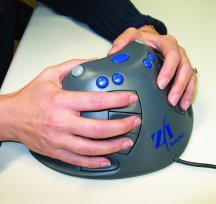
I hate calling out one vendor over another for anything. But if other vendors follow suit, my life, and those of others who cover this industry, will be better. And, what's wrong with a bit of self interest? Ready? The best thing for geo-journalists this year is the new online Press Imagery Gallery from Intergraph. The company provides high resolution pictures that I can download at midnight in my pajamas and use online or in print. I don't have to ask permission, explain yet again what 300 DPI means, or even interact with a person. That last part is especially rewarding, as I (and I'll suggest my peers) like to ask vendors far more difficult questions than "can I have a picture for my article, please?" I highlight Intergraph, but must also note that imagery vendors, notably DigitalGlobe and Space Imaging have terrific, easy-to-use galleries. Intergraph is noted in part because the company doesn't sell imagery!(That's the new Z/I Mouse for 3D input. The image is from the gallery.) The other half of the story? Intergraph never, ever sends unsolicited imagery with its press releases. Most reputable larger firms have learned not to do so. Are you listening, small firms? Please don't send images (or at least images more than a few hundred kilobytes) without permission. Instead, post them on your website and provide a URL from which they can be downloaded. And, if you are up to it, create a gallery! 2. Marketing Battle of the Year: GIS vs. Geospatial
I suppose I fueled the fire with my article on the topic earlier this year. I was asked to write another article on the topic (I declined) and read no less than four other treatise in other publications. Traditionalists ESRI, GIS Monitor, and others are sticking with GIS. The majority of companies, the U.S. government, and the Open Geospatial Consortium are backing geospatial. I hate to say it, but from a marketing standpoint, the geospatial proponents may have an edge, but we'll see. 3. Best Geo-Blogs: TheFeature and SmartMobs
Blogs are hot, no doubt about it. But, what's worthy of reading if you are interested in the future of geotechnologies? The two I find most interesting seem to revolve around one man, Howard Rheingold, the author of SmartMobs and numerous articles about technology and society. TheFeature.com describes itself an "opinionated, independent voice for the mobility community. It is the mobile Internet industry's premiere thinking space." The website is owned by Nokia but the writers are independent. Rheingold posts there quite a bit.
SmartMobs.com is "a website and weblog about topics and issues discussed in the book." "Smart mobs emerge when communication and computing technologies amplify human talents for cooperation. The impacts of smart mob technology already appear to be both beneficial and destructive." While connected to the book, it's overly focused on it, and covers quite a variety of topics. One other "honorable mention" goes to Starhill.us from Mike Liebhold. It gets that designation mostly since it's not updated too often. Still, it covers lots of "on the edge" work and thought not noted elsewhere. 4. Acquisitions that Might Not Alter the Landscape: GDT, Haestad Methods
It's very hard to predict if one company being acquired by another will have an impact on the company, its products, or the marketplace. The two significant acquisitions this year, in my mind, were GDT's acquisition by Tele Atlas and Haestad's acquisition by Bentley Systems. The Tele Atlas acquisition was described as filling a hole in the company's worldwide revenue picture (the hole was a solid U.S. revenue stream, something GDT could provide). That suggests to me, as does the fact that GDT's president is serving as Chief Operating Officer of Tele Atlas, that while it'll take many of us sometime to say Tele Atlas instead of GDT, there will not be a huge shakeup. The Haestad acquisition is yet another in a series of acquisitions by CAD and GIS companies of their third party players. Autodesk has made many such acquisitions as have ESRI and Bentley. The challenges in these acquisitions involve plans to integrate (or not) the technology and products into the "mothership." While there is sometimes consternation and perhaps some layoffs, these acquisitions rarely shake the world markedly. Such acquisitions do, on the other hand, further whittle down the pool of independent developers, who are, whether users know it or not, some of the best advocates for product enhancements in the core products like ArcView, AutoCAD and MicroStation. 5. Hottest Conferences: Open Source GIS Conference/MapServer User Meeting and GEOINT
I can't pretend that I attended every geotechnology-related conference this year (or any year) but two that I did attend in 2004 stood out. First off, I want to recognize the Open Source GIS Conference 2004 & Second Annual MapServer User Meeting in Ottawa, Canada. As I noted in my coverage, energy at the event was high, and key business and social relationships were being made. Those new to open source were learning the ways of the open source world from more experienced hands. Everyone was exploring the challenging freedom of open source and its implications for geotechnology even as they pondered how they or their consultants and programmers would make a living in the long-term. If you want to see what's happening outside the hallowed walls of Redlands, Huntsville, and other GIS programming and marketing hubs, put the 2005 conference on your calendar.
The other event which shook me out of my many-year-old GIS imposed stupor was GEOINT 2004. While the geospatial focus was clear, for those from that arena the "INT" education was exceptionally valuable. I like to think that for those from the "INT" side the "GEO" part was valuable. This is another conference to get to at least once in a geospatial career, if only to get a sense of what intelligence means in the context of the geospatial disciplines. 6. Best News for Navigation: Galileo
After much discussion about which countries should be involved, how it should be financed, how and if it should be interoperable with the U.S.' GPS, Galileo is on the road to being built. With first launches planned for next year and an operational system expected online by 2008, this is surely an exciting time for anyone involved with navigation. It seems to me that in introducing the idea of Galileo with the term satnav or satellite navigation, the European Union and European Space Agency, who back the project, did well to steer clear of Galileo's use as a tracking tool. Says the European Commission: Galileo will be the global standard for the civil satellite navigation market, estimated to be worth Eur300bn by 2020. Word is that the proposals from the two consortia bidding to build the system are quite similar; the decision on which to go with may well depend on investments. As a regular user of GPS, it's hard for me to imagine a "pay to play" satellite navigation system, but clearly, all of the various backers see potential. The private sector is supposed to pay for the system in the long-term. 7. Biggest Flash in the Pan for Cartography: Election Maps While maps were "all the buzz" before and after the election, I fear the public learned little about cartography and GIS. The election night coverage, while it did include GIS, didn't get great marks from the geo and the regular press for illuminated patterns or even being interesting. Still, the basic fact that maps are a good way to represent complex patterns, did shine through. And, the fact that many, many Americans and others worldwide compared the state red/blue map to the county red/blue map, or looked at a cartogram could be considered a worthy introduction to the discipline. 8. Biggest Comeback Challenge for 2005: Space Imaging
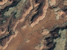
After talks broke down at the beginning of the year for part of the NextView contract, the company went head to head with Orbimage on a new procurement under the same contract, and lost. After a protest that was thrown out, the company's proposed sale of its commercial and civilian government products and solutions business unit fell through. While challenged, Space Imaging may be down, but it's not out. Executives are standing tough, even as they explore their options. (At left, Monument Valley, Utah, Sept 2003, courtesy Space Imaging.) 9. Lots of Talk, Little Action: Bringing Geo Together
There's been lots of talk in the past year about bringing the geospatial community, via its various professional, lobbying, and other groups, together for the good of all. But with conferences splitting off, professional organizations vying for the same members' time and dollars, and new organizations popping up (USGIF and GISCI), there's been little momentum. The latest move by professional organizations to look for government grants and contracts (STIA received $70,000 from the Department of Labor; GITA will look to the Department of Homeland Security for funding for its NGI4CIP work) will likely continue to strain any possible togetherness, at least in the short term. 10. Best News for Lawyers: More (and continuing) Patent Litigation
To add to the ongoing litigation in the image compression arena, HP is taking on Intergraph regarding a software patent, and a New Zealand firm was hoping to get a patent on the calculation and display of isolines, such as contours. Add to those a patent announced just this week on 2D/3D spatial searches on the Web, and lawyers will be busy. Perhaps it's time for GIS students to take a short course on patent law.

Indoor Locating: Ubisense The system has three parts: (1) a software backend that does the "work" of locating (2) tags that people or objects wear or carry (UbiTags), and (3) in-room sensors (UbiSensors) to gather information from the tags. Unlike RFID, where the tags are "dumb" and need to be activated by an energy source to "speak," Ubitags are active. They emit UWB short duration pulses. The choice of UWB technology is important for two key reasons, says the company. First off, using radio waves introduces far more reflected signals and makes location determination more difficult. Second, the short burst technology, vs. an always on solution, means that battery life is longer. The pulses sent by pager-sized devices are picked up by UbiSensors located around the room. These each have four receivers and use Time Difference of Arrival (TDOA) and Angle of Arrival (AOA) to determine location. (The former is used to locate cell phones based on how long signals take to reach different cell towers.) The Angle of Arrival, among other things, keeps the number of sensors required very low. Four sensors is the minimum number for an area, but scalability is offered as a major perk. Accuracy? The company claims 15cm 3D accuracy in real-time. The sensors look to be the size of paperback books. The software side looks a lot like facilities management applications I've seen. You import your CAD floor plan in, locate the sensors, define areas to be tracked, and the like. In the demo a camera tracked a tag-wearing person as he walked down the hall. All in all, pretty intriguing. I confess my first thoughts when watching the demo and thinking about its application to hospitals (a potentially huge market) involved not tracking hospital machinery, but getting out of hospitals. I recall a long, long walk pushing a friend in a wheelchair, who just had her wisdom teeth out, within the University of Chicago Hospital's enormous indoor campus. The complex of buildings, for security reasons, at least then, had but a few (non-emergency) exits. If I could pick up a tag to guide me to my destination and get me back to the exit, that'd be great! The Ubisense solution might be able to do that - it supports radio frequency communications, too, so the sensors can "communicate" back to the tags.

I wrote: "Each geography/organization had a story about how they 'got into'/ 'were pushed into' collaborating. In Edmonton, Ontario, Canada, an explosion involving gas and water infrastructure was the impetus. The participant went on to note that moving to the metric system was a second reason to "get everyone on the same basemap." Said reader Bernie: "I think your reference to Edmonton should be Edmonton, *Alberta*, Canada." Another correction from reader Mark: "In your last GIS Monitor newsletter, you referred to an 'asterix.' The correct spelling is 'asterisk.'" The editor replies: My apologies to the folks in Edmonton and Ontario and to Asterix, the French comic book character with whom I confused the Cingular orange cartoon asterisk mascot. � Ron Bisio at Trimble pointed out a piece on National Public Radio that helps explain why people speak more loudly on cell phones. The difference between a regular wired phone and a cell phone, according to David J. Farber, professor of telecommunications at Carnegie Mellon, has to do with a "side tone." A wired phone has a side tone which allows you to hear yourself, a little, in addition to the other person. Cell phones have "side tones" but they are not as "effective" in that that there is a longer delay before they "come back to you." That causes speakers to speak even louder.
.jpg)
Points of Interest Microsoft and Autodesk to Share Patents. Microsoft and Autodesk announced an agreement to cross-license their patent portfolios. So, basically, they can use each other's "ideas" in software development. The agreement covers patents in several areas, including data management, collaboration, computer-aided design (CAD), digital effects, digital rights management, location-based services, and project management. While Autodesk admits to looking at Microsoft's patents, it's not saying which ones it might use. This is the first such arrangement for Autodesk, but Microsoft has several similar agreements in place with SAP, Cisco, Siemens, Hewlett-Packard, and IBM. I have to wonder if Microsoft might be interested in some of Autodesk "best" GIS technology, that is, MapGuide. GPS Shutdown Plan. President Bush ordered plans for temporarily disabling the U.S. network of GPS satellites during a national crisis to prevent terrorists from using the navigational technology. While this has always been in the cards, now there'll be a plan. And, it'll impact Galileo, too. From what I've read in the past, it's possible to lock out GPS in some areas, and not others, so if it is in fact used, perhaps we won't all be impacted? After much coverage of the story, the administration replied very quickly. "We've got no plans to shut down the GPS system," said Lt. Col. Chris Conway, a Defense Department (DoD) spokesperson. John Pike of Globalsecurity.org explained that shutting down GPS would not really deter terrorists. He noted he knows of no terrorist plot that required GPS. In related news, the administration put forward a document on space policy. In that document, the President called for the formation of an executive committee on GPS with personnel from DoD and the Transportation Department, the departments of State, Commerce, and Homeland Security, the Joint Chiefs of Staff, NASA, and other agencies as needed. I'll go out on a limb here: how about putting John Pike on the committee? Backpacker Goes Local. Rodale Press' Backpacker (which I read avidly some years back) is going local. Come February, the magazine will publish six regional issues, each of which will include cards detailing hikes for readers in that geography. Ideally the hikes will be but a car ride away. Also of note, the magazine claims to be the first "GPS-enabled" publication since it includes coordinates in the publication to allow readers to find exact trailheads and vistas. GPSing Photos. This is a need that's been discussed before in GIS Monitor. First responders and other community safety personnel would certainly find it useful. Still, offerings in the professional realm are limited and often "cobbled together." So, it's interesting that the New York Times (free registration required) covers the options from very expensive (fancy cameras with GPS input feeds) to less expensive (carrying a camera and GPS and geocoding after the fact). Can't we make this easier and more interoperable? No Blue? Researchers at Ohio State College of Optometry have an idea why many of the populations living near the equator have no word in their language for blue: they can't see blue. The scientists suggest that eye damage early in life from ultraviolet-B light, which is much stronger near the equator, means that people in those areas grow up with a "yellow tinted" view of the world. Other researchers suggest that other reasons may account for the lack of a term for the color. USGS Coalition. I'd never heard of this group, but it's a group of 69 organizations "united by a commitment to the continued vitality of the unique combination of biological, geological, hydrological, and mapping programs of the U.S. Geological Survey." The membership includes universities (like California Institute of Technology), non-profit professional organizations (like ACSM, AAG, ASCE ) and most recently a private company, ESRI. Navteq CEO to Sell. Navteq president and chief executive Judson C. Green plans to sell about 12 percent of his Navteq holdings, or up to 400,000 shares, after the end of a lock-up period ending Feb. 2. It's currently valued at about $18.5 million. I can't speak to the significance of the sale. Name the Gulf. Iran is pointing to historical maps in a bid to prove the legitimacy of calling its nearby sea the Persian Gulf instead of the Arabian Gulf. It's the Arabian Gulf in the new National Geographic world atlas. Last month, Iran prohibited sales of the atlas to protest against the use of the term. The issue has caused widespread protests by intellectuals, historians, and students across Iran, formerly Persia. Australian Geo Monopoly? Telstra, the mostly federally owned Australian phone company, bought Universal Publishers, owners of the Gregory's and UBD street directories. Says a story on the acquisition: "From here on, when drivers download street maps for their GPS, they will pay Telstra." The government is pushing for Telstra to be fully privatized. More on Miner and Miner Deal. According to The Coloradan (Fort Collins) 70% of Miner and Miner was sold to Madrid-based information technology company Telvent. Miner and Miner president Jeff Meyers owns 20% and Jack Dangermond, president of ESRI holds the remaining 10%. Telvent will pay nearly $7.9 million in an up-front payment of $3.83 million, followed by a deferred payment of $4.05 million in early April. Telvent approached Miner & Miner about forming a partnership about eight months ago which ended in the partial buyout. There are no plans to change the employment structure or how the Miner and Miner operates. The plan is for 6-7% growth in staff next year.
Kudos and Conundrums Kudos (concepts we applaud) Geo Gov Success. A new Geospatial Management Office (GMO) will be created in the Department of Homeland Security (DHS) pursuant to legislation MAPPS helped draft and move through Congress. The bill to revamp the Nation's intelligence apparatus, based upon the recommendations of the 911 Commission, passed earlier this month. The office will coordinate geospatial information needs of the Department, implement standards, work with FGDC, and award grants to state and local government. It sounds like a good idea, the challenge, I suppose, is getting the right people in the Office. ACSM also takes credit for lobbying the Allard bill, which forms the GMO, and for gaining passage of Federal Prison Industries reform legislation, which will become permanent and will allow businesses to compete for federal contracts which, in the past were automatically given to Federal Prison Industries. (The December issue is not yet posted here, but is the source of this information.) Conundrums (concepts we question/give us pause) Warning: Geo Web Search Patent. Cycore, a Swedish company that focuses on 3D for the Web, has received approval of a 2D and/or 3D spatial Web search methodology patent, originally filed in 1998. (There are U.S. and European versions.) "The patent, covering the process of searching for nearby businesses and services based on geography, may affect Web search engines that are developing similar technology, making Cycore a player in the Web search industry." That's from the press release and says to me: we are going after infringers!
Please note: Material used herein is often supplied by external sources and used as is. � Announcements @Road a provider of mobile resource management services will acquire Vidus Limited, a provider of dynamic field service automation solutions. NASA and the U.S. Department of Interior presented The William T. Pecora Award for excellence in remote sensing to William Krabill of NASA's Wallops Flight Facility, Va. Krabill, a 35-year NASA veteran, is an investigator for airborne LiDAR topographic mapping and Global Positioning System (GPS) applications. His vision of combining airborne laser ranging measurements and GPS has revolutionized glaciology, coastal zone mapping, and measurement of land surface change. MapInfo announced that its E9-1-1 solution is the first submission to successfully complete Future Path Plan Compliance Review by the National Emergency Number Association (NENA). This Internet Protocol (IP)-based E9-1-1 solution was developed by MapInfo in conjunction with SIPquest, GeoComm, and others, and has been awarded a "Conditionally Compliant" rating by NENA. According to NENA, the system will be eligible to receive a fully "Compliant" rating upon the successful production of operations and maintenance documentation through a pilot program. Xybernaut has been granted two new patents for leaving and retrieving messages and data of all types at specific locations -- such as coordinate waypoints -- within a commercial mobile radio service (CMRS) provider network or other networks. The patent, called "Way Point" (coordinate location), describes the technology for directing messages or information to a specific location or a pre-determined distance surrounding a location. The information, which could be personalized for individuals or organizations, could be any type of information, including voice messages, audio, video, animation, websites, documents, text, or e-mail. Gee, this could be a potential glitch for an open worldwide "message in ether" vision espoused by some. Laser-Scan announced that starting in 2005 the company will extend support for all Ordnance Survey Great Britain (OS) customers migrating to OS MasterMap. � Contracts and Sales Varion Systems, the software development and value-added reseller division of GeoAnalytics, has been hired by Oneida County to implement PV.Web 2.1 to provide Intranet access for County staff to GIS data. Intermap Technologies announced a contour dataset derived from and designed to complement its family of NEXTMap Britain digital elevation models. The contour dataset will be of particular interest to engineers and planners who need to be able to present projects in hard copy format and visualize the shape of the terrain over large areas without obscuring underlying mapping. Optimal Geomatics Inc. has been awarded a contract by new client Georgia Power, a Southern Company. The contract involves two separate sets of deliverables including GIS and LiDAR products. As part of Georgia Power's effort to update its Geographical Information System (GIS) database, Optimal will map approximately 5,000 miles of transmission line right-of-ways (ROW) and develop an inventory of structure locations, and asset attribute data. The GIS database delivered by Optimal will also include a record of encroachments within the ROWs. NuTech Solutions was selected by the National Geospatial-Intelligence Agency (NGA) to provide critical research and development underpinning as part of its Semantic Markup and Exploitation of Geospatial Products Program. It's an extension of an existing contract. ESRI and Shell International Exploration and Production B.V. have agreed to expand their relationship and implement a comprehensive agreement under which Shell and all its affiliates worldwide can access all of ESRI's software products. � Products Kingswood MapMechanics now offers data on Afghanistan, Iraq, and Colombia. BAE Systems has released SOCET SET version 5.2, its robust digital photogrammetric software application. The new version includes the SOCET for ArcGIS module, which provides 3D feature collection capabilities in ESRI's ArcMap environment, permitting users to edit personal or multi-user geodatabases without photogrammetric expertise. Exor announced a mobile computing software suite, ePAQ, for PDA use (Personal Digital Assistant). The ePAQ software provides dedicated tools to satisfy the unique demands of mobile workers who work with bridges and structures, street works, and roads. ER Mapper released a JPEG 2000 compatible version of its popular free ECW image viewing software "ER Viewer." ER Viewer allows users to efficiently view large multi-terabyte ECW and JPEG 2000 images. The company also offers its ECW JPEG 2000 Software Development Kit (SDK), which is free for the majority of application developers. Matrox Graphics Inc. and Xi Graphics, Inc. announced the release of Matrox ParheliaT, Millennium P-Series, and QID display drivers for the LinuxR (Red Hat, SuSE, and Mandrake) operating system. These display drivers, developed by Xi Graphics in close partnership with Matrox, support advanced Matrox features including DualHeadR, TripleHeadT, quad-display, TV output, Clone, Multi-Display Zoom, OpenGLR acceleration, and multi-card configurations. � Events Trimble will hold its International User Conference Oct. 23-26, 2005 at the Mirage Hotel in Las Vegas. � Training � People Analytical Surveys, Inc. announced that on December 13, 2004, its board of directors elected Edward P. Gistaro and Lori Jones as members of the board. It also announced the resignations of Mr. Christopher Dean and Mr. Christopher Illick from the Board, effective December 15, 2004. Then on Dec 20, the company announced its board of directors elected Thomas Roddy as chairman and appointed Lori Jones as chief executive officer. It also announced the resignations of Mr. Livingston Kosberg and Mr. Wayne Fuquay from the board. Mr. Fuquay also resigned as chief executive officer of the Company. GeoDecisions named John W. Banning a GIS analyst for the firm's Austin office. Prior to joining GeoDecisions, Banning was employed by ESRI. Air-Trak, Inc., a developer of the Cloudberry GPS tracking and communications system, announced that Greg White has been named president and CEO. White has been serving as interim CEO since August. Trimble announced that it has named Rajat Bahri as its chief financial officer. Bahri brings more than 15 years of experience in a broad range of significant finance roles at Kraft Foods and General Foods. BAE Systems has named Mark E. Sarojak, sales director for the Americas, representing the company's Geospatial eXploitation Products (GXP) line of business. GXP's sales force also includes John Parker, western U.S. regional sales manager, and David Reed, recently promoted to southeast U.S. regional sales manager. GeoAnalytics, Inc. announced that John Leonard has joined the firm to coordinate business development and account management activities for the South Central region out of Austin, Texas.
Advertise With Us
Contact GIS Monitor is published by: GITC America, Inc.
Subscribe/Unsubscribe |