Letters, Points of Interest, Kudos and Conundrums, Week in Review (Announcements, Contracts, Products, Events, Hires) Back Issues, Advertise, Contact, Subscribe/Unsubscribe If, for some reason you cannot read this document, visit: http://www.gismonitor.com/news/newsletter/archive/061704.php
More from the Open Source GIS Conference
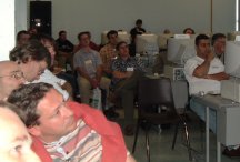
More Sessions I missed the presentation on ArcIMS Emulation with IMSEMU, but heard about it later. Apparently there have been several efforts in the open source community to put a wrapper around MapServer to make it behave as though it was an ArcIMS server. The idea is that then you could "communicate" with MapServer via ArcXML or use any ESRI client that supports ArcIMS with it. At first I found the whole thing sort of funny. Why would you want to do that? I learned that if you have users who are committed to ArcMap for example, this is another way to add servers to which they can connect. Further, while it's possible to use ESRI client products' Web Map Service (WMS) support to connect to MapServer (since it's a WMS server), there are more capabilities using other tools. I ran into several users who had already implemented the IMSEMU emulation. I also learned about CHiRP, a MapServer implementation in Whistler, BC, Canada, that provides habitat mapping for the community which includes lots of tourists as well as residents. Its creator was concerned about "giving back" to the community after it aided her in this, her first MapServer implementation. What she didn't realize was that her implementation is now yet another resource for the community as a whole. Several people echoed her concern that they were "taking and not giving back. It's my sense that everyone was indeed giving back in subtle and perhaps non-technical ways, by spreading the word about open source GIS and in other less "obvious" ways.
I sat in on a workshop (that was over capacity, left) that walked attendees through setting up PostGIS (a spatially enabling technology that sits on top of PostGres) and integrating it with MapServer. To my surprise, it looked and acted "exactly like" SDE and Oracle Spatial, with which I've worked in the past. Said another way, if you are a database person, this is nothing new. As one attendee noted in the closing session, the workshops weren't so much aimed at "telling you everything you needed to know" but rather to give you the confidence to go home and give it a try. Another session focused on three different MapServer technology updates. First up was a tool for creating a simple environment for building a MapServer client. It's used in a "famous within the open source GIS community" website that provides historical maps of Amsterdam. Its developer, Jan Hartman, aimed to create a "desktop like" browser. To conserve space he offers windows for graphics, legends, etc. that can be "put away." To do that he built a library called MapClient. With it he can build websites easy enough for students and the public to use. Watching the mini-tutorial I realized that "even I" could grasp the simple coding involved. One particularly cool interface option: providing two independent map windows, with independent zooming and panning. Howard Butler from Iowa State then highlighted his work integrating MapServer with ESRI's SDE. The combination works for him as it provides speed, versioning, projection on the fly, and the ability to use MapServer's MapScript for simple coding. Frank Warmerdam then gave an update on new raster features in MapServer. I confess that at times I had no idea what he was talking about! Wrapping Up The final day of the conference included three sessions meant to tie up the ideas in the previous days. DM Solutions president, Dave McIlhagga, presented his take on open source and partnering. One difference between open source partnering and commercial partnering perhaps is that in the former the two parties have "more similar" goals - getting the application on as many machines as possible and growing the technologies use. His examples illustrated how several players have funded development of specific features in MapServer (say support for the Open GIS Consortium's Web Map Service Specification) but later benefited when another organization funded another feature (say support for tabular x,y data). There's a sort of "think globally, act locally" vision here. If users develop or fund the development of features they need, they will get return, and the global user base will, too. Clearly, there's a different way to measure value in the open source world; part of the value is local ("I can now do what I need to do!") and the rest is collective ("We all can now support WMS!") This is a very different way of thinking about technology, compared to buying a box or two or ten of commercial software. The attendees next split to participate in panels to wrap up the open source GIS part of the conference and the MapServer part of the conference. I attended the former which ran the gamut of topics from "What are the key developments in the last few years?" (Java use, one-click installs, the strength of the community, ease of use) to "What comes next?" (more ease of use, support for portals ["my yahoo!-like"], advanced clients). We came back several times to the nature of the business model for open source GIS "business." Two of the three panelists (from Refractions Research and DM Solutions) used open source as their "calling cards" as Paul Ramsey put it. They use the technology (PostGIS and MapServer, respectively) to bring people to their door. The third panelist from PeopleGIS described open source as an enabler. In presentations, representatives don't typically note what technology underlies the company's solutions. The MapServer discussion, I was informed, focused more on practical matters, such as what happens if some key person in the community gets hit by a bus. That concern must exit on the commercial side, too ("What if company x goes bankrupt?"). The short answer seems to be that if the code is important and valuable to someone, a new maintainer will step up to the plate. More on that session is available in Howard Butler's blog.
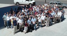
The closing session brought everyone together and a few attendees shared their expectations and what they in fact "took away" from the conference. One panelist was surprised to find that he was an advocate for open source, though he "didn't know it." He noted that his work with open source and time at the conference had changed his thinking. "Now I think strategically" about how to take this technology into other disciplines. An end-user came hoping to learn about how others "solve problems" in the open source world. He expected to find common solutions, but in fact found "uncommon" solutions. He echoed ideas about the importance of the community and shared ways to help connect people in tighter regional or platform groups (Web, database, desktop, etc.).(That's the official attendee picture at right.) The developer on the panel noted he found himself with a "buzz" from the few days and "reenergized." He'd expected to pow-wow with other developers but found himself learning quite a bit from the end-users about what they wanted. "I got some context" as he put it. I was surprised as the conversation expanded out to the audience that for the first time there was "bashing" of commercial vendors. Until that session I had heard attendees speak almost universally with respect about the commercial GIS players, even allowing that there's room for both traditions. I was pleased when one of the "more senior" members of the community put the conversation back on track. I ran into Tyler Mitchell, who in the community is known as the "survey guy" at the last session. It seems Mr. Mitchell maintains polls of various sorts regarding MapServer. Most are ongoing. You can see the details and results here.
Just in case you think that once you leave a conference it's over, that's not so. On the plane on the way home I saw a demo of JUMP, a Java-based desktop GIS. It's very impressive and takes just 10 Mb of space. In fact, the demo I saw was running off a USB-enabled wristwatch. (That's a bit of the toolbar above just to illustrate that open source software looks a lot like commercial software.) Final Thoughts As I noted last week, there was quite a lot of energy at this conference, as well as quite a lot of sharing. It was pointed out to me that at the closing session when I spoke, I used the term "we" including myself in the community. That's easy to do in the open source community and I've been considering why that is. Here's a guess. If there's a "problem" with the software, there's no one to "blame" or "argue with" except ourselves. We "own" (or don't own, depending on your perspective) every line of code and every bug. Everything is "out there" blemishes and all. That changes how people, even business people who would otherwise be "competitors," interact. Several of the businesses in attendance noted new clients and partnerships sewn up at the event. Users left energized to install and test out a new database or tool. If you want to grasp the wonder of open source technology for GIS, explore the energy of the community that sustains it, and perhaps see the future model for the business and technology of GIS, make plans to attend next year's event, scheduled for Minneapolis. In the meantime, there are open source GIS conferences scheduled for Germany (MapServer hosted by CCGIS) and Thailand (The Free/Libre and Open Source Software (FOSS) for Geoinformatics: GIS - GRASS Users Conference) later this year.

Letters
"I believe I was one of the first to design a GPS collar for bovine tracking, in conjunction with Dr. Pete Teel, here at Texas A&M; University. 'Cows In Space' was designed to track the cattle, to determine where they most likely acquired the common cattle tick on free ranging, mesquite-infested pastureland in southern Texas. I'm looking for the article, appearing in the Proceedings of GIS-LIS some years back... ca. 1996. We were able to achieve about 6m accuracies using an inexpensive OEM GPS receiver and differential corrections. We should have gotten better than that, but there were technical difficulties associated with the graduate education process... "While we're not specifically associated with shocking cows back across the fenceline, we did do pretty well in tracking the beasts."

Points of Interest Free U.S. Geocoding. Reader Howard passed along the URL to a free geocoding website/service (SOAP, XML-RPC, and REST-ful RDF) for the United States. Built on PERL scripts and TIGER '98 data, it's free to use for non-commercial purposes. The code is available, too, should you want to "build your own." The TIGER data, 24 gigs, is compressed to a 750 megabyte BerkeleyDB database. SDI Newsletters. A reader points others to the monthly spatial data infrastructure newsletters, "an exceptional source of GIS news for developing countries": SDI-Africa (published since May 2002, supported by USAID) SDI-Asia and the Pacific (published since December 2003, supported by GSDI Association) SDI-Latin America and the Caribbean (published since January 2004, supported by GSDI Association). The monthly regional newsletters highlight advances being made in data management (online data discovery, Web mapping applications and services, interoperability, data standards, data custodianship, data policies, inter-agency coordination, enabling legislation, etc.). There are also links to data sources, tools, applications, funding and training opportunities, and job vacancies. Back issues are here and subscription info is here. A Loss. I was notified this week that Tim Burks (most recently of Insite in Colorado Springs but formerly of Generation 5, BTG and many other GIS companies) passed away. He was among friends and colleagues when an apparent heart attack overcame him. I ran into Tim in my early days with ArcCAD. My then colleague Matt Davis of ESRI recalls Tim this way: "Tim was a good, hard working person that cared about the industry and technology a great deal, � a real good guy." More on Clear the Air. I mentioned Clear the Air and its pollutions maps during the week on the website and wondered if it was Flash-based. Reader AJ had a look at the code and confirmed it is indeed Flash-based. He also found several interesting advertisements right in the code - including URLs and phone numbers. Fascinating! Amusement. Here in the U.S. we have all sorts of tools that allow finding the "closest" whatever to our address. In the U.K. they have a better one: a tool to find "funny" place names near a particular postcode. I keyed in my former employer's code (about the only one I know) and learned that Claggy Cott, Shingay, and Six Mile Bottom are all within 30 miles. And, of course you can map the locations, too. Thanks to reader Larry for the pointer. GPS Jamming. The military is testing a system for jamming signals from GPS satellites. The test will run through June 20 and may cause unreliable signals for boaters 60 miles off North Carolina and in northern and central Florida. Cell phones may also be affected. Route Finding for the Military. University of South Carolina Viterbi School of Engineering Information Sciences Institute Computer scientist Craig Knoblock now has his "route finding" software in use. Five years in the making, his product gets one from point to point - only it does so such that no one else can see them! The challenge was bringing together data from many different sources, projections, and accuracies. The first users are in the military, but other location-based services applications are possible. Heads Up for ZigBee. ZigBee is an emerging wireless standard for short-range machine to machine communications. Think of tiny sensors, lots of them (thermostats, lighting controls, environmental sensors, and medical monitors) all reporting back to one or more "real" computers. Certification Consternation. There's a long and, at times, rather gory discussion of, you guessed it, certification, on the GISLIST (it's accessible from several portals). It was prompted by a note concerning Oregon's decision to adopt the GISCI's certification. There's a nice Q&A; with GISCI's Scott Grams and some very insightful analogies amid, well, other things. If you didn't see it, GIS Monitor noted Oregon's decision in March. Impervious Surfaces in U.S. Would Cover Ohio. Christopher Elvidge of the National Oceanic and Atmospheric Administration's National Geophysical Data Center in Boulder, Colorado, with colleagues produced the first national map and inventory of impervious surface areas (ISA) in the United States. Taking all of the roads, parking lots, buildings, etc. in the contiguous states together amounts to an area about the size of the state of Ohio. ISAs contribute to local warming, changes in run-off, and in some areas will increase your tax bill, if they are on your property! The map was created from nighttime lights observed by satellite, Landsat images, and data on roads from the U.S. Census Bureau, and aerial photography. Free Registration Required. CNN has an article this week that tackles the increase in the number of newspaper websites requiring registration for online access. Among other things it notes bugmenot.com which provides free "communal" passwords that can be used for such sites. I do agree with the article's sentiment that publishers are still learning for what they can and can't ask and for what they can and can't charge. 3-D Video Game Tech Comes to Navigation. Wired reports on Sony's new XYZ 3-D navigation system. It's only available in Japan and provides 3-D, video game-like graphics. Says a rep from U.S.-based Garmin: we are not seeing demand for this yet. The system boasts a 30Gb hard drive and the system can be attached to a computer to access updated maps. New GPSs from Thales. The company introduced three new "adventure" GPSs. The core Magellan eXplorist 100 supports 14 channels, WAAS/EGNOS and has a four level gray scale screen at about $100. The 200 adds a U.S. or European basemap for another $50. The 300 adds an altimeter, barometer, and electronic compass for about $300. Kids Save the Day on West Nile Project. The city of Parkston, South Dakota, received a $4,100 grant for mosquito control in an effort to curb the spread of West Nile. All well and good, but the grant came with strings: the city had to mark potential mosquito breeding areas using GPS. All well and good but the Public Works director wasn't GPS savvy. So, enter three teens who know the technology and the problem is solved! 12-year-olds Thomas Scheets and Derek Wolf along with 13-year-old Beau Behrend are mapping bridges and other areas in town.

Kudos and Conundrums Kudos (concepts we applaud) Data Brokering for Canada. Bernie Connors, Geomatics Manager at the New Brunswick Department of the Environment & Local Government, shared some kudos for the Canadian government. "I saw � a presentation by Radarsat on a new Web service called Smart Broker. � I think this deserves a GIS Monitor kudo." Smart Broker is an online data brokerage service that provides the Canadian Geospatial Data Infrastructure (CGDI) community with access to geospatial products. It is an innovative new marketing approach that allows multiple users to share available imagery while offering lower cost of ownership advantages. Basically, if you are in the market for some data, imagery mostly, it appears, you can document your interest and the vendor will help seek other potential partners. Vendors can then use this information to choose projects and ideally, with many interested parties, all costs will be lower. The project was funded by GeoConnections and developed by a team led by MacDonald, Dettwiler & Associates Ltd. along with partners RADARSAT International, British Columbia Ministry of Sustainable Resource Management, Manitoba Conservation, and DigitalGlobe. There's already one project looking for partners. Maps for Those Who Really Need Maps. The Nahua live in Amazonia. The bad news is loggers want to cut trees on "their" land. But, how could this people, with its own language, and no maps as we know them, make its ownership of the land known? Enter Conrad Feather, an anthropology student at Cambridge. He explored the people, got to know them, and with help from fellow students mapped their territory. This is how he explained his work, using language appropriate for the Nahua, to an interviewer in New Scientist: "You must give them [the government] a number because the government thinks only in terms of numbers. Every place has a number and you can get this number by this machine, the GPS, that communicates with the stars." This month Feather won the prestigious St Andrews Prize for the Environment for his work. Conundrums (concepts we question) NAIP Awarded? A recent press release noted that three organizations received contracts with the United States Department of Agriculture to collect National Agricultural Imagery Program imagery using digital sensors. I've seen no formal announcement regarding this award, or an award for traditional sensors (film cameras). The release notes "The USDA Farm Service Agency (FSA) awarded the largest digital ortho-photo collection contract ever granted" for the project.
Please note: Material used herein is often supplied by external sources and used as is. � Announcements The WebSim Partnership -- the Object Management Group (OMG), Open GIS Consortium (OGC), Simulation Interoperability Standards Organization (SISO), and Web3D Consortium -- together announced that they are hosting the "First Workshop on Web Enabled Modeling and Simulation." Wednesday, June 23, 2004 the House Government Reform Subcommittee on Technology, Information Policy, Intergovernmental Relations, and the Census will conduct an oversight hearing on "Geospatial Information: Are we headed in the right direction or are we lost?" The purpose of the hearing is to examine the progress made by the federal government to consolidate and improve utilization of the masses of geospatial data collected by departments and agencies across the federal government and by state and local governments. Representative Adam Putnam of Florida is running the show and many will testify, including MAPPS John Palatiello who passed along this information. ESRI formed a new Enterprise Solutions team. This will centralize responsibility for enterprise program support within ESRI and provide a new set of services and processes to better support mission critical users. IDELIX Software Inc. has been granted U.S. Patent # 6,727,910 "Method and System for Inversion of Detail-in-Context Presentations." The patent was issued on April 27, 2004, and is directly relevant to a method commonly referred to as the Pliable Display Technology "Undisplace" functionality. IDELIX has 23 additional patents pending in the United States and internationally. The International Society for Photogrammetry and Remote Sensing (ISPRS) announced that Changno Lee and James S. Bethel are the winners of the U.V. Helava Award for their paper "Extraction, modelling, and use of linear features for restitution of airborne hyperspectral imagery." It appeared in Volume 58, Issue 5-6 of the ISPRS Journal of Photogrammetry and Remote Sensing. Dr. Lee is with the Spatial Imagery Information Research Team of ETRI in South Korea. Professor Bethel is in the Department of Geomatic Engineering at Purdue University, West Lafayette, Indiana, USA. QC Data, has acquired the Denver-based data conversion and migration services firm Emery DataGraphic, Inc. (EDG).� Contracts and Sales KHEOPS announced that its business partner CMTek is using JMap as its geospatial module for Smartrak, a commercially available solution that CMTek has designed in order to analyze the impact of mobile advertising campaigns. DigitalGlobe has been awarded a $500,000 contract by Allegheny County, Pa. to provide satellite and aerial imagery of the region for a major overhaul and upgrade of the county's GIS. Other publications published the press release this week; GIS Monitor reported on this in April. � Products Taylor Technologies, Inc. announced compatibility of its GIS solution, Rapid Integration Toolkit (RIT), with ESRI ArcIMS. Using RIT, ArcIMS users are able to implement and customize the delivery of GIS data without complex programming. Haestad Methods introduced FlowMaster 2005, an advanced version of its popular hydraulic toolbox for water resources engineers. FlowMaster 2005 is a powerful, easy-to-use modeling software program that lets professionals streamline the hydraulic design and analysis of pipes, open channels, weirs, orifices, and inlets. MapInfo announced its expanding role in the healthcare market with CareInsite, an easy-to-use network analysis software solution. CareInsite enables health plans, hospitals, and pharmaceutical companies to evaluate the development of provider networks. Maptuit Corporation released FleetNav Fuel 2.0. The newest release of FleetNav Fuel 2.0 offers the trucking industry with a solution to reduce rising fuel prices, by providing truck drivers with optimized fuel plans and management with detailed compliance reports to ensure optimal savings. � Events ASPRS celebrated its 70th anniversary at the 2004 Annual Conference in Denver, Colorado, May 23-28 with a record attendance of nearly 1,900. This figure reflects a 65 percent increase from the previous year's event. � Hires and Appointments The United States Geospatial Intelligence Foundation (USGIF) added seven new directors: Jack Dangermond, President, ESRI, Dr. Michael F. Goodchild, Professor of Geography, University of California, Santa Barbara, Arthur V. Grant, Vice President, Raytheon, Brig. Gen. Michael G. Lee, USAF (Ret.), Associate Partner, IBM, Timothy W. Milovich, Chairman & Chief Executive Officer, Questerra, LLC, James A. Myer, Chief Executive Officer & Chairman, Photon Research Associates, Inc., Herbert F. Satterlee III, Chairman & Chief Executive Officer, DigitalGlobe, Inc.
Advertise With Us
Contact GIS Monitor is published by: GITC America, Inc.
Subscribe/Unsubscribe |