Letter, Points of Interest, Business Notes, Week in Review, Back Issues, Advertise, Contact, Subscribe/Unsubscribe
OPENING SESSION I've heard it before, but like many in the audience, I am always happy to hear the message anew. It's a reminder that GIS does not exist in a vacuum, and that GIS users are a community that has a special place in the world today, and in the future. The opening sessions put the work each attendee does in perspective - from managing utilities, to mapping elephant habitats, to managing IT for fire departments. In his "welcome," Dangermond, as always, thanked the users for attending and acknowledged that it can be hard to get to San Diego. Dangermond turned his remarks first to 9/11. He noted that GIS proved itself during the crisis and that the GIS community proved itself as well. The tragedy also made it clear that GIS is a key foundation to homeland security, which will require an integrated approach to help in any future crises. Then he moved to the theme of the conference, "Geography Sustaining our World." He outlined how the earth is an oasis that we humans are stressing. Said another way, we are overdrawing on our natural capital, just as one might overdraw a bank account. To cut back the stress and overdrafts, we need to move toward sustainable development defined as "living within the regenerative capability of the biosphere." GIS, Dangermond argued, is a key framework for the move toward sustainable development. Dangermond then moved to highlight some of the interesting work being done at ESRI. He was quick to admit that his colleagues might have selected other topics, but described these as "the places where we are putting our money." 1. Services and servers, and the networks that connect them (GLUE, SOAP, UDDI) - Dangermond sees GIS as moving toward a server-centric organization. Services, linked together, will become new services available seamlessly on the Web. That vision will have three key parts: service users, service providers and metadata (used to find the data and services). 2. The movement of data storage to the database - Information Technology managers have, for some time, put GIS outside the transaction world of the database into a decision support services role. Now, Dangermond suggests, it's time to put them together. He admits there are trade-offs, but sees significant return on this vision. He highlighted three ways ESRI is taking advantage of database storage: the use of disconnected editing as well as replicated data management with ArcPAD, the integration of survey data in the database with the Survey Analyst extension to ArcGIS, and the discipline-specific data models for ArcGIS. 3. Geoprocessing - One key goal is to move all of the geoprocessing from past products ("old" ArcInfo, its extensions, as well as "old" ArcView and its extensions) into ArcGIS. Down the road these tools will be enabled via scripting and a modeling interface referred to as a "dashboard for services." These new environments will first appear on the desktop in ArcGIS 9, then on the Web. 4. Standards - Dangermond highlighted that creating and moving toward using standards is a process, and that ESRI is involved with 12 standards organizations. 5. Mobile computing - SmartPhones available later this year will run ArcPAD, and the upcoming Tablet PC will run ArcEditor. 6. Real time data tracking - Sensor networks will serve data up to browsers and wireless phones. 7. Database cartography - Cartography as we know it, dynamic cartography, will in time be replaced with cartographic "layers" in the database that drive symbology. Instead of editing the symbology, one will edit the symbology layer. This idea parallels the idea of topology layers, discussed below. 8. Network schematics - The ability to see both a geographic and schematic view of network data. The demo of an extension in development, later in the day, was one of my favorites. 9. 3D - The next version of 3D Analyst will store terrain data in the geodatabase for fast access. 3-D symbols and features will be available for abstract and real world visualization. Dangermond himself demonstrated "whole earth visualization," a methodology to plunk down "postage stamps" of data on a 3D globe. It provided, as Dangermond put it, quoting the head of development Scott Morehouse, "a different concept." Later in the week, two local news programs taped segments revealing this technology referred to as "ArcGlobe." After highlighting some product futures (details below) Dangermond highlighted the new EBIS, ESRI Business Information Solutions, which has moved the data products once from CACI to new books and CDs that illustrate data using the new ArcReader technology. In other ESRI news, the Geography Network reported 300% growth last year. A new set of about 40 commercial SOAP-enabled Web services will debut this year. Until now ESRI has informally provided these services for clients from Redlands, but the company is now ready to make them available commercially. Finally, Dangermond turned inward to discuss ESRI as a company. The company has five purposes (this is a superset of the three I recall when I worked there): advancing GIS, serving users, developing ESRI workforce, supporting employees, and developing a stable and growing company. And, if anyone needed to hear it, Dangermond was clear: ESRI is "not going public." ESRI had 22% growth last year and a 13% increase in staff. The company serves 100,000 organizations with one million software seats. Some 1400 business partners provide products and services around ESRI's software. In the recap of the morning, one bullet point jumped out at me: "GIS provides a foundation for action and global security." "Action" was the key here: GIS causes things to happen. And, after the first session, I for one, felt mobilized to act. The morning was friendly; Dangermond, as always, had users introduce themselves to someone they did not know, resulting in cacophony in the huge room. And, as Steve Lackow of RPM later commented to me, with a focus on sustainable development, ESRI chose a theme that "returned the company to its roots." He also pointed out that the issues of sustainable development - including integrating a variety of data - are key to solving homeland security challenges.
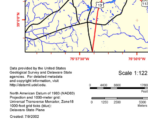
PRODUCTS Maguire spoke of ArcGIS 8.2-the current version-and highlighted its new features: enhanced labeling that is rotated based on values in the database, transformations and rubber sheeting, and animations with ArcScene highlighting how different component object model (COM) objects can be hooked together. Tracking Analyst 2, is a whole new version, and can be used as a Web-based service. Now, points, lines and polygons can be tracked through time. Demos walked through a histogram of events showing the expansion and contraction of fires until snowfall finally put them out. Alas, a demo of real time traffic in Salt Lake City, delivered via the Web, bombed. ESRI continued a tradition of having users demonstrate some of the features, based on workflows from their organizations. My favorite 8.2 demos: The first was in the introduction video. Fellow Penn State alumnus Dawn Robbins, the Geographic Information Officer of the County of Ventura, CA, described her team's use of ArcGIS 8.2. The second was a live demonstration of the new ArcGIS schematics extension. ESRI acquired NetGraph, a French company, some months ago. The result was a project to turn an existing product into an ESRI extension for schematics. The extension allows the presentation of networks in three ways: in correct geographic locations, in geoschematics which maintain some aspects of the geographic distribution, and in orthogonal schematics which puts all of the network into 90-degree turns, but maintains the correct network relationships. The powerful idea here is that you can look at one or more of these at once - and they are all linked. Make a change in an orthogonal schematic, and the others update. And, you can "drill down" to see more detail of, say, an electric station. Turn a circuit off in that "drilled down" view and it's updated in the database. The symbology tools in the extension, to size up text or symbols, were just great. I hope they'll appear elsewhere in ESRI's product line. If you have anything to do with networks, have a look at this extension. Bernie Szukalski and his team showed off the current ArcIMS 4.0 version. ArcMap Server, the tool to use ArcMap to make ArcIMS-publishable maps is now part of ArcIMS, and worth a look. Because it supports geodatabase annotation and ArcMap cartography, the map outputs on the Web are beautiful. A demo used a moving window to "reveal" annotation only when the window passed over it, keeping the map very neat. The metadata server is the other big news. It supports not only FGDC but also ISO format data via a wizard. The wizard is extensible, which means that users can, for example, add in their own lists of key words. In ArcGIS it's possible to create views of metadata based on a variety of criteria, including the Dewey Decimal System. But the real power here is publishing metadata via the metadata server, which can put an organizations server into a Federal Geographic Data Committee (FGDC) Clearinghouse so others can find the offerings. Or, if the organization wants to gather metadata from potentially useful servers on a regular basis, metadata server users can "harvest" metadata onto a local server. That's a powerful idea, because, as John Calkins put it, "states could harvest from counties, and nations can harvest from states." Update the harvesting on a regular schedule and voila, you've got something akin to a National Spatial Data Infrastructure (NSDI) and GeoSpatial One-Stop. The Geography Network is getting a new interface and a new download tool in the coming months. The demonstration however focused on an implementation of the geography network framework by the state of Delaware (click on Map Lab to make a map). The incredibly robust website is a pilot for the National Map. The application pulls together data from many state agencies and provides forums to provide feedback to the participating agencies. The best part of the demo was a tool to create your "own" USGS look-alike quad either in a "mini-quad" size of 8.5 x 11 inches, or in a true full-size quad in a variety of formats (JPG, PDF, for example). The layout was just beautiful.
After lunch, a video spoofed the opening of Star Wars to highlight how GIS was entering a new chapter, "lead by ESRI users." It was very cute and got many chuckles from the unsuspecting audience. The afternoon was spent on the upcoming ArcGIS 8.3 release, due in Q4 of this year. Maguire introduced the big step forward: topology storage in the geodatabase. Note that until now, the geodatabase had no topology, which made tasks like polygon maintenance difficult. To ESRI's credit, that's why ArcGIS 8.x until now included tools to support and edit coverages. With 8.3, the real shift to the geodatabase should begin. Topology in the geodatabase is rather a misnomer because in fact, topology storage doesn't happen! What are in fact stored are topology rules and a means to identify errors. Topology, it turns out, is far more efficiently created on the fly. Building topology in the new lingo means validating the geometry of features against rules. ArcGIS 8.3 uses a wizard, which walks the user through the choice of topology rules (such as "lines must not have dangles," or "polygons cannot overlap"). Those creating topology choose which of the 25 rules apply the data in question. Then, there is an "error inspector" tool (I LOVE the name!) used to review and correct the results (dangles, slivers, etc.) Topology, or more correctly, the rules of topology and errors, is stored in its own geodatabase layer, associated with the feature layer. Or, as one ESRI technical person from St. Louis so aptly put it, the features classes "participate" in the topology. That participation is key because it's what allows coincident editing. Once the user selects a feature, and then the tool for coincident editing, the tool "has a look" at all the other feature classes "participating" in the topology. By default the assumption is that the user wants all the coincident features to "move" together. If that's not the goal, the user can leave some "behind." So, for every topology rule, there can be exceptions that the user controls. The whole process reminds me of topology creation in CAD databases in MGE and other CAD solutions, which provides a smaller, but similar set of rules and used topology created on the fly. The process will certainly take some getting used to for those who grew up on the classic ArcInfo "build" and "clean" commands, but the flexibility will likely mean fewer cycles of editing. ArcScan and Survey Analyst are the new extensions expected at ArcGIS 8.3. ArcScan ports the functionality of the "old" raster-to-vector ArcInfo extension to the new environment. The demo had some great clean-up tools for raster, and it was very fast. ArcSurvey, developed with partner Leica Geosystems, provides tools to manage survey data, integrate it with GIS, and use the data to make GIS data more accurate. I confess that I found the process confusing, but understand the intent. A Denver Bureau of Land Management staffer described how Survey Analyst will help update land information and integrate parcel information. ArcGIS 8.3 will also provide better integration with ArcPAD, including the ability to extract data and appropriate forms-built on the fly-from the structure of the geodatabase to the handheld. Editing can be done while disconnected, and then updated. Or, it's possible to use versioning to reconcile changes. ArcEditor on the Tablet PC is another mobile solution for ArcGIS users. The user sketched an area, then turned the sketch into a feature. The audience was impressed when handwritten script was correctly captured as the text "conservation area." The 8.3 product line will play out this way: ArcView 8.3 will include shapefile editing. ArcEditor will be needed to create and edit topology in the geodatabase and support ArcScan. ArcInfo will be needed to create liner georeferencing (dynamic segmentation) and perform geoprocessing on it. I got just a taste of 9.0 before I had to duck out of the main session. Clint Brown and his team showed off the various ways to access and combine tools coming in 9.0. (1)Tools will be continue to be accessible from ArcToolbox, and (2) there'll be a new command line! And, most interestingly, there'll be (3) a visual environment to build models. Models in this case refers to collections of tools linked together. This was technology available in Spatial Analyst 2.0 that's being moved to core ArcGIS. It will support all of the geoprocessing tools of ArcGIS and any installed extensions. You may recall that a few weeks ago I wrote about FME Workbench. This is essentially the same idea. The new Network Analyst tools coming in ArcGIS 9 sound like they parallel the topology rules noted above, but aimed at creating correctly formed networks. Unfortunately, I could not attend the keynote by Cynthia Moss on elephants, which I heard was very interesting and highlighted the project's use of GIS. I also missed Alan Leidner speaking about his work leading the team in New York City during 9/11. Leidner was presented with the President's Award.
SESSIONS Survey Analyst is a project of ESRI and Leica Geosystems expected for ArcGIS 8.3. One thing I'm finding as I look at the new extensions and tools, they all work roughly the same way. A new set of data types are stored in the geodatabase as a layer and used as a companion to a feature layer. In the case of Survey Analyst, this means that the companion layer-the survey layer-can store four unique feature types: survey points, survey coordinates, measurements, and computations. Survey points, unlike "regular" points, can't be picked up and moved around, just as surveyors require. The other feature types hold computed survey points, measurements from the field or COGO, and computations derived from survey information. Because all of this data is stored in the geodatabase, should any of it be updated or corrected, the whole computation can be rerun to update all of the related measurements. The survey layer also has tools to determine and display measurement quality via "error ellipses." There is a tool called Survey Explorer that provides a window into the raw data, including instrument setups. And, there are tools to use the raw data to create new data from the field information. Until now I've been talking about the survey layer. This layer underlies the features themselves, which is very powerful. The map features can be tied to specific survey points on the survey layer. So, if the underlying survey information changes, the features can be updated accordingly. This is rather revolutionary since surveyors are typically wary to store precious data in a place where it can be changed. Now that the raw data has a "safe" place in the geodatabase, that shouldn't be a fear. Furthermore, the geodatabase is a great way to integrate surveys of related geographies in one place. There's another subtle, but important point about Survey Analyst. The "old" way to move survey data into GIS involved an intermediary step-through CAD. The CAD file was then imported into the GIS. In Survey Analyst, the intermediary step, where there is the potential for data loss, is eliminated. The other subtle benefit of Survey Analyst for GIS users is that existing data can be updated based on new surveys. I can't say I completely follow all of the surveying tools, but I get the gist of this extension, and I think it's pretty powerful. Even if you are not a surveyor, there are two general ideas to take away from this extension that will play out in future ESRI products: � Feature companion layers, like the survey layer, will reveal new features or store rules. � Special new feature types, like uneditable survey points, will be created with properties that make sense for particular disciplines.
A FEW MINUTES WITH DAVID MAGUIRE First I asked about .NET, which seems to be all things to all people. Maguire made it clear that my confusion results from the variety of ways that Microsoft uses the term. It is at the same time: (1) a marketing term, like ActiveX was, (2) a set of tools or API for developers, like Windows, and (3) a set of services or applications for end-users, like Microsoft Office. The difference between Windows as a platform and .NET as one, is that .NET is designed for the Internet, not the desktop. And, just to put this platform in perspective, there are others, many of which only cover a bit of the spectrum of services. But one other, J2EE, the Java 2 Enterprise Environment, aims to provide a broad based platform on par with .NET. Who'll win? The jury is still out according to Maguire. I got a chance to look at a Tablet PC in the Microsoft booth. It was pretty neat and will be a boon to those who want to sketch in the field. The handwriting recognition didn't seem as poor as some of the introductory reviews led me to believe. That led me to ask Maguire about how the Tablet PC falls into ESRI's plans for mobile computing. He highlighted the price point, support of gesture, new "ink" technology to distinguish it from ruggedized tablets of the past, and deemed it not a huge step forward, but a solid small one. He also reminded me that the iPAQ/ArcPAD solution (about $1000 for hardware and software) is not in the same league as the Tablet PC/ArcEditor solution ($7000 + for hardware and software). Another ESRI employee reminded me that for many tasks, (such as updating the attributes of a single utility pole), an iPAQ has plenty of screen real estate. Anything requiring significant context, like updating street locations, might fit better on the Tablet PC. Finally, I asked about topology and its new incarnation in the geodatabase. Maguire reminded me that to really "get" this new implementation of topology I had to forget everything I knew about coverages and topology. The move is part of a larger effort to move all sorts of data and rules into the geodatabase: images, cartography, terrain, survey data, etc. Part of the reasoning behind this migration is that studies showed that it was easier (faster) to create topology on the fly than to store it. And, Maguire noted, there are many features that simply may not ever require the building of topology. Features that are simply there "for show" won't need the overhead of building topology, while others such as parcels that share a boundary with the pond's waterline, will.
Nelson explained that TeleAtlas did a survey of users to ask what was important about data. In roughly descending order of importance, the topics were: postitional accuracy (the road reflecting its true location on the earth), geocoding, coverage (extent of data), currentness and price. That's right, price was actually at the bottom of the list! That's a big change since the advent of the $1000 full U.S. data set from Wessex back in 1992. Hamai pointed out that LBS customers want more added on top of the accuracy: navigation and routing attributes, points of interest, etc. The top attribute, positional accuracy, varies across the major companies offering vector data from about 77% (TeleAtlas) updated within the last 12-18 months to about 60%. That percentage reflects how many of the roads that cover this percentage of the populated areas have been updated recently. What does updated mean? Most companies start with some federal data, like TIGER. Then, at least in TeleAtlas' case, they look to existing government imagery to update the TIGER. Digital orthoquads are useful, but not available everywhere. Next, the company turns to existing "on the shelf" imagery, and if needed will buy other imagery or commission new flights. Ideally, the company likes to use sub-meter imagery to update the vectors, but that's not always available. Using this variety of sources turns out vectors that are legally described as having 12-meter or better positional accuracy, but are more like 6-9 meters accuracy. How is the updating done? Some 800-900 of the 1500 employees at TeleAtlas, in locations across the globe, perform the updating by comparing the vectors to the new imagery. About 400 are in India running several shifts a day. And, on top of that, after QA, some 200 drivers in the U.S. with counterparts overseas actually travel the roads with pen computers to spot-check data and update information only available on the ground: one-way signs, the number of lanes, street names, and other attributes. This is hard work and drivers typically cover no more than five or six miles an hour. I asked the Nelson and Hamai to comment on the future of data. They noted that positional accuracy should get even better, and that technologies like Web services will make platform dependence a non-issue for data sharing and distribution down the road. Hamai also cited the importance of landmarks for telematics and other navigation services. The two agreed with my statement that since the general public learned about mapping services such as MapQuest, expectations of accuracy are much higher than ever before. I spent some time in the Trimble booth getting my hands, literally, on the new GeoXT and GeoXM devices. I like this particular description of the product: it's a mobile GIS that has GPS built in. Now, that's sort of odd for Trimble, a company known for GPS receivers, but it's accurate. The handheld, which is secured to your hand with a strap, is really a powerful handheld with up to 512 Mb of flash storage and a powerful GPS receiver. You can run ArcPAD, or Trimble's own TerraSync mapping product, or any CE software for visualization. And, the unit feels really good in your hand - ergonomic and comfortable. The attendees who started playing with it didn't want to give it back. And, initial orders are strong causing about a month delivery delay from order date. There are some cool new tools that go beyond "just a GPS linked to a mapping application." A map of the satellites shows not only where they are now, but where they will be later in the day. This helps plan when might be the best time to capture certain areas. I also liked the idea of a software filter in the unit that will generously allow even "bad" location data to be captured or restrict that only "good" data can be captured. An external antenna that fits into a hat prevents a user's body from hiding GPS signals. The system has a cradle that both transfers data to desktop computer and charges the battery. The system can take advantage of GSP Correct, which allows for post processing. Post processing can be done with Pathfinder Office, or GPS Pathfinder Express, an e-mail service that returns corrected data in GIS formats. With accuracies down to 30 cm using carrier wave correction, and prices running from $2500 up to $6500 depending on accuracy and software selections, this product looks like the next big thing for field data capture.
� The barriers to data gathering and sharing are not technological, but political. � The ESRI conference is starting to look like a Hollywood production - with a big stage and fancy lighting. (I'll note that ushers actually � The conference is really big, but the flavor is the same as it used to be. Besides, all of the specialty meetings for industries and geographies help scale it down to a manageable size. � The work done by the students, on the "My Community, Our Earth" projects, show that the world is in good hands with the next generation. (I was taken by a hand-colored map of the counties of Pennsylvania that illustrated poverty distribution and advocated for a living wage. Good job Mechanicsburg (PA) High School. I'll also note that the limited geographic scope of these projects gave credence to the "think globally, act locally" mantra.) � Check out map #1029. This is first year I'm going to vote for a map in the gallery. (This particular map provided a lighthearted view of the bourgeoisie using developable land in California for golf courses, rather than affordable housing for the proletariat. Clever!) � "Thanks Jack! I teach GIS to 7th graders!" read a note that was pressed up against the glass wall of Jack Dangermond's "office" at the convention center.
LETTER "Your notes on the GISBID.com site are interesting. You might also note that URISA provides a bid notification service to its corporate and small business members. Any company, municipality, county, state, or federal agency can provide URISA with a copy of a request for proposals (or scope of work, or request for qualifications) for a GIS related project. URISA then provides a copy of this to all of its corporate and small business members." Wendy Francis of URISA passed along further details: "There is no cost to the corporate member, nor to the organization submitting the RFP. "Most of the RFPs have been from the U.S. or Canada. I recall one or two coming from outside of North America. It's a quick turnaround.... I receive the RFP via email and I forward it directly to the email group. The members seem to really appreciate it as it's one less RFP they have to hunt for, and it's targeted. "Last year was a bit more active, but I have typically been distributing 2-3 RFP's per month, this year.... They've all been GIS-related and have all been submitted by cities or counties. "Purchasing managers, GIS managers... whoever is distributing an RFP "An organization or individual does not have to be a member to submit the RFP for distribution."
• The License Agreement allowing MapInfo to private label SRC technology under the TargetPro name ended June 30, 2002. There is a program now underway to move TargetPro users to SRC's underlying technologies, Allocate and Solocast. MapInfo's new v4.0 release of TargetPro is built on SpatialWare and SQL Server. • IDG, which produces the MacWorld exhibitions for Apple, has pulled press passes for about 30 journalists writing for independent websites. According to one of the "banned," an IDG representative informed him that the sites "printed 'rumors and speculation' about Apple and its products" and have been uninvited. An IDG spokesperson, speaking to Wired, explained that there are about 1,000 journalists on the list for the 2002 show, about the same as last year. • According to the Sunday Herald (Glasgow) the Sea Mammal Research Unit (SMRU) at St. Andrews University partnered with Siemens to adapt mobile phone technology to monitor gray seals. The seals have been tagged with GSM phone technology. The first phase uses text messaging, but a follow-up will include GPS tracking and depth determination, too. • Wired covers Bob West's "Spamdemic Map" which illustrates how spam creates, well, more spam. This is not a geographic map, but rather a set of elements and the relationships between them. • Wireless NewsFactor has a very interesting article about why mobile services are hot in Japan and not here in the U.S. Some highlights: In the U.S., marketers referred to the "wireless Internet" causing potential users to expect what they get at home on the PC and are therefore disappointed. In Japan, though many services actually travel via the Internet, people don't even know that! Phones in Japan are personal, like clothing, not utilitarian, as they are in the States. Finally, there is a suggestion that since American's drive more, our Japanese counterparts take more advantage of these services while traveling on public transportation. Interestingly, rush hour use is not that high in Japan. If you've any interest in wireless, this is a must read. • URISA has decided to provide issues of its Journal online. The decision made back in January is part of URISA's commitment to the Open Access Initiative, which makes online journal access available free when the printed edition goes out. The initiative is mainly aimed at academic journals, which can be prohibitively expensive for smaller institutions and individual scholars. Kudos to URISA for its commitment to the profession. • Congrats are in order for Joe Francica, editor of Directions Magazine: he placed 2nd overall in the ESRI 5K run on Wednesday morning.
Maporama, the leading provider of online location-centric applications, announces today that it has joined the Universal Description, Discovery, and Integration project (UDDI) - an industry initiative working to enable businesses to quickly, easily, and dynamically find and transact with one another using preferred applications. AirIQ Inc., a leader in mobile resource management, today reported second quarter revenue growth of 122% for the three months ending June 30, 2002 (year over year). AirIQ provided the tracking technology behind the court case in Connecticut involving rental car tracking. PCI Geomatics has announced a new incentive: buy any PCI Geomatics Geomatica software add-on module and receive a second module (of equal or lower value) free. This offer ends August 30th, 2002. Leica Geosystems' GIS & Mapping Division announces the partnership of Leica Geosystems and SeaSpace Corporation to create a seamless data transfer between ERDAS IMAGINE and TeraScan. The application will allow the direct read of TeraScan TDF format files into ERDAS IMAGINE. Tele Atlas North America, a worldwide leading provider of digital map data, has signed an agreement with UPS Logistics Technologies, Inc., a UPS Logistics Group business unit, to integrate TeleAtlas North America data into software solutions for the logistics industry. GlobalDining's location-enabled directory services, such as its restaurant finder, are now available to wireless carriers utilizing TCS' Xypoint Location Platform. � Contracts. Leica Geosystems' GIS & Mapping Division announced the use of the GS5+ to implement the first ever GPS/GIS-based pavement management system at Eppley Airfield (Omaha, Nebraska, USA), a commercial airfield. Cities Revealed's high-resolution aerial photography has been selected by the infrastructure management service group, Mouchel Consulting Ltd, to help manage the entire M25 Sphere and intersecting trunk roads leading into London. The City of Cleveland has selected ESRI to be the core software provider for the pilot of its citywide GIS implementation. Tadpole-Cartesia, the field mapping software subsidiary of Tadpole Technology has been named one of the winners of ESRI's ArcPad Challenge. The honor specifically cites Tadpole-Cartesia's products that uniquely extend ArcPad's capability to natively run multiple data formats. The City of Saint Charles, IL (Pop. 27,896) purchased CityView Enterprise in order to automate their Community Development processes, including Planning, Construction, Inspections, Code Enforcement and Business Licensing. Earth Search Sciences, Inc. a leading commercial provider of revolutionary hyperspectral technology, today announced that it has been awarded a contract by the United States Bureau of Land Management to classify hydrocarbon indicators in an area of southeastern Montana using the company's breakthrough remote sensing instrument in an airborne survey. The initial contract amount is for approximately $200,000. � Products LizardTech Inc. today announced the latest version of its MrSID Encode Software Development Kit (E-SDK). The MrSID 3.1.5 E-SDK is a C++ toolkit that enables key software ISVs and GIS developers to integrate MrSID technology and natively produce MrSID imagery files in third-party applications. Meteorlogix, a commercial weather services provider, announced the release of MxInsight Analyst, a software extension for ESRI ArcView GIS software (version 3.2 or 3.3) that enables end users to overlay real-time weather data. iMARK 3.0, from Claritas, features the full GIS capabilities of the MapInfo Professional software application. IDELIX Software Inc., makers of the visualization technology known as Pliable Display Technology (PDT), today announced the completion of their PDT Web Map Client developed in conjunction with the GeoConnections Initiative and Natural Resources Canada. Legato Systems, Inc., provider of enterprise information management software, announced the availability of ApplicationXtender for ArcGIS. This solution seamlessly links Legato's content management solution, ApplicationXtender, with ESRI's system for geographic data creation, management, integration, and analysis, ArcGIS. This is a less intimidating document management solution than some of the bigger options. Intergraph Mapping and GIS Solutions announced GeoMedia Transaction Manager 5.0, a long-term transaction versioning, and temporal data management software solution that provides a true enterprise approach to managing spatial information. � Hires PlanGraphics, Inc. has expanded the responsibilities for Fred Beisser who now serves as Senior Vice President of Finance. In his new role, Mr. Beisser will be responsible for shareholder and investor communications and programs, as well as periodic and annual reporting to and compliance with the Securities and Exchange Commission. Thales Navigation, a leading global provider of GPS solutions including its Magellan consumer and Ashtech professional product lines, has appointed Neil Vancans as General Manager of its newly formed Professional Products Strategic Business Unit. As General Manager, Vancans' responsibilities include defining the business strategy, as well as leading the sales, marketing and engineering efforts of the strategic business unit.
July 10 - ESRI Team Wins NIMA Joint Mapping Toolkit Contract July 09 - ESRI and Partner Announcements from ESRI UC July 09 - OGC Seeks Help in Pilot Activity July 08 - Microsoft Unveils Updated MSN MapPoint July 08 - ESRI, AP Announce Release of MapShop 1.8 July 08 - DeLorme's Satellite Imagery Available Nationwide July 05 - U.S. Mappers Told to Buy, Not Spy July 05 - Ordnance Survey Chooses ESRI/Tadpole for Field Work July 03 - Satellite Image of Flag of Flowers July 03 - Stereo Analyst Extension for ArcGIS Announced July 03 - LocatioNet and Ericsson Partner
ADVERTISE WITH US
CONTACT
SUBSCRIBE/UNSUBSCRIBE |