Letters, Points of Interest, Week in Review (Announcements, Contracts, Products, Events, Education and Training, Hires) Back Issues, Advertise, Contact, Subscribe/Unsubscribe If, for some reason you cannot read this document, visit: http://www.gismonitor.com/news/newsletter/archive/092503.php
MORE FROM NSGIC Ryan Cast, the new Geospatial Program Director for the Department of Homeland Security, spoke at lunch on Wednesday, then joined attendees for a Q&A; session later in the day. Cast is from the U.S. Border Patrol and seems relatively new to the geospatial industry and our challenges. That said, he seemed genuinely interested in input from the state coordinators. Cy Smith of Oregon presented a detailed discussion of the accomplishments of the Open Data Consortium (ODC), work funded by a USGS contract with the GeoData Alliance. ODC is finalizing a draft of a model data distribution policy. Smith was quick to note that the policy is not overwhelming, covering about 12 or 13 pages. It is a recommended approach, based on a large number of alternatives, with an "if then" format that allows potential users to pick and choose which parts are appropriate for their situations. The document is principle driven. One key principle: the value of geodata is realized through its widespread use. The document details three data recipient classes, and suggests "who pays what": value providers are charged no fee, data redistributors are charged a fee, data users (who make no change and just "use it" are charged the price of duplication). To determine if products built on the data do in fact require a license, the document suggests a method. If the data is still identifiable or extractable from the new product, it requires a license. The document also includes liability disclaimers appropriate for data sets, as well as maps and websites. The ODC established a working group of more than 60 professionals from local and regional government, state and federal government, universities and the private sector. Together, they have been discussing the various issues of concern and have arrived at consensus on a data distribution policy. Smith explained that Oregon got involved in the effort to try to harmonize existing conflicting policies across the state. Confidentiality about employment data was an issue, as was information about threatened and endangered species. The agencies concerned about these issues compiled a white paper with details about the issue and suggested solutions. The bottom line for the state is that it must somehow balance privacy with the right to know. The group exploring the policy in Oregon found that clever use of scale, categorization, map methodology (using points vs. lines vs. polygons) could provide information, but maintain privacy. Oregon's pursuit of a statewide policy yielded these suggestions for success: setting up an intergovernmental group, defining GIS roles and responsibilities, working toward a statewide agreement and ultimately endorsement of the document by all the parties. Based on some comments I made regarding Will County, Illinois a few weeks ago, I asked the first question. "How does a data sharing policy mesh with local government's need to do cost recovery?" Oregon is a case in point since local governments are authorized to charge for GIS data. Smith responded that local government sometimes has difficulty seeing that the value of the data is in its use, particularly beyond the local jurisdiction. Typically, local governments don't see a high enough value in the data to justify the rather large investment required to properly maintain it. Without a high priority being placed on data maintenance at the local level, and without the ability to recover that cost by charging data consumers, there would soon be no data worth sharing. In Oregon Smith has tried to find other funds to pay for local data such that there is no fee charged. The model policy recommends changing internal accounting practices in local government so as to credit GIS operations departments with some of the additional revenues and the cost savings that accrue from the many uses of GIS data, thereby making it unnecessary for a public agency to sell data to maintain its GIS operation. The most recent status report of the ODC notes a paper in progress on just that topic: the group is "writing [a] paper describing 10 ways local governments are paying for their geodata operations without charging for their data." I for one was very impressed with the work done to date. This sounds like a most valuable addition to the virtual GIS library on this topic. A draft is nearly complete and the final document is expected to be available soon. Smith shared that at NSGIC he learned about a related study currently underway by the National Academy of Sciences. The final piece of business before outgoing president Gene Trobia (Arizona) passed the torch (actually a mug) to Bill Johnson (New York) was to approve a resolution titled "Supporting Homeland Security with Geographic Information System and Spatial Data Development." The document was approved and says, in short, that since GIS is important to homeland security, NSGIC calls on the Office of Domestic Preparedness to include guidance on things geographic including: building data that supports homeland security, as well as NSDI and The National Map, coordinating with state coordinators to eliminate data collection redundancy, identifying development of data as a cost of supporting emergency responders, and sharing data to support Geospatial One Stop. Business completed, NSGIC attendees loaded up the buses for the Thursday night party. I mention this only to highlight the NSGIC band, which, in addition to performing several "garage rock" standards, shared their rendition of "Louie, Louie." The tune was rewritten for the occasion fitting "metadata" to the duplicate "Louies." The band members wore duck sunglasses on their heads and duck callers around their necks. (FGDC's metadata "marketing" slogan is "Don't Duck Metadata.") The "Lynda" noted in the lyrics is Lynda Wayne, of GeoMaxim, an FGDC Metadata Support person and metadata evangelist. Metadata Louie 2003 NSGIC/Nashville performance: Chorus FGDC, you say to me Chorus The ISO, they come along Chorus The data queen, she talk so fast

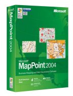
MICROSOFT ANNOUNCES MAPPOINT 2004 I had heard the predicted path for Hurricane Isabelle would take it through Maryland (where GIS Monitor's servers live) around lunch time on the 18th and decided that GIS Monitor would have to go out before that 1:45 pm lifting of the embargo. Thus, I could not include the announcement in last week's issue. I was happy with my decision until I realized that Microsoft's MapPoint 2004 website was live on Wednesday afternoon (a full day before my non-disclosure was to be lifted). Also, that afternoon, I saw ads for the product online! I contacted the PR firm and learned "We were unaware of it [the ads/MapPoint website] and the Microsoft site content was supposed to be held until 1:45 ET." Later in the day I received a phone call from the agency, which provided no further explanation for the mix-up. Despite the crossed wires at Microsoft, here's what I took away from my briefing. The MapPoint story has stayed very much the same since its unveiling in 1999 at Comdex. This year's fact sheet positions the product this way, "[MapPoint] provides users with a unique combination of high-quality maps, comprehensive and up-to-date demographic and consumer data, easy-to-use visualization tools, and intuitive wizards - all at an affordable price." Based on what I saw, that's accurate. What's new? There's more demographic data, from Applied Geographic Solutions Inc. (AGS), Simmons Market Research Bureau Inc. and Compusearch Software Systems Inc. Most notable is census tract level consumer purchase behavior from Simmons, data available nowhere else. There's enhanced geographic data, especially in the European version. Also new: users can create their own symbols. GPS support has been enhanced and more users may be looking at the product as a "take along" when traveling. In fact, one of the NSGIC folks who was driving home told me he had consulted MapPoint for his route, trying to stay away from Isabelle-related backups. The estimated retail price of the North American version of MapPoint 2004 is $299. Upgrades are $229. Trial versions (60 days) of the North American, European, or both are available for less than $15 on the Microsoft website. As has been the case for previous releases of MapPoint, the big draw for the professional community is the comprehensive, inexpensive data set, robust geocoder and routing tools. Application developers have stepped up to the plate to take advantage of these strengths. Some solutions are in conjunction with "professional" desktop GIS packages. I don't see any further allure for the GIS professional in this release. That said, for a small business or a home user, this is still a terrific mapping package for the money.

So, is it a big deal? Sort of. The technical solution is nothing new. The problem to be solved revolves around the fact that neither Oracle Locator (a toolset included with basic Oracle, for managing spatial data) nor Oracle Spatial (the "fancy" add-on that provides enhanced spatial tools) has a standard way to store "auxiliary information for text and point data, such as orientation." As the Intergraph release puts it, "Text and oriented point feature representations have not yet been standardized [in Oracle's spatial data model], and as a result, are still being treated differently by some major GIS product lines." My first thought on reading about the problem was that a solution should involve Oracle extending its data model to include this information in a standard way. In point of fact, that's the goal of this initiative. However, as anyone involved in developing new data models or interoperability specifications knows, developing, testing and implementing such a plan takes a long time, especially when more than one player is involved. So the four GIS companies, with Oracle's support, put their heads together to be sure each one's client software could understand "text and oriented point features" produced by the others. The effort thus far has spanned just five months. How does the solution work? Mark Doherty of Intergraph explained it to me. The team used the old intermediary format solution. Basically, what happens is that once one of these two types of features (text or oriented points) are written to Oracle, by say, GeoMedia, a trigger calls a procedure to "convert" the data into a published agreed-upon "interoperability format." Then, another trigger is called to convert that format to native MapInfo or Autodesk format. If this process sounds reminiscent of using DXF format files to move data from one software product to another, it should. It's pretty much the same idea. But, this solution is done transparently to the user, and it's done in the database in real time. The vendors each had to build an "interoperability kit" that did two things for each data type: write its native format to the "interoperability format" and read the " interoperability format" into its native format. The group is happy to have any other vendors build kits, too. So, this initiative is not a big deal technically. It essentially uses an old idea. But, it's a big deal "culturally." Two things strike me about this work. First off, vendors are coming together to serve customers. Now, that shouldn't be a big deal, but in this industry, it's been rare. This work, therefore, is worthy of recognition. Second, and this is subtle and related to the first point, the vendors are taking responsibility, together for interoperability. Even a few years ago, if you wanted to connect up product A to product B, you hired a consultant who perhaps knew something about one or the other systems. Today, the vendors themselves, the ones who know the software inside out, are taking on those same types of problems. If you ask the vendors why the initiative is "a big deal," their answers are not surprising. Mark Doherty, of Intergraph, notes that three competitors (Intergraph, Autodesk and MapInfo) and two other industry players came together to solve specific customer problems. While the Open GIS Consortium (OGC) has encouraged that type of work for years, this is outside of that arena. I have to believe that the experience these vendors (all long time members) had within OGC played a part in making this project a reality. (I am a consultant to the Open GIS Consortium.) Tom Myers, product manager at MapInfo notes, "This is good for customers because they can avoid unnecessary technology hurdles and choose the right tool for the right job." As I understand it, Oracle itself provides a lot of the technology (interfaces, a structure to store spatial data) that underlies customer options. This initiative covers the sharing of just two feature types. Duncan Guthrie, Laser-Scan's Sales & Marketing Director comments, "This is a big step in achieving true interoperability and with the kits being open source, we welcome other GIS vendors to follow suit." Laser-Scan was the only vendor of the four GIS companies that stated that the kits were open source. Chris Bradshaw, vice president of the Infrastructure Solutions Division at Autodesk, noted in the company's press release, "This is [a] direct answer to our customers asking for a higher level of interoperability in our products." In short, before GIS users go dancing in the streets about this announcement, remember that: � This initiative "solves" one tiny corner of the data interoperability challenge. So, what's next? With this press release, the group has completed "Phase 1" of the initiative. Phase 2 includes further testing of the "interoperability format" to be sure it does the job, then joining with Oracle to take the format to OGC as a potential extension to the Simple Features Specification. While there are other interoperability challenges the team has identified, the group has made no commitment on what they might tackle next, if anything.

GIS SERVICE PROVIDER SURVEY
Participants are eligible for several raffle prizes (including software) provided by ESRI, GDT, Autodesk and others. Interested parties will be able to purchase the results in January. (GIS Monitor supporters will receive a complimentary copy.)

LETTERS "I almost always read the GIS Monitor from beginning to end. I've found it to be the most comprehensive summary of what's going on in the industry. "However, I wanted to extend a special thanks to you for your coverage of the NSGIC this year. The information was timely and well-written and I especially appreciate the effort that went into summarizing what occurred there. "Thank you and keep up the good work." The editor notes: Covering NSGIC is as challenging as covering the ESRI conference, maybe even more difficult. Thanks for the kind words. � Duane Marble wrote to share info about the demise of a search term for our industry. "See the full page, color, back cover for SCIENCE for 5 Sept 2003. 'Gene Expression and Proteomics' and the 'Gateway Proteomics System.' "[The articles are] all about mapping pathway interactions. The gene people have killed anything to do with 'maps' or 'mapping' as a useful search term (GIS died long ago on rocks such as 'gastro-intestinal system')." � Gary Price, a librarian, writer and editor of ResourceShelf, a daily update of online search, Web database, and new reference tool news aimed at librarians, commented on the new Google spatial search tool. Gary read about this yesterday on the website, though it's also below. I update the main page with interesting nuggets throughout the week. I also provide a link, daily, to a single page recap of GIS headlines. (Do you have time to plow through one page or longer press releases to get to the point? I didn't think so.) "A comment about Google and geo searching. This is not a new idea in the web search world. First, Overture also unveiled a demo that looked very similar last week. Because it's not Google it received very little coverage. "Also, as far as limiting by location goes in the Web search world goes, this is hardly a new idea. The now defunct Northern Light offered such a service over 3 years ago. "I have examples and links on my site. "On ResourceShelf I also like to highlight new research. This post with a link to a new paper from Stanford might be of interest. "Research Report, From Where to What: Metadata Sharing for Digital Photographs with Geographic Coordinates"

Google Researches Spatial Queries. Google is testing a new "Search by Location" tool for its search engine. The vision is that by typing in a postcode or address along with search terms, the results will be displayed on a map. "The technology behind Google 'Search by Location' is one of the first of its kind, and is an exciting new direction for Google users seeking local information," a Google representative told ZDNet. The FAQ reports that the app doesn't use strict geocoding, but analyzes "the entire content of a page to extract hints or, what we call 'signals,' about the geographic nature of a page." Sounds to me like they are creeping in on the expertise of MetaCarta. More on the advertising side of this technology is available here. Phone Numbers Lose Geographic Reference. It's likely the news that some of us may be able to take our home phone numbers and move them to mobile numbers has reached many readers. Gartner Dataquest suggests that about 10% of landline users will make the switch. And, for those who are looking to go the other way, the switch can also be made in the opposite direction as well. Part of the challenge regarding who gets to switch has to do with geography. Landline numbers are assigned based on geography, in particular down to a "rate center" or what I know as an "exchange" - the three numbers after the area code. Since wireless numbers are not assigned that way (and can typically work from many locations, not just a limited area, as a landline can) there are some issues about wired numbers from one rate center being assigned to a carrier who doesn't have numbers in that rate center. The Federal Communications Commission (FCC) has set a November 24 date for carriers to comply with some requests for the switch. In the meantime, the FCC is working on clarifying the geographic question. This ruling may be another step toward geography not mattering. That said, if you want play around with where phone numbers might be in the U.S., try this website. Tracking You for Other Reasons. SenSay is a sensing technology, discussed in Wired, that keeps track of your location, but also the sound and light levels where you are, as well as the heat coming off your body. Its goal is to help you receive communications in the appropriate way. If you are in a conference room and are scheduled to have a meeting, the SenSay can send a routine call directly to voicemail. If it's urgent, it might take a different path - perhaps asking the caller to call-back and sending a warning text message to the recipient to warn of the upcoming call. There are the typical GPS tracking concerns, and to me, this sounds like an awful lot of technology for actions as simple as putting a phone on vibrate, or shutting it off entirely. Intel likes the idea, developed at Carnegie Mellon, and has agreed to become the first manufacturing partner. Product is expected in about two years. Also interested: the U.S. military. Not Just Me. I've railed against local newspaper websites that don't identify their location in the past. I was pleased that this was the number one gripe about newspaper websites at the Poynter Institute's website this week. A colleague commented to me that many library websites fail to include their location. ISO to Charge for Country Codes? It came to light last week that the International Standards Organization, ISO, is proposing that users of country codes (.US, .UK, etc.) as well as language and monetary unit codes, be charged a fee. ISO currently charges fees for its standards, but not for using its codes. Three organizations have already come out against the idea. The International Committee for Information Technology Standards (INCITS), the World Wide Web Consortium (W3C) and Unicode argue that such fees would weaken standards adherence and adversely affect non-English websites. Another twist: some critics are arguing that this move is akin to "belated intellectual property claims." Another Way to Get to Autodesk University Free. If you submit a design to the Autodesk Design Awards and you are a grand prize winner (12 total), you'll get a free trip (air, registration and spending money) to Autodesk University. You must be a registered user and a legal resident of the 50 United States (including District of Columbia), the United Kingdom, Canada outside the Province of Quebec, and Italy. Submittals are due by October 7. And, you can submit a mapping website, along with other formats like DWG, and DWF (not surprisingly the "preferred" format). Good luck! If you don't want to enter the contest, remember this lottery for a free registration runs until October 9. Sun Introduces New Pricing. Sun, once the preferred platform for GIS, introduced a new pricing model for its software. "We're trying to build the best cars, not the best tires," says John Loiacono, vice president for operating platforms. The "happy meal" approach (honest) involves pricing based on a company's employee count. The company will charge $100 per employee for an application server, a Web portal and security software, among other components. New Geo Word. Washington County, Oregon, a rural county will be implementing "geopolicing." The idea is that instead of rotating assignments, officers are assigned to defined geographic areas. Bottom line, Sheriff Rob Gordon notes, "Because deputies are consistently assigned to the same beat, they become more familiar with the communities within their beats." Quote of the Week. Bentonville, Arkansas is putting its maps online using Autodesk software. Charlie Barnes, a mapping technician, described the choice this way in the Benton County Daily Record: "In five years, if we decide to go to ESRI products, it will copy over. So we didn't box ourselves in."

� Announcements Laser-Scan and Cadcorp, have announced a co-operation agreement. The companies intend to work together to allow users of Cadcorp's flagship product, Cadcorp SISseamless access to Laser-Scan's Radius Topology, when deployed with Oracle spatial technology. Lockheed Martin Corp. announced an agreement to acquire Titan Corp. for approximately $2.4 billion, a move that will strengthen its position in defense and intelligence technologies. Navigation Technologies announced that its NAVTECH Map Data provides a digital roadmap database to exploit the powerful features of Oracle Spatial 10g. Miner & Miner, Consulting Engineers, Inc. and CGI CYME (CYME) recently announced an official business alliance. The alliance formalizes the agreement between the two companies to continue to provide electric utilities with the ability to access CYME's network analysis software, CYMDIST, from within Miner & Miner's GIS-based ArcFM Solution. NovaLIS Technologies has been selected Business of the Year by the Metro Halifax Business Awards. Telcontar and TransDecisions announced a worldwide cooperative marketing agreement. Under the agreement both companies will be able to add value for their customers by offering additional products as needed. TransDecisions will offer Telcontar's Drill Down Server spatial software platform as an option for their fleet logistics customers, while Telcontar will offer TransDecisions' patented geocoder for customers requiring high volumes of batch geocoding for vehicle telematics, wireless LBS, and mobile resource management.

� Contracts and Sales Groupe Alta announced that MacDonald Dettwiler and Associates (MDA) has awarded Hauts-Monts Inc., a member of the Groupe Alta, bookings of over $2 million (CDN) to provide digital land information products to monitor crop growth for the U.S. Department of Agriculture. Applied Geographics, Inc. (AGI) has been approved by the State of Indiana to participate in the Department of Information Technology 's (DoIT) Business Partner Alliance program. The BPA program allows AGI to partner with DoIT to provide GIS planning, coordination, development, and implementation services to state agencies and local governments throughout the state. CompassCom Inc. and Sierra Wireless announced that they have been selected by the City of Aurora in Colorado to migrate its Public Works Department to next generation technology. Denver Public Schools selected ESRI to provide GIS software for K-12 schools. � Products Geosoft, a provider of geospatial software for earth science industries, announced the release of Target for ArcGIS, a surface and drillhole mapping extension to ESRI's ArcGIS software. Fastrax Ltd. and Mobintelecom Oy introduced TRAXER, a pocket-size device for personal security. In case of an emergency, TRAXER is activated quickly by pressing an easy-touch panic button. Upon activation the device uses the Fastrax GPS receiver to define its exact position direction and velocity, and auto dials or sends an SMS message to a set of predefined numbers via the GSM network. The auto dial and messaging cycle is repeated until the alert and position information is delivered. TRAXER standard security features also include voice and speed monitoring and geo-fencing. Mapping the News: Case Studies in GIS and Journalism, is a new book from ESRI Press that not only helps journalists dig deeper in reporting the news but also helps media organizations visually present the news to its readers and subscribers. Kivera announced its release of Open Location Services (OpenLS). I believe what that means is that the company released a product that supports the proposed standard from the Open GIS Consortium. ESRI Business Information Solutions (ESRI BIS), a division of ESRI, announced the launch of Retail MarketPlace, a new database that enables businesses to analyze both supply (retail sales) and demand (consumer spending or retail potential) for retail and food services establishments. The new navigation CD from Tele Atlas for the Becker platforms Traffic Pro and DTM includes information on road speed limits. ESRI has updated the Geodata.gov website to provide links to websites and maps relevant to Hurricane Isabel. Click on the "Hurricane Isabel Information and Maps" icon. FEMA's Hazard Maps is also interesting. RaveGeo is now available in a Java implementation. RaveGeo Java software reduces the size of vector-based geographical information up to 90-95% and allows the data to be streamed quickly and efficiently to Web browsers. GeoConcept SA announced the worldwide availability of GeoConcept Edilis 6.5, an intelligent space and infrastructure management solution designed for local authorities, engineers, and surveyors. The product includes a module for managing electricity and telecommunications, enhanced wastewater management tools. The enhanced routing module offers roads signs and marking management. MapInfo announced the availability of MapInfo PSYTE U.S. Advantage, the company's neighborhood profiling solution completely re-engineered with new, location-enhanced lifestyle and consumer demographics. The company also announced availability of RiskDataInfo, a comprehensive data set of weather and natural hazards for its Insurance Decision Solution Suite (IDSS), an insurance visualization solution. Now, insurance companies and reinsurers can visually analyze and consider the potential impact of weather and other natural hazards in relation to a specific location. RiskDataInfo allows insurance carriers and reinsurers to consider comprehensive historical data on hail storms, hurricanes, earthquakes, tornados and wind storms, to make more informed decisions on risk exposure, allowing reduced costs and enhanced profitability. Laser-Scan announced the development of Radius Topology for Oracle 10g, which will enable users to take advantage of the topology storage feature in Oracle10g. � Events The deadline to submit abstracts for the 2004 Integrating GIS & CAMA Conference is October 3, 2003. � Education and Training Intergraph Mapping and Geospatial Solutions announced a new partnership with the International Federation of Surveyors (FIG) to promote the use of advanced technology in land administration and management infrastructure among surveyors and surveying organizations worldwide. Through the partnership, Intergraph will award 21 GeoMedia grants, valued at over $8.2 million (U.S.), exclusively to FIG members. FIG is a federation of national associations with members from 100 countries, and it is the only international body that represents all surveying disciplines. San Antonio College received a $24,985 grant from the National Endowment of the Humanities to help integrate Web-based mapping into the school's humanities curriculum. GIS will be tested for use in two modules: Exploring Globalization Visually and Exploring the Mayan World. Sounds very cool. � Hires and Appointments Bud Porter has joined Power Delivery Associates as Vice President of Business Development. He's worked at ESRI, Enghouse and Synercom.
ADVERTISE WITH US
CONTACT
SUBSCRIBE/UNSUBSCRIBE |