Letters, Points of Interest, Week in Review (Announcements, Contracts, Products, Events, Education and Training, Hires) Back Issues, Advertise, Contact, Subscribe/Unsubscribe If, for some reason you cannot read this document, visit: http://www.gismonitor.com/news/newsletter/archive/100203.php
DIGITALGLOBE PICKS UP NEXTVIEW CONTRACT DigitalGlobe, which employs about 300 people mostly at headquarters in Longmont, Colorado, will likely add some 50 more in the coming months, and perhaps another 50 over the next few years. Space Imaging, based in Thornton, Colorado, which teamed with joint venture partners Raytheon and Lockheed Martin, and newly airborne ORBIMAGE, has about 270 employees. The company is still in discussions with NIMA about future work and possibly a new satellite. While disappointed, the company expects revenues of more than $200 million this year. According to Space Imaging, about half of that revenue comes from overseas. Based on reports, both companies were surprised at the award and had expected a split award similar to the ClearView contract. The rationale behind the choice is still not public, but in a call to DigitalGlobe, NIMA representatives noted that the company scored well in each of five categories: business viability, schedule, technical, management, and price. The general sense from my reading and discussing the award with people in imaging is that NIMA will likely fund some further work with Space Imaging. The agency doesn't want to risk Space Imaging going out of business. Having two U.S. imagery providers keeps costs down and provides a "backup" should DigitalGlobe run into delivery problems. With only one U.S. provider, NIMA would perhaps at some point have to resort to the procurement of imagery from overseas. Exactly how ORBIMAGE fits into the vision is unclear. The company worked with Space Imaging for the NextView bid, so a longer term partnership may be in the works.

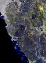
NASA REJECTS ONLY LANDSAT CONTINUITY BID
Landsat 7 has been plagued by an anomaly since May. The latest report on the anomaly, dated October 1, notes that attempts to fix the malfunctioning Scan Line Corrector (SLC, a device which compensates for the satellites forward motion) have come to an end; the problem appears to be permanent. The satellite will continue to acquire imagery, and a procedure to distribute the so-called "SLC-off imagery" is in the works. It turns out that even with SLC off, the center parts of images are useful.
Integrated Geospatial Technologies: A Guide to GPS, GIS and Data Logging is a 90% accurate title for their work. The book does a great job detailing a variety of geospatial technologies in clear prose. There are chapters on cartography, sensors, GPS, and remote sensing, all speckled nicely with topics that frequently get the short shrift in GIS, such as tracking time. However, the 10% I feel is missing is perhaps the aspect that would make this book truly unique, that is, integration. As promised in the introduction, the book indeed covers theory and technology together for each topic. What seems to be missing is "how these things fit together" or the "challenges of fitting them together." In all fairness, it's worth dwelling on the 90% that does work. As I read the book I considered how I might use it in a classroom setting. I've been out of school for a while (17 years since my Bachelors) but I'd like to think that by now there's a place for a course called "geospatial technologies" and this book would fit nicely. It packs in quite a lot, from Dr. John Snow's map of cholera to the theory behind how GPS works, to spatial modeling. There's not a lot of dry detail about how specific devices work, nor discussion of programming languages, which allows the text to flow nicely. And, lest the technology be too overwhelming, there are just a few simple formulae devoted to the mathematics behind photogrammetry. That's just about right for the generalist who may take just a few geography classes or for someone looking into how these technologies might illuminate an application area like forestry or health care. I do have to point out some places for improvement, some of which I think fall to the publisher. International Data Corporation (IDC) is not, as noted in the book on page 74, based in Farmington, Massachusetts, but in Framingham. Unfortunately, Geography Markup Language (GML) is misrepresented as Geographic Markup Language on page 79 and again on page 249. (I've noted this same error in reviews of other publications.) And for those who missed it the first time, the same bulleted list of GML's goals is printed at both locations! Graphics are a bit sparse and a few are just plain puzzling. For example, the discussion of spatial filtering on page 112 is quite clear, but the graphic titled "Idrisi: Filter" makes me question what I missed in the text. By the way, no specific vendor software is mentioned, except in a multi-paragraph history of GIS and in crediting a graphic or two. Finally - and I've noted this before when reviewing other books - the graphics are fuzzy! A graphic illustrating the history of geotechnology with just text and arrow on page 164 is simply painful to read. The one on page 227 looks like a poorly captured PowerPoint slide. In summary, the book is strong on narrative and broad on coverage. It's weak on integration and could use a bit more attention to graphics and text editing. Nevertheless, I look forward to the second edition.

GIS SERVICE PROVIDER SURVEY
Participants are eligible for several raffle prizes (including software) provided by ESRI, GDT, Autodesk and others. Interested parties will be able to purchase the results in January. (GIS Monitor supporters will receive a complimentary copy.)

BOOK REVIEW: COMMUNITY GEOGRAPHY: GIS IN ACTION Like Mapping Our World: GIS Lessons for Educators, this is not a "learn GIS book" but rather a geographic analysis book that focuses on using GIS and geographic thinking to make a difference. Each module includes a case study that focuses on a specific topic (crime, weeds, pollution, wildlife conservation), ArcView exercises that help to explore the topic, and an "On Your Own" section that extends the lesson by exploring activities students can undertake in their own communities. The "On Your Own" section suggests related topics that might be of interest, outlines the creation of project plans (sounds like what GIS consultants do everyday!), encourages the formation of partnerships, details data collection ideas, then points students to the fun part: exploring and analyzing their findings. Finally, the section suggests that students "Act on Geographic Knowledge" - what Professor Simkins at Penn State used to call the "so what??" part of geography. Students are encouraged to share what they've learned with the "right" people, and make a difference. The Teacher's Guide provides reproducable handouts, scheduling suggestions, and detailed lesson plans to take the burden off the instructor. For example, if you are going to take water samples with children, as is suggested in several activities, you'll want to be sure parents know ahead of time. You'll also want to know whether or not the students can swim! Like Mapping Our World: GIS Lessons for Educators, this is a phenomenal resource. I want to share three more observations. First, this is a very attractive book with color photographs of students in action, color maps, and tables. The book clearly "practices what it preaches" about visualization. (View some samples here.) Second, as a one-time science fair judge I can think of some great project ideas coming from this book. Finally, while ESRI published the book, keying the "hands on" activities to ArcView and ESRI formatted data, there's no reason the ideas can't be used with whatever geospatial tools are on-hand. I point that out to highlight that ESRI's educational materials are meticulously produced, and should be used as widely as possible. That said, I'm happy to pass on my review copies to a reader involved in education. Drop me an e-mail with a brief discussion of how the book might help either you or a school and I'll send the set off to a worthy recipient.

MAPINFO AND MIDDLEWARE: A CLARIFICATION
First off, I made sure I understood what middleware was, in particular, in contrast to third party solutions that work "inside the database." Myers confirmed that I had it right when I described middleware as software that sits between a client and server. An "in the database solution" takes advantage of the development environment "in the database" to add extended functionality. Myers explained that at one time there was a middleware version of SpatialWare for Oracle. That version was retired in recent years, when MapInfo formed a partnership with Oracle and began working directly with Oracle Locator and Spatial. The two other versions of SpatialWare, one for IBM's Informix and one for Microsoft's SQL Server, are both "in the database" solutions.

LETTERS "Prof. Joel Morrison (formerly Chief Geographer with USGS) [spoke at the] 'DigitalEarth2003' conference [last] Wednesday � in Brno [Czechoslovakia] about a study undertaken for [the] U.S. government..." "... and one of his key points � was �[that] GI literacy for mass users in the near future (beginning in school education) [meant they must] be aware [of] GI data & services technologies [just as they are aware of] Microsoft's Office: Word, Excel, PowerPoint packages... e.g. likely the 'GI module in Microsoft's Office package'... "I hope the original PPT of his speech will come out soon at Czech conference service page..." � Always vigilant Jim Herberich of ENSR called me to task on acronyms. "I seem to recall you decrying acronym proliferation a while ago, yet I'm baffled as to what 'NSGIC' might be..." The editor replies: Jim's right. In two issues discussing the National States Geographic Information Council annual meeting I failed to write out what the acronym means. My apologies. � Wes Flack, of the U.S. Census Bureau wrote to clarify some points I muddied in my coverage of a presentation at the National States Geographic Information Council meeting. "I just want to clarify a couple of things about your summary from the "1. Overall, you refer to the MAF/TIGER Accuracy Improvement Project "The goal of MTAIP is to align TIGER to the best available local data wherever that data is as good or better than our +/- 7.6m CE95 threshold. "We plan to complete MTAIP by 2008 so that the enhanced, nationwide, seamless MAF/TIGER is available for use in the 2010 Census. "2. You said: "'The representative also asked that coordinators examine some provided samples of the TIGER Enhanced Data (TED) and share any concerns.' "TED (The TIGER Enhancement Database) is not enhanced TIGER, but rather, our inventory of geospatial data. This inventory of governmental and commercial GIS data and imagery is what is used to determine the source material and methodology used for improving the coordinate accuracy of TIGER for each county in the nation. We have provided state-level extracts of TED to each of the state coordinators so that they might review it for accuracy and completeness. By keeping TED accurate and complete, we hope to avoid the potential for any duplication of effort."

POINTS OF INTEREST Microsoft is fighting open source with comments suggesting the open source community is akin to communism, a "slush fund" aimed at making sure the company does not lose to open source on price, and several reports touting that Windows costs less than open source in specific areas. Finally, Microsoft is making some source code available to some users, mimicking at last part of the open source vision. It is possible we'll see this type of response in the geospatial marketplace? Thanks to Larry at MIT for sharing this story. RFID Technology Turned Upside Down. RFID tags have been in the news as pallet or product tracking devices. The tags are attached to products and receivers note their "passing by." Researchers at the University of Rochester put the technology to use in reverse. The tags "stay put" and when a receiver passes by, information is delivered. The vision is for a two-meter zone of contact, appropriate for guided tours in museums or providing the blind with locational clues. Products are expected in about two years. Tracking Travel in London. Transport for London's new smart cards for annual subscribers will soon keep track of all times and locations where they are used. That, say some privacy advocates, will create a database of the locations where many, many of London's commuters travel. Anonymous travel is possible, but it requires a higher per trip cost. The agency says the data is to be used only to learn more about how people travel and that it will be used in aggregate, not to track an individual. Data will be stored locally for about two months, then archived for years. Data Sharing Redux. I've read several articles (1,2,3) about disagreements between the City of Newton, Iowa, and its county, Jasper County. It seems the city would like access to the county's GIS data for free. The county wants to charge the city $83,000 saying it has already spent $245,000 of its budget to develop the system. The city, which makes up 42% of the county's population, argues that its taxes are what funded the work. Insight from the Open Data Consortium and practitioners to help mediate such discussions can't come soon enough. E-gov Edges out Non-E-gov. A survey from the University of Michigan helped build the first E-Government Satisfaction Index. The report is downloadable for free, so long as you register. The results show that E-gov websites outclassed traditional processes by a score of 70.9 to 70.2 in "customer satisfaction." Of the twenty-two federal websites examined, geospatial ones were a mixed bag: NASA was a strong performer at 79, the State Department "geography" website (aimed at students) garnered a 61, and NOAA's MapFinder scored at the bottom of the list, with a 51. Spain Grows E-gov. The Spanish government launched an initiative to help small municipalities develop e-government functions. The plan involves the development of standard software programs that support simple on-line services and information resources. Support for a local authority useable GIS application is also in the works. Sounds like a good way to encourage a national spatial data infrastructure. Shopping Cart Tracking Grows Up. I've been following the use of different tracking technologies aimed at either getting customers to buy more at grocery stores or prevent theft. Here are some reports from the real world. The Future Store, a revamped "showplace" of a grocery in Germany, is providing tablet PCs for loyalty cardholders to use. After a card swipe, the shopper has access to past "points of interest" and lists created on the store's website. There are ads, too. As shoppers pick up items, they use a barcode scanner right on the cart so that once shopping is complete, they go to a special checkout line to pay the already totaled bill. The systems use the software-only Ekahau positioning technology and can locate a shopper in an aisle, but it cannot zero-in on what product is the focus of attention. While there are speculative gains from the technology (like not losing a sale to convenience stores since it's on the electronic list) there's no data to support return on investment claims at this time. Bluesoft has as product that tracks carts - specifically, ones that go down the alcohol aisle in a German shop. If the cart goes through a checkout line, tracking is turned off. If it leaves without going to a checkout, some pricey bottles might be picked up outside by store personnel. GAO: More Interoperability in GIS Needed. The General Accounting Office (GAO) had more to say about GIS this week. In particular, that forest fighters were hampered by non-interoperable GIS systems. The GAO suggested the Agriculture and Interior Department secretaries promote the development of an enterprise architecture for wildland fire management. "Local land managers and incident teams often acquire, collect and develop geospatial information and technologies to meet their specific needs, resulting in a hodgepodge of incompatible and duplicative data and tools," said the report. Maybe the GAO doesn't know it, but it's doing quite a lot to support growth and effective use of GIS in the federal government and the development of the national spatial digital infrastructure. Quote of the Week. "The Education department of NWFP [North West Frontier Province in Pakistan] has launched the most Modern Geographic Information System (GIS) of the world, which can locate each and every school with its details on the map." PowerPoint Gets Beaten Up. None other than Edward Tufte, the fellow who wrote The Visual Display of Quantitative Information, has joined the ranks of PowerPoint detractors, arguing it has damaged culture. An article in The New York Times (free registration required) highlights how PowerPoint "hid" key facts in the Shuttle Columbia discussions. The Shuttle review board turned Tufte's criticism of that specific fact into a page-long discussion in its report. Want more insight? Read Tufte's "PowerPoint is Evil" in a recent issue of Wired. Do I like PowerPoint? I do use it, but I work hard to keep the number of slides down. I've been lulled to sleep at many conferences by long slideshows, no matter if they have bells and whistles (literally) or not. When I sit down to do an interview with a CEO or VP type, and PowerPoint is on the laptop, I get a bit nervous. The best executives, I believe, are happily derailed from the presentations and provide great interviews. I fear their marketing counterparts, who watch earnestly from across the table, are disappointed that all the hard work that went into the PowerPoint might be lost, at least on me. Sorry! The other issue I have with PowerPoint presentations is that that are becoming stand-ins for actual written, narrative documents that explain things. I receive presentations from clients with complex graphics with arrows and boxes and am told to use them as resources for white papers and such. It's tough work, indeed. Far more useful to me: a half hour conversation with the presentation's author. Partners? What Partners? On a recent flight, I read an article on Custom CAD in AUGIWorld (the print publication of Autodesk User Group International), which weighed having an in-house or contract programmer provide software enhancements against buying third party applications. The article was fine, but the accompanying table listed AutoCAD Third-party developers by vertical market was particularly interesting. How many were listed for the Infrastructure Solutions Divisions (that's the GIS folks)? Just four. While AutoCAD 2004 does have 20 or so developer products just for "map production" according to the Autodesk Partner website, the number for Map (for all areas) is higher, somewhere around 40. Mapping Money from OPS. An article in Underground Focus details how the state of Mississippi One Call Center (the people who mark underground power lines to prevent disaster when utilities and others dig) worked with the state's director of pipeline safety to apply for a $300,000 grant from the federal Office of Pipeline Safety (OPS) to update their not-so-great local maps. The Call Center and the state each contributed $300,000 and a three-year program was underway. Part of the language of the grant was that data could be shared, so long as the recipients agreed not to sell it, or profit from it in any way. Two thoughts here: First, there are many sources of mapping funding, as Mississippi learned. Second, how grants are worded can drive/enable data sharing that otherwise might run into barriers. As I've noted before, this is a pretty interesting publication - with lots of pictures of explosions and fires - and discussions on how to prevent them. Geography Matters to Advertising. Custom ads for specific publications are a new trend. Ad agencies tailor the format according to the content and style of the publication (a witty book of cartoons might grace The New Yorker, or a fake centerfold might appear in adult publications). According the The New York Times advertising newsletter, custom ads for specific geographies are also hot. New York's City's Metropolitan Transit Authority has different ads that speak to where they are - on busses, subways or waiting areas. As a high-end watch retailer put it, "When people open a magazine, I want them to know I know where they're reading the ad." I suppose the same is true for other ads. I am reminded of a sign outside a large apartment complex along the Charles River here in Boston that we used to pass when I was a child. "If you lived here, you'd be home now," it declared as we regularly sat in traffic. I remember thinking that was clever, even then, but never, never asked Mom if we could move. Olympic Map. The Chicago Sun Times reports that in preparation for the 2004 Summer Olympics in Greece, Navigation Technologies has developed a digital map of Athens and 114 nearby municipalities. The map includes street names in Latin characters. The map will be updated again before the games. GIS Grows in Russia. According to a new report, GIS market growth in Russia was about 4-5% per year starting from 1998, but in 2002 growth exceeded 50%. Federal and local governments contributed 79% in total revenue, and 21% was the share of private companies. The report costs a few hundred dollars, for those interested. Speeding GML. CubeWerx released a public beta of its "cwxml" library. CWXML is a high-performance, open-source C-language library for parsing and generating XML and Binary XML (BXML, a stand-alone work-alike drop-in replacement for an XML). Say folks who understand this stuff better than I: "[It] make[s] streaming GML faster." Geocoding Service. The folks at PublicGIS.com now provide several Web services including a geocoding service. These support standard Web services interfaces (SOAP, XML, RPC) and are free for non-commercial use.
� Announcements TatukGIS announced a new component for the comprehensive TatukGIS Developer Kernel toolkit to support IntraWeb, the popular Web application development environment from Atozed Software. Governor Bill Owens has proclaimed September 29-October 3, 2003, as GIS Week in the State of Colorado. The City of Saskatoon was presented with an Award of Excellence at the ESRI Regional User Conference in Regina, Saskatchewan. NearSpace and BSA FM are collaborating to deliver the interactive-mapping component of an intranet-based Employee Locator. The mapping component uses the NearSpace WebLocator product and the Clarian CAFM data that is maintained by BSA FM. NearSpace CEO is Creighton Hoke, a former Autodesk GIS employee. Word has it that Intergraph is among the potential buyers of British Columbia-based MSDI. Founded in 1993, MDSI develops wireless work force management software and has a strong customer base in the telecommunications, utility and cable sectors. Could be a nice match for IntelliWhere and IMGS. Spatial Technology will be Laser-Scan's reseller organization in Scandinavia for Radius Topology. Members of the Asia Pacific Inter-City SARS Prevention Forum yesterday signed a cooperation memorandum, agreeing to establish an online GIS to communicate real-time information about SARS and other infectious diseases. Thailand's Science Ministry's plans to buy a French remote sensing satellite are being reconsidered as the country explores developing its own human resources and technology. Autodesk announced new benefits for Autodesk Subscription customers in the United States and Canada, including Web Support direct from Autodesk, Subscription-only access to e-Learning lessons, and beta programs. Cadcorp announced the appointment of several new distributors: Consulcad in Melbourne, Australia, Cadstation in Brisbane, Australia, and Matrix in Auckland, New Zealand. ESRI President Jack Dangermond served as honorary chairman during a special World Standards Day exhibition, reception, and dinner on Tuesday, September 30, 2003, at the U.S. Chamber of Commerce in Washington, D.C. The release notes that Dangermond's participation in the U.S. celebration of World Standards Day highlights ESRI's commitment to the development and interoperability of geographic information system standards. Group 1 Software completed the purchase of Sagent's assets this week. The global GPS market may reach more than $22 billion by 2008, according to technology market research firm ABI. @Road, a provider of mobile resource management services, announced that the U.S. Patent and Trademark Office has issued patent number 6,594,576 titled "Using Location Data to Determine Traffic Information." � Contracts and Sales Prepared Response, in Seattle, Washington, is being paid $3.5 million to create mapping databases (with inside and outside imagery, details on entry and exits, hazardous materials, etc.) for all the state's approximately 450 high schools. It expects to complete the project by January 2005. One system, already in place, has already been used. King County, Washington has selected Tadpole-Cartesia's ESRI-based GO! Sync technology as the key component in the development of TNET, a high-accuracy, multimodel GIS transportation network and maintenance program. Geographic Data Technology, Inc. announced that Atlantis Data Systems has selected GDT's street and address database to fuel ADS's fleet tracking and management solutions. MacDonald, Dettwiler and Associates Ltd. announced that the company has been awarded a $4.1 million (CDN) contract to modernize the processing of land information requests for the Borough of Telford & Wrekin, a local authority in Shropshire, England. Glynn County, Georgia has selected Tadpole-Cartesia's GO! Sync technology to replicate its enterprise ArcGIS environment throughout various county departments. � Products ESRI's Production Line Tool Set (PLTS) Nautical Charting Solution is now shipping. Televigation has launched TeleNavTrack, the first mobile phone-based tracking service with integrated audible and visual GPS navigation, electronic time sheet reporting and interactive dispatching, that operates over Nextel Communication's all-digital wireless network. ComputaMaps' free terrain data now incorporates data from the Shuttle Radar Topography Mission. Definiens Imaging announced the availability of eCognition enterprise 3.0, its new client/server production suite for the automation of image classification workflows. � Events GE Power Systems has announced that its Network Reliability Services business will host a Users Conference specifically targeted for its network management and substation automation end users. It will be held in New Orleans at the Fairmont Hotel and will run from October 26 through October 29. Strategic Research Institute presents the U.S. Commercial Remote Sensing Industry Conference, December 1 & 2, 2003, in Washington, D.C. This forum will analyze current and future opportunities and explore key issues within the U.S. commercial remote sensing industry, including its relationship to system and technology partners and value-added product and service providers. GITC America, publisher of GIS Monitor, is a sponsor. Former Indian Space Research Organization Chairman (ISRO) and Member of Parliament Dr. K. Kasturirangan will be the keynote speaker at Map Asia, 2003, an international conference in Kuala Lumpur beginning October 13. � Education and Training Southeast Missouri State University's two person geography department is among 18 departments at the university being considered for elimination. � Hires and Appointments
ADVERTISE WITH US
CONTACT
SUBSCRIBE/UNSUBSCRIBE |