

2006 June 8
This issue sponsored by
ESRI
Contents
- Editor's Introduction
- New MapGuide Enterprise and MapGuide Studio
- Basic GIS Coordinates
- Briefly Noted
Departments
If, for some reason, you cannot read this document, please visit:
http://www.gismonitor.com/news/newsletter/archive/archives.php?issue=20060608
Editor's Introduction
This week I report on Autodesk's release of the new versions of MapGuide and MapGuide Studio and I review an excellent book. I also bring you a fun quotation and resume the news items from press releases section, pending a reorganization of our website.
Please send me your comments, criticisms, and commendations. I need more feedback!
— Matteo

New MapGuide Enterprise and MapGuide Studio
Autodesk is launching new commercial versions of MapGuide Enterprise and MapGuide Studio, after having already launched the open source version of MapGuide. MapGuide Enterprise 2007 is a new mapping platform that allows developers to publish maps and spatial information to the Web. MapGuide Studio 2007 is a new authoring tool that allows developers to create and build MapGuide-based applications. It is basically the same product that is out in preview. The English versions of both products should be available July 3.
I spoke with Andrew Mackles, GIS Product Line Manager for Autodesk Infrastructure Services Division, and watched a demonstration by Arnab Ganguly.
Mackles, while pointing out that "Enterprise is more or less the same as the open source version," stressed that the commercial version contains a few additional software components, such as connectivity to Oracle and SQL Server, which are not included in the FDO in the open source version. Also, unlike the open source version, the commercial one uses the Mentor system, which supports "thousands of coordinate systems worldwide" and which Autodesk has been using in MapGuide for a couple or years. The commercial version also supports several additional languages.
"The other big difference," says Mackles, is that the commercial version "has been thoroughly quality-tested and certified on specific platforms" and that Autodesk directly supports it. Also, some components that require separate licensing with third party providers for the open source version are included in the license for the commercial version and subscription members have access to patches and to a support portal. "We think of MapGuide Enterprise as having all of the advantages of the open source software, plus it has the backing of one of the world's largest software companies. Companies like open source because they own the IP and can customize it, but they still very much want the backing of a company. We are following right in the footsteps of MySQL, Red Hat, and Novel and a lot of the other open source companies by providing the backing and the assurance and the certification."
How far does Autodesk go to support modifications? "The commercial versions will never be on the bleeding edge," Mackles told me. "We prize stability and reliability. If a customer really wants to get in there and start hacking, they are going to be much more attracted to the open source version. That said, if they are using tools that are in the commercial version—such as productivity tools and converters—but have not re-compiled the code, then it comes under our support. [The commercial version] does not support the cutting edge of innovation that is out there, but it will support the majority of the enterprise customers in what we expect that they will do with the software."
While MapGuide 6.5 focused on a specific set of platforms and customers, MapGuide Open Source and MapGuide Enterprise greatly expand the options for developers and end users. "So they can deploy on what they want, serve on what they want, develop with what they want, and use virtually any browser that they want," says Mackles.
Ganguly took me to the gallery of sample applications on the website of the Open Source Geospatial Foundation (OSGeo), the consortium that Autodesk formed to manage open source geospatial projects. The first thing that he pointed out is that MapGuide is browser-independent and does not require users to install a plug-in, because its AJAX viewer uses dynamic HTML and AJAX behind the scene. For the demo he used Firefox.
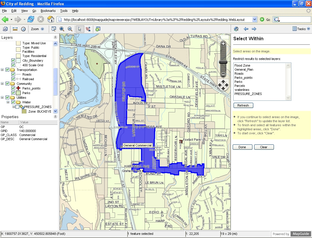
MapGuide features standard map functions, such as zoom-in and zoom-out, panning, and buffer zones. However, developers can customize the toolbar, by adding function buttons, defining links, etc. To the left of the map screen, there are "layers" and "properties" panes, reflecting the layers that available in the user's map, while a task pane on the right hand side is for application-specific dialog boxes. It allows the user to do such things as:
- connect to a site and create a session
- query feature data and work with geometry
- change the view of a map from the server-side script
- read and manipulate XML-based resources
- store temporary resources within a session
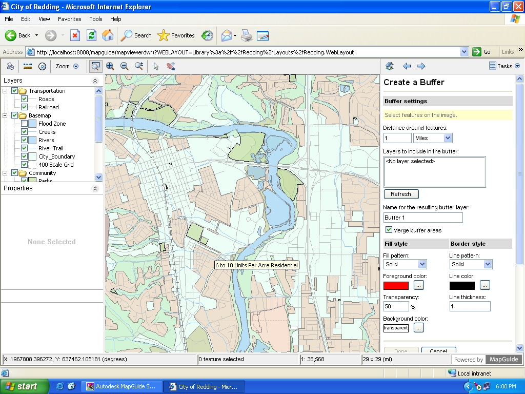
- plot a map as an eplot DWF.
MapGuide automatically brings in the relevant data depending on the zoom scale. For example, zooming in to the parcel layout displays the properties for each parcel. Behind the scenes, Mapguide can serve up data from a variety of formats—including shapefiles, MySQL, Oracle, SQL Server, ArcSDE, and Autodesk's SDF. The last abbreviation stands for Spatial Data Files, a binary format that is now platform-independent and is optimized for serving up data on the Internet; it also ties together Autodesk Infrastructure Solutions Division's products, all of which have SDF links.
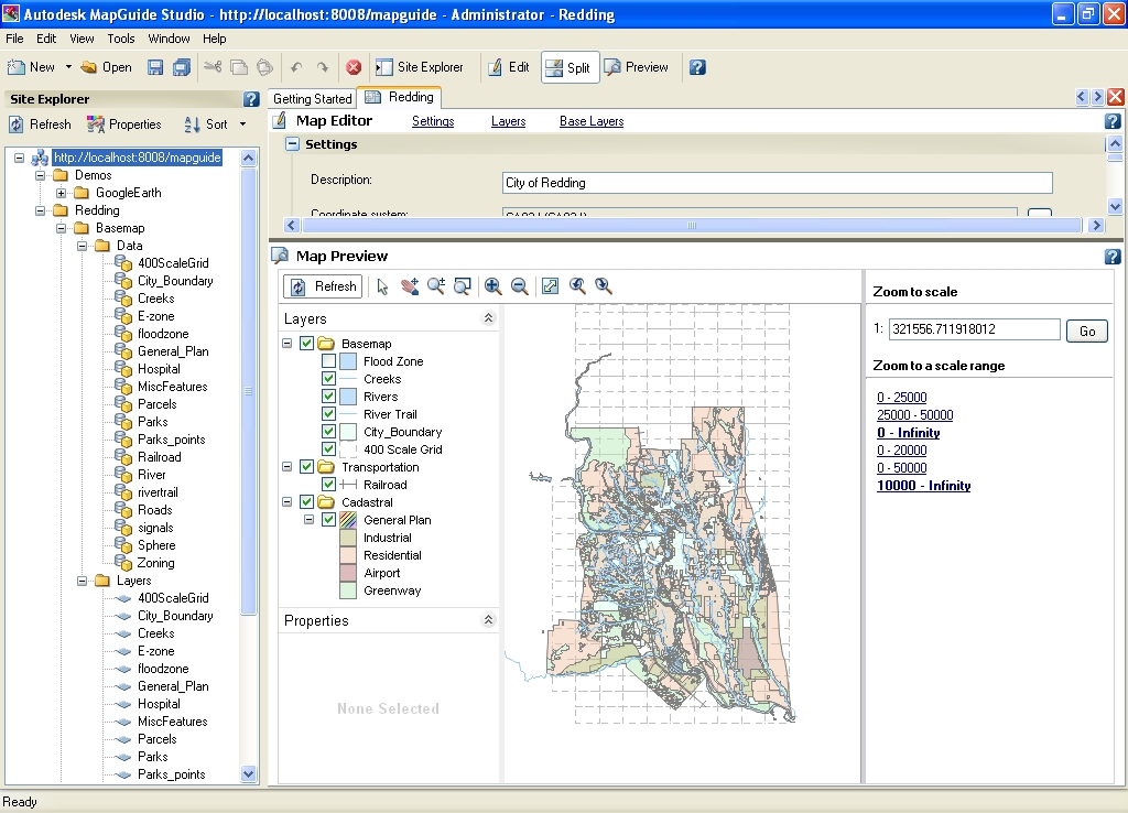
Selecting an item in MapGuide will bring up its properties, based on the settings defined by the user with Autodesk Studio. Placing your cursor on an item will bring up a tag with content that was also defined using Studio. This information is coming in on the fly, Ganguly points out, "so you could actually have expressions, or links into secondary tables." These tables might not be geospatial in nature, but would still link a parcel to an external database, for example an Access database of ownership information. "You can link them together using Studio and serve them up on the Web."
Using Studio the user can define custom application functions, which are then available via the task pane. In the sample that Ganguly showed me, clicking on the "navigate" tool allows you to navigate on the basis of municipal districts and the map will zoom to the correct scale to show you the whole district.
Ganguly loves to point out that MapGuide also effectively becomes a geospatial search engine that can query several different types of formats—including shapefiles, SDFs, and Oracle. "So you don't even have to know what a shapefile or an SDF are," he says. "We enable that through the use of FDO, which is like ODBC (Open DataBase Connectivity) for GIS data. So you have a single API that will do the query behind the scene and pull the data for you. You can have multiple systems running in conjunction." For example, users can find a specific parcel by running a query by owner name. MapGuide will retrieve the relevant data from the database and compile a list. When you click on a listing the map will zoom in on the relevant parcel. "What we are serving up is a geospatial database that has standard attribute information—such as owner, land value, etc.—and also the option of showing that in context on a map," says Ganguly. One feature that I particularly appreciate are the browser-typer arrows that allow you to step back through tasks.
In addition to the AJAX viewer, which uses AJAX technology behind the scenes in a raster format, MapGuide also has a DWF viewer, an Autodesk activeX program that generates data in a vector format. The two viewers have exactly the same interface and functionality and access the same datasets; however, activeX will only work with Internet Explorer as the browser. Users deploy MapGuide on a server, then choose whether to use the DWF client or the Ajax client—depending on their intended use of the system. "You just write your application once," says Ganguly. "You define just one application, with multiple client options."
Another important feature of the new MapGuide is "tiled mapping," which creates map tiles on the server. When you pan around in MapGuide, the map appears seamless, but it is actually downloading the tiles as needed. One advantage is that you don't have to download tiles that you have already cashed. "This is very similar to the interface that people are used to in Google Maps," Ganguly told me. "It gives you a feeling of continuity and makes the application easier to use, because the base map is there." In addition, data layers that are constantly changing can be layered dynamically on top of the base map. This works well, for example, for vehicle tracking applications. "As far as the user is concerned, the interaction is exactly the same."
Ganguly seemed most excited about one aspect of the product: "MapGuide is not just a mapping interface," he told me. "The primary objective of MapGuide is not just to deliver a map. It is actually a server-side application that can deliver content to any application that needs it. One example we have of that is Google Earth. Everyone loves Google Earth. We are looking at MapGuide as a content provider for Google Earth." To demonstrate this, Ganguly ran a query—searching for all parcels with a value greater than $500,000—then clicked on "Publish to Google Earth." This automatically opened up Google Earth, zoomed in to the area of interest, and overlaid the data returned by the query on top of Google Earth's raster imagery. As Ganguly pointed out, the data was streaming in on the fly from a MapGuide server. Because the database he was accessing contained the height of buildings in addition to their footprint, Ganguly was then able to show me a bird's eye view of an area, using Google Earth's standard tilt control. "We are merging the best of both worlds and putting both of them together on a Google Earth client," says Ganguly.
How does the registration work? "Most of the data is referenced on the LL84 coordinate system. We deliver that data, as an XML file, using coordinates that are in lat-long as well, which is how you get that accurate kind of overlay." MapGuide can translate coordinates on the fly, for example from a state plane system to lat-long, and deliver that content as XML into Google Earth.
Basic GIS Coordinates
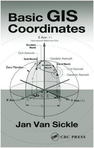 Jan Van Sickle, Basic GIS Coordinates (Boca Raton, Florida: CRC Press, 2004), 173 pages, $82.95.
When I was 13, in my junior high school shop class in Italy, I built a simple range finder. It consisted of an L-shaped wooden platform, with a nail at each end of the long arm and a mirror mounted on a swiveling disk at the end of the short arm. To use it, I aligned the two nails with a distant object, and then rotated the disk until, out of the corner of my right eye, I could see the same object in the center of the mirror. I could then read the distance to the object on the disk, on a scale that I had calibrated by aiming the device at objects whose distance I had previously measured. Unfortunately, my shop teacher did not appreciate the concept and was not impressed by my product. As I recall, I had to build something else in order to pass the class.
At the other end of the spectrum of distance measurement tools, space geodesy now allows for millimeter precision over very long baselines. Yet one basic problem still besets surveyors, cartographers, and mappers, and it is as old as the Earth itself: the Earth itself. Its surface is, in Jan Van Sickle's words, "not very cooperative. It is bumpy." "Connection to the real Earth," he writes, "destroys the abstract, perfect, and errorless conventions of the original datum. They get suddenly messy, because not only is the Earth's shape too irregular to be exactly represented by such a simple mathematical figure as a biaxial ellipsoid, but the Earth's poles wander, its surface shifts, and even the most advanced measurement methods are not perfect." This makes coordinates "slippery"—and this book necessary for those who need to understand them and apply them. Because "any successful GIS requires a merging of old and new data," and, therefore, involves legacy coordinate systems, any serious GIS user can benefit from this book.
Besides the Earth's inherent "messiness," coordinates are complicated for another reason as well. Throughout history, astronomers, surveyors, and cartographers have developed different concepts and tools to solve the same problems. For example: "[T]here are three different versions of down, each with its own latitude. For geocentric latitude, down is along a line to the center of the Earth. For geodetic latitude, down is along a line perpendicular to the ellipsoidal model of the Earth. For astronomic latitude, down is along a line in the direction of gravity. More often than not, these are three completely different lines."
Basic GIS Coordinates explains the progression of ideas that are the foundation of coordinate systems—including state plane coordinates, UTM coordinates, and the rectangular system. Van Sickle traces both the intellectual and technological developments—the concepts and the means—of measuring our world. He includes just enough history to entertain and to clarify why things are as they are—without distracting from the flow of his technical explanation. Likewise, he refrains from overwhelming the reader with the supporting mathematics. For that we have computers. "Computers," Van Sickle writes, "are astounding in their ability to make the mathematics behind coordinate manipulation transparent to the user. However, this book is not about that mathematics. It is about coordinates and coordinate systems. It is about how coordinates tie the real world to its electronic image in the computer. It is about understanding how these systems work, and how they sometimes do not work."
One key development of recent decades that Van Sickle explains is that the advent of space geodesy both allowed and necessitated adjusting coordinate systems to reflect the new measuring precision. In the past, when new surveying work, inevitably, created coordinates that did not fit those published for the known stations, "the surveyors had no choice but to adjust the surveyed measurements to match the published coordinates." This became untenable once satellite-derived measurements became available. Van Sickle, who has been mapping since 1966, understands this development well. He created and led the GIS department at Qwest Communications International, a telecommunications company with a worldwide 25,000-mile fiber optic network. In the early 1990s, he helped prepare the GCDB, a nationwide GIS database of public lands, for the U.S. Bureau of Land Management. His experience with GPS began in the 1980s, when he supervised control work using the Macrometer, the first commercially available GPS receiver.
Overall the book is extremely well organized and well written, following a logical order. The explanations build steadily, adding layers of complexity to the introductory chapter. The illustrations are clear and easy to understand. The writing is extremely precise and therefore, if read slowly, it is very clear. The author keeps calculations to an absolute minimum and works them all out completely. Each of the five chapters ("Foundation of a coordinate system," "Building a coordinate system," "Heights," "Two-coordinate systems," and "The Rectangular System") is followed by ten short exercises, complete with answers and explanations. Those new to the topic will get a thorough and comprehensive introduction, while longtime surveyors, cartographers, and GIS experts will use it as a quick reference and to refresh basic concepts.
A book of this nature could easily have been several times longer. Brevity necessitated some choices. I was surprised not to see a magnetic declination map nor to find any reference to local compass variation. Finally, I have but two quibbles with this book. The first is with the second word in the title: coordinates exist independently of both their implementation and application, so they are not "GPS coordinates" (a phrase I come across often) or "GIS coordinates" any more than "theodolite coordinates" or "nautical coordinates." The second one is that, in his effort to achieve maximum clarity, the author is often a little repetitive. Having said that, I've run out of criticism. This is a wonderful book. If you missed it when it first came out, buy it now.
Briefly Noted
I am reading Franz Kafka's The Castle, a wonderful classic. The protagonist, K., is a surveyor, so the book is full of references to surveyors and surveying. Here's my favorite, from a conversation between K. and the village council chairman:
"You were, as you say, taken on as a surveyor, but we don't need a surveyor. There wouldn't be the least bit of work for a person like that. The boundaries of our small holdings have been marked out, everything has been duly registered, the properties themselves rarely change hands and whatever small boundary disputes arise, we settle ourselves. So why should we have any need for a surveyor?"
News Briefs
Please note: I have culled the following news items from press releases and have not independently verified them.
-
CONTRACTS & COLLABORATIONS
-
The City of Rockville, Maryland took advantage of the floating license option introduced with LizardTech's GeoExpress 6 to streamline license management and provide more flexible agency-wide access to GeoExpress' image processing and compression tools. Initially, the City purchased GeoExpress in order to reduce the file size of its engineering drawings without sacrificing color or detail in a file that would transfer quickly and render properly in their legacy viewers. GeoExpress' networked data cartridge made it possible for anyone in the organization to share the image processing workload. However, having a single license associated with a computer dedicated to processing tasks meant that employees had to move away from their own workspace, which proved inconvenient and time consuming.
The floating license option enables the city to install GeoExpress on the local workstation (client) of all employees who needed to perform image processing or compression, no matter how infrequently. The License Manager, installed optionally on any networked computer as part of the GeoExpress installation, acts as a server, distributing temporary licenses to other clients at the time of use, allowing multiple simultaneous users up to the number of workstation licenses purchased. When a user is finished using the software, the license associated with that client is "returned" to the License Manager and becomes available for the next client. The result is efficient license management and increased productivity through a streamlined image processing workflow.
-
BIL Solutions Ltd., formerly BNFL Instruments, is using Ubisense's real-time location system (RTLS) to develop a new way to measure and record radiation dose rates that could improve safety measures and quality assurance for nuclear plants and their employees. This new solution is being trialled by British Nuclear Group, the parent company of BIL Solutions, in a project funded through Nexia Solutions by the Nuclear Decommissioning Authority (NDA). BIL Solutions manufactures detection, monitoring, and measurement technologies serving nuclear, defense, civil, environmental, and industrial sectors.
The company has integrated the Ubisense RTLS platform with dosimetry, the principles and techniques involved in mapping radiation dose rates, to produce a real-time map that reflects radiation levels and the location of each worker. British Nuclear Group began trialling the system in January 2006, and is further considering the benefits of the automated safety and quality assurance controls this technology offers. The Ubisense system may also be used to improve workforce efficiencies enabling employees to spend more time working in the safest area possible.
British Nuclear Group expects scalable and measurable improvements in its overall work process. The Ubisense platform relies on ultra-wideband (UWB) technology to locate people and assets within 30 cm in 3D. In this particular deployment, the precise level of tracking accuracy generated by the Ubisense platform enables British Nuclear Group to track and locate employees in real-time to monitor and evaluate work and safety conditions.
-
GeoDecisions, an information technology company specializing in GIS, recently implemented the Web EMS (Environmental Management System) Manager for Waste Management, Inc.. As a national provider of comprehensive waste and environmental services, Waste Management will use the Web EMS Manager to effectively manage its environmental programs at its Alliance Sanitary Landfill, located in Taylor, PA.
The Web EMS Manager is a customized application that allows users to better manage data, documentation, audits, and corrective actions, in addition to assigning and tracking compliance tasks. Implemented as a desktop application, the Web EMS Manager directs users to EMS requirements to ensure consistent environmental compliance. The Web EMS Manager also features a user-specific dashboard with key information that can be tailored to maintain requirements for the user's individual operations.
GeoDecisions recently helped Waste Management migrate environmental program data into the Web EMS Manager and is currently training Waste Management staff in the effective use of the application. The system enables Waste Management to identify and track training needs by employee, establish specific training programs for individuals and departments, and generate status reports.
-
The Advisory Unit: Computers in Schools has been awarded a contract to collaborate with eMapSite, an online map distributor, to deliver a new pilot to support geographical studies. MapPilot (The National Digital Mapping Supply Service for Schools pilot) enables schools to freely access high quality digital maps for the whole of Britain online via broadband networks. MapPilot will run for one year until 2007 March, administered by the British Education Communications and Technology Agency (Becta) and Ordnance Survey (OS), Britain's national mapping agency, for schools in England, Scotland and Wales.
Ordnance Survey digital map data is available to schools under the Mapping Services Agreement, held with Local Authorities. With the introduction of this new national scheme, pilot schools will be able to freely access high quality OS digital maps anywhere in Britain, online via broadband networks or through recognized educational mapping suppliers. Supporting the National Curriculum, OS map data underpins mapping and GIS in geography, ICT, citizenship and other subjects. The pilot will allow schools to investigate how greater access to digital map data can influence teaching and learning.
-
Sioux County Iowa is using mPower Integrator, developed by mPower Technologies, with ESRI ArcIMS to develop their Web GIS applications. In the spring of 2005 the county was contemplating how to develop their ArcIMS. Consulting services were too expensive, and doing it themselves was not practical either, given limited budgets and staff time available. Micah Van Maanen, the IT Director for Sioux County, had seen what Plymouth County, their neighbor to the South, was doing with a product called mPower Integrator, and thought it might be what they needed.
-
DM Solutions Group, a member of the open source Web mapping community, has integrated MapGuide Open Source as a key technology to its commercial service and product offerings. Central to these services will be an open source Web authoring environment developed by DM Solutions Group that will be maintained within the MapGuide Open Source project.
The new Web authoring environment will allow users to load and style their GIS data for MapGuide and will act as the default interface to MapGuide Open Source. This is a critical component for growing adoption and long term sustainability of the open source project. This environment will be available to the MapGuide Open Source community by the end of June.
DM Solutions Group has developed a successful business model around custom solutions delivery, professional services, and sale of related products for MapServer through its commitment to the open source project. The company envisions growing its success by emulating this model with the new MapGuide Open Source project.
In addition to the company's professional services and custom solutions delivery, DM Solutions Group plans to expand its data product offerings to include map products for MapGuide Open Source and Autodesk MapGuide this summer. Autodesk MapGuide software became an open source project this winter following the announcement by Autodesk to release the code for its next generation of Web mapping technology to the open source community.
-
Timmons Group has completed a GIS interface for the Virginia Department of Historic Resources (DHR) statewide Data Sharing System (DSS). DSS has been identified as one of the most "cutting-edge" and beneficial environmental data systems in the United States by FEMA, the Army Corps of Engineers and the Transportation Research Board of the National Academies of Science.
In fulfillment of the DHR mission and vision, DSS is a tool to provide spatial analysis and information dissemination of historic, architectural, archeological, and cultural resources. DHR employees, property owners, developers, local planners, public agency officials, and community leaders leverage DSS to ensure timely and informed decisions are made regarding Virginia's significant properties.
DSS was developed to counteract shrinking staff levels and budgets. It is a tool that has improved DHR productivity levels as a state agency, even in the face of increased requests for historic preservation services. In FY 2004, DSS helped DHR respond to 4,351 federal and state requests for environmental review. Benefits include: increased productivity, better customer service, centralized data repository and efficient workflow for capturing and maintaining state assets.
DSS serves the needs of long-term planning goals, as well as decisions made on an emergency-basis. In its early stages, the application was used by FEMA Historic Preservation Specialists in the aftermaths of Hurricane Isabel and Tropical Storm Gaston. One of the most fundamentally important features of the program is that users are able to map and generate detailed accounts of DHR-managed resources, as well as add custom annotation to the maps highlighting areas of interest when creating hardcopy reports. The DSS site is built on ESRI ArcIMS and ArcSDE on Oracle.
-
-
CONFERENCES
-
Following last February's Integrating GIS & CAMA Conference in Orlando, the Urban and Regional Information Systems Association (URISA) and the International Association of Assessing Officers (IAAO) are accepting abstract submissions for the 2007 conference in Las Vegas. The conference, jointly sponsored by URISA and the IAAO, has successfully brought together assessment and GIS professionals for education and networking for the past ten years.
The eleventh annual conference will take place at the Flamingo Hotel in Las Vegas, 2007 March 4-7. The theme for the 2007 event is "Don't Leave Your Value to Chance." The Committee has specified four general program tracks for this year's conference and has provided topic ideas for each: Systems & Data Integration, CAMA Modeling, Hot Topics, and Management Issues & Case Studies.
The 2007 Conference Chair is Greg Daniels, Assessor for the City of Lynchburg, Virginia and the Associate Chair is Jason Guilford, Senior CAMA Analyst for Lucas County, Ohio. The Conference Committee, comprised of URISA and IAAO members, will use the submissions from this Call for Presentations as the basis for the educational program. Abstracts will be accepted until 2006 July 31.
-
-
OTHER
-
GeoDecisions, a firm specializing in geospatial solutions, will reach its 20th anniversary on June 10. The firm provides a broad array of geospatial services and solutions for the government, homeland security, military, transportation, and commercial markets.
Recently, GeoDecisions, in partnership with the Pennsylvania Geospatial Technologies Office, completed the development of Pennsylvania's Geospatial Analysis of Threats and Incident Reports (GATIR) application. GATIR provides geospatial capabilities to the Pennsylvania Emergency Incident Reporting System (PEIRS) to help the Commonwealth's agencies, local governments, and first responders coordinate effective emergency response and protect resources and assets.
GeoDecisions has also partnered with the Military Surface Deployment and Distribution Command Transportation Engineering Agency (SDDCTEA) to develop IRRIS, a Web-based transportation security and logistics application that empowers military planners with access, knowledge, and visibility to view, analyze, and track mobile assets worldwide.
GeoDecisions was founded in 1986 by faculty members at The Pennsylvania State University. In January of 1992, GeoDecisions became a subsidiary of Gannett Fleming, an international planning, design, and construction management firm with more than 1,900 employees. Since its initial beginnings with a handful of employees, GeoDecisions has grown to more than 150 IT and GIS professionals.
-
ESRI and Trimble, a manufacturer of global positioning system (GPS) receivers, have extended the application deadline for the 2006 ESRI and Trimble Mobile Government Grant Program: Coastal Communities to June 30. The extension offers hundreds of eligible jurisdictions additional time to apply for the final grant within the Mobile Government Grant Series, Totaling more than $96,000, the ESRI and Trimble software, hardware, and training grants will be awarded to a total of 10 state, regional, and local governments within the United States. This opportunity is open to all governments and disciplines—including cities, townships, special districts, regional governments, and state agencies—within the 656 coastal county communities in the United States bordering the Pacific Ocean, Atlantic Ocean, Gulf of Mexico, or Great Lakes.
The first objective of this program is to provide assistance to state, regional, and local governments with similar projects via the public domain templates available on ESRI's website. The second is to provide reusable applications that can be shared between governments with similar projects via ESRI's ArcScripts Web page. Applicants do not need to be involved in work related to coastal issues. The grant recipients will be announced on July 21.
-
Advertise with Us
You can reach more than 23,000 GIS professionals every issue by sponsoring GIS Monitor. For more information, email us.
Contact
Please send comments and suggestions to:
Matteo Luccio, Editor
GIS Monitor
Ultimate Map/GIS Directory — Your search is over!
GIS Monitor is published by:
GITC America, Inc.
100 Tuscanny Drive, Suite B-1
Frederick, MD 21702 USA
Tel: +1 (301) 682-6101
Fax: + 1 (301) 682-6105
Subscribe/Unsubscribe
If you wish to subscribe or unsubscribe visit our subscription page.