2006 June 8
Contents
- Editor's Introduction
- New MapGuide Enterprise and MapGuide Studio
- Basic GIS Coordinates
- Briefly Noted
Departments
If, for some reason, you cannot read this document, please visit:
http://www.gismonitor.com/news/newsletter/archive/archives.php?issue=20060608
Editor's Introduction
This week I report on Autodesk's release of the new versions of MapGuide and MapGuide Studio and I review an excellent book. I also bring you a fun quotation and resume the news items from press releases section, pending a reorganization of our website.
Please send me your comments, criticisms, and commendations. I need more feedback!
— Matteo
New MapGuide Enterprise and MapGuide Studio
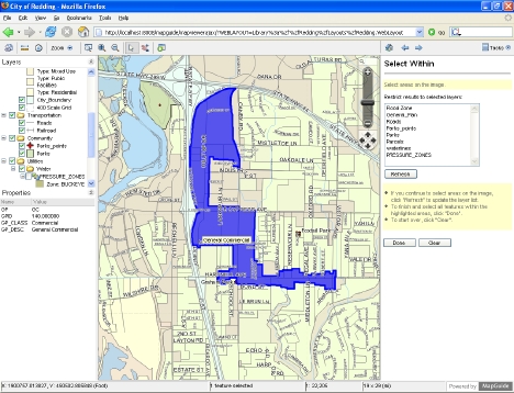
Autodesk is launching new commercial versions of MapGuide Enterprise and MapGuide Studio, after having already launched the open source version of MapGuide. MapGuide Enterprise 2007 is a new mapping platform that allows developers to publish maps and spatial information to the Web. MapGuide Studio 2007 is a new authoring tool that allows developers to create and build MapGuide-based applications. It is basically the same product that is out in preview. The English versions of both products should be available July 3.
I spoke with Andrew Mackles, GIS Product Line Manager for Autodesk Infrastructure Services Division, and watched a demonstration by Arnab Ganguly.
Mackles, while pointing out that "Enterprise is more or less the same as the open source version," stressed that the commercial version contains a few additional software components, such as connectivity to Oracle and SQL Server, which are not included in the FDO in the open source version. Also, unlike the open source version, the commercial one uses the Mentor system, which supports "thousands of coordinate systems worldwide" and which Autodesk has been using in MapGuide for a couple or years. The commercial version also supports several additional languages.
Basic GIS Coordinates
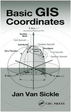
 Jan Van Sickle, Basic GIS Coordinates (Boca Raton, Florida: CRC Press, 2004), 173 pages, $82.95.
When I was 13, in my junior high school shop class in Italy, I built a simple range finder. It consisted of an L-shaped wooden platform, with a nail at each end of the long arm and a mirror mounted on a swiveling disk at the end of the short arm. To use it, I aligned the two nails with a distant object, and then rotated the disk until, out of the corner of my right eye, I could see the same object in the center of the mirror. I could then read the distance to the object on the disk, on a scale that I had calibrated by aiming the device at objects whose distance I had previously measured. Unfortunately, my shop teacher did not appreciate the concept and was not impressed by my product. As I recall, I had to build something else in order to pass the class.
At the other end of the spectrum of distance measurement tools, space geodesy now allows for millimeter precision over very long baselines. Yet one basic problem still besets surveyors, cartographers, and mappers, and it is as old as the Earth itself: the Earth itself. Its surface is, in Jan Van Sickle's words, "not very cooperative. It is bumpy." "Connection to the real Earth," he writes, "destroys the abstract, perfect, and errorless conventions of the original datum. They get suddenly messy, because not only is the Earth's shape too irregular to be exactly represented by such a simple mathematical figure as a biaxial ellipsoid, but the Earth's poles wander, its surface shifts, and even the most advanced measurement methods are not perfect." This makes coordinates "slippery"—and this book necessary for those who need to understand them and apply them. Because "any successful GIS requires a merging of old and new data," and, therefore, involves legacy coordinate systems, any serious GIS user can benefit from this book.
Briefly Noted
I am reading Franz Kafka's The Castle, a wonderful classic. The protagonist, K., is a surveyor, so the book is full of references to surveyors and surveying. Here's my favorite, from a conversation between K. and the village council chairman:
"You were, as you say, taken on as a surveyor, but we don't need a surveyor. There wouldn't be the least bit of work for a person like that. The boundaries of our small holdings have been marked out, everything has been duly registered, the properties themselves rarely change hands and whatever small boundary disputes arise, we settle ourselves. So why should we have any need for a surveyor?"
News Briefs
Please note: I have culled the following news items from press releases and have not independently verified them.
-
CONTRACTS & COLLABORATIONS
-
The City of Rockville, Maryland took advantage of the floating license option introduced with LizardTech's GeoExpress 6 to streamline license management and provide more flexible agency-wide access to GeoExpress' image processing and compression tools. Read more …
-
BIL Solutions Ltd., formerly BNFL Instruments, is using Ubisense's real-time location system (RTLS) to develop a new way to measure and record radiation dose rates that could improve safety measures and quality assurance for nuclear plants and their employees. Read more …
-
GeoDecisions, an information technology company specializing in GIS, recently implemented the Web EMS (Environmental Management System) Manager for Waste Management, Inc.. Read more …
-
The Advisory Unit: Computers in Schools has been awarded a contract to collaborate with eMapSite, an online map distributor, to deliver a new pilot to support geographical studies. Read more …
-
Sioux County Iowa is using mPower Integrator, developed by mPower Technologies, with ESRI ArcIMS to develop their Web GIS applications. Read more …
-
DM Solutions Group, a member of the open source Web mapping community, has integrated MapGuide Open Source as a key technology to its commercial service and product offerings. Read more …
-
Timmons Group has completed a GIS interface for the Virginia Department of Historic Resources (DHR) statewide Data Sharing System (DSS). Read more …
-
-
CONFERENCES
-
Following last February's Integrating GIS & CAMA Conference in Orlando, the Urban and Regional Information Systems Association (URISA) and the International Association of Assessing Officers (IAAO) are accepting abstract submissions for the 2007 conference in Las Vegas. Read more …
-
-
OTHER
-
GeoDecisions, a firm specializing in geospatial solutions, will reach its 20th anniversary on June 10. Read more …
-
ESRI and Trimble, a manufacturer of global positioning system (GPS) receivers, have extended the application deadline for the 2006 ESRI and Trimble Mobile Government Grant Program: Coastal Communities to June 30. Read more …
-
Advertise with Us
You can reach more than 23,000 GIS professionals every issue by sponsoring GIS Monitor. For more information, email us.
Contact
Please send comments and suggestions to:
Matteo Luccio, Editor
GIS Monitor
Ultimate Map/GIS Directory — Your search is over!
GIS Monitor is published by:
GITC America, Inc.
100 Tuscanny Drive, Suite B-1
Frederick, MD 21702 USA
Tel: +1 (301) 682-6101
Fax: + 1 (301) 682-6105
Subscribe/Unsubscribe
If you wish to subscribe or unsubscribe visit our subscription page.


