Letters, Points of Interest, Kudos and Conundrums, Week in Review (Announcements, Contracts, Products, Events, Training, People) Back Issues, Advertise, Contact, Subscribe/Unsubscribe If, for some reason you cannot read this document, visit: http://www.gismonitor.com/news/newsletter/archive/012005.php
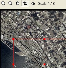
LizardTech Introduces GeoExpress 5.0 with MrSID It might have been an interesting twist to call the product GeoExpress 5.0 with JPEG 2000 since that's the other big news: the integration and support of that open, ISO standard format. JPEG 2000 is of particular importance to LizardTech because the U.S. Department of Defense (DoD) and its contractors use it. In particular, DoD uses National Imagery Transmission Format (NITF), a sort of Spatial Data Transfer Standard (SDTS) for images. Version 2.1 of NITF supports JPEG 2000. I'd suggest that DoD is an early adopter of JPEG 2000 in the geospatial realm; the more conservative geospatial community, civilian government, is taking its time in exploring the new format and the new tools that support it. And, while there's a lot of buzz about JPEG 2000 as that exploration occurs, Morley is quick to point out that using the format, and using it "well for a particular goal" requires a bit of study. Think of it this way: to best use all the power of JPEG 2000, one must "tune it" with specific profiles. How it's tuned may make working in small areas faster or alternately, make it speedier to zoom over large areas. Those choices may in turn increase or decrease file size. In contrast, the MrSID format is "pre-tuned" by LizardTech, "at the factory" so it's simpler to use, but less flexible. The National Geospatial-Intelligence Agency has developed two JPEG 2000 profiles to suit some of its needs. EPJE (Exploitation Preferred JPEG 2000 Encoding) and NPJE (NSIF/BIIF/NITF Preferred JPEG 2000 Encoding) options are included in GeoExpress 5.0. Users can call upon these when creating JPEG 2000 files or concoct their own profiles. The profiles are stored in XML files and presented in a pull-down menu for easy use. While end users may not write their own profiles, they may well use profiles designed by "power users" in NGA or their own organization. And, of course the XML storage means profiles are "open" (XML is text-based, and thus humanly readable) and can be easily shared between organizations. Back to the new tools available� How about reprojecting a MrSID file directly? Recall that in the past that meant converting a MrSID file to another format, reprojecting it, and then recreating a new MrSID file. Now the process can be done directly on the original MrSID. The process will look quite familiar to reprojecting vector data in a GIS package. And, interestingly, what goes on behind the scenes is exactly the process I described above as the "old way." I asked why that was. "The MrSID format is just not designed to do that kind of transformation," explained Morley. (On the other hand, as I note below, JPEG 2000 has its limitations, too.) From a practical standpoint, I should be clear, the transformation tool does provide the end user with a simple, "one step" reproject, something that's been requested for some time. One other note: reprojection increases encode time by about 1.5 times. How about mosaicking images that are in different projections? Or in multiple formats - MrSID, JPEG, etc? Or with different resolutions? Or compressing images with multiple bands? Or cropping? All can be done - and the result can be returned in MrSID or JPEG 2000. Reality does creep in, however. Mosaicking images from different projections in GeoExpress has the same issues when it's done elsewhere: there will likely be gaps. JPEG 2000 presents another reality check. The nature of the format introduces some limitations, which may lead users to select the MrSID format as more appropriate in some situations. Morley provided an example with one of the "cooler" tools in GeoExpress 5.0. What if you want to compress an image differentially? For example, provide lossless compression in certain area of interest, and lossy ("fuzzed up") compression elsewhere? You might want to do that to obscure an area that's sensitive or simply reduce file size, but still provide some context for less important areas. We played with imagery from Washington, D.C. and attempted to "fuzz up" the area around the capital. (See, for reference, this story from last year.) Going through the process with JPEG 2000 output left a jagged interface between the two areas. MrSID output showed a sharp boundary between the clear (lossless) and fuzzy (lossy) areas. The "grid" in JPEG 2000 causes that difference. By the way, for now, the areas set for "differential compression" in this release must be rectangular. In future releases that is likely to change. GeoExpress 5.0 is really the product family name. The product range runs from GeoExpress 5.0 Light (suggested retail price (SRP), $1,500, which allows use of existing JPEG 2000 and MrSID images but does not encode) to GeoExpress Bundled (SRP varies with number of annual compression credits - varies from 100GB to 1 TB) or an "unlimited" license, (SRP, $7,900, GeoExpress Unlimited Standalone). A trial version is available for 30 days.

Charter Allows Data Sharing in Emergencies There's a 24-hour a day operator to help requestors through the process of tapping the resources of the membership. Requests can come from any civil protection agency that's in the jurisdiction of a member or from a member. So, here in the U.S., many local, county, and state public safety agencies are covered since NOAA is "in." Looking over the last few activations of the charter, which included tsunami related requests, I found these requestors: French Civil Protection, Swedish Rescue Services Agency, ISRO, Sistema Federal de Emergencias (SIFEM, Argentina), and the German Federal Foreign Office. Data delivered via the charter may include raw or analyzed images and maps. Some of these delivered products are available on the website. I think it's great that this data sharing arrangement was made and seems to be working. It's also interesting that it has had little fanfare, and is very simple to implement and manage. This charter appears to me to be a valuable reference in developing data sharing relationships. I read about the charter on this blog which points out that data such as this should be available when needed, not just during an emergency. The author points to several efforts to make spatial data available to humanitarian groups at any time. These include UNOSAT and RESPOND.

GPS Tracking and the Law
That story has sparked a fresh set of articles on GPS, tracking, and privacy. Hiawatha Bray, the technology writer for the Boston Globe (and a big favorite in my parents' house) took a look at the decision and the related technologies. He notes that the opposition suggested that the planting of the device "could be construed as a violation of the Fourth Amendment." Recall that the fourth amendment prevents illegal searching of people or their property. The judge replied that the accused "had no expectation of privacy in the whereabouts of his vehicle on a public roadway," so that the amendment was not applicable. While some label the implications of this decision "creepy," others are confident that law enforcement will not abuse the privilege simply because they don't have the time to track people who are not suspected of wrongdoing. Still, Bray notes, with GPS-enabled phones, and transponders tracking toll both visits, it's very easy to track individuals and vehicles. The interesting point here is that we need to update our laws to the technology. In the old days high speed car chases, helicopters, and even running feet had friction; there was a cost built into tailing someone. Now, those costs are becoming nearly moot. It's also valuable to note that "modern tailing," via GPS, drops the potential risks to officers significantly. Declan McCullagh, writing at CNET, also looked at the decision. He quotes Lee Tien, staff counsel, for the Electronic Frontier Foundation, who thinks a warrant should be required for such tracking. "We're in a world where more and more of our activities can be viewed in public and, perhaps more importantly, be correlated and linked together." That's a good point; it's not just the location data itself that of concern, it's the ability of law enforcement and others to link it to other data, for context. Law professor Dan Solove puts the current state of the courts this way: "The court has a very narrow and crabbed understanding of privacy. If something's not totally secret, you don't have a reasonable expectation of privacy." That is, if you want to be sneaky, be really sneaky. I think it's a good sign that coverage of these rulings is becoming more routine, though those were the only two explorations I found in the technology press. I also appreciate that McCullagh includes a full description of how GPS works along with discussions of its less sinister uses. I wish more coverage of GPS included the simple primer.

Department of Corrections While several readers wrote to correct this particular error, I'll share just one: "Your interesting article on liability issues was made humorous, if wrong, by your substitution of the word 'libel' for the word you wanted: liable. Please try to avoid these kind [sic] of mistakes, which diminish your otherwise helpful newsletter." Another reader offered a bit of a grammar lesson remarking on a vendor's offer to provide software to a particular area: "'the offer is made only to those in the strickened areas' should [be] spell[ed] 'stricken' (adverbs are commonly but incorrectly turned into adjectives in American, the most dynamic of Englishes..)" The editor responds: I appreciate that GIS Monitor readers have such high expectations for this publication.
ECO Intern for Hire Here's the latest potential hiree. Marie Mills is seeking work in GIS or a related field. She wrote: Since graduating from the University of Washington, I have created hundreds of maps for public and private entities. My ECO internship, as GIS Specialist for the Washington State Department of Transportation, began as a project to build a statewide groundwater data layer. My duties grew to promoting the understanding and use of GIS technology within the agency and producing maps and performing analysis to support the Agency's environmental concerns. I gave informational presentations, budgeted resources, and built and maintained an environmental data library. I also hired and supervised GIS assistants to create an independent GIS Program, within the Environmental Affairs Office, serving the Agency's environmental mapping needs. Overall, I have ten years experience in the field of GIS, using geography to analyze and map relationships. For work samples, education, and complete work history visit here. Contact: mmills(at)tumtum.com
"Just read your note about liability - "I had contacted our Public Health Director about putting together a proposal to use GIS to help identify high risk lead paint housing in the county and she declined the opportunity because of a lawsuit in the Albany area. It seems that someone successfully sued a local government office for having just this type of information and yet a child was still exposed to lead paint because they hadn't had time/resources to fix the problem. "We also had a case where a local real estate agent was sued because a new property owner found out that the land was potentially within a viewshed of some proposed windmills in the next town. The viewshed model was created using available data on behalf of the town planning board as part of their review of the project. At the public meeting I tried to explain all the caveats to the model and what the limits to its use would be. Then, an attorney asked me whether or not the map showed reality. I responded by saying 'No, it's a map model based on available data' and he was very agitated that it wasn't able to prove which parcels were within the viewshed. "Now I fear that my hands are going to be tied whenever such requests comes my way again - lots of data and great technical modeling capability without anywhere to use it!" � Bob Blickwedehl made some interesting points about some terms used in GIS Monitor. "I noticed a recent article in the recent issue of GIS Monitor that used the term geotech to refer to geospatial technology. As a geotechnical engineer who is also into GIS, I find this confusing. For the last 30 years, the profession which formerly was referred to as Soil and Foundation Engineering has been referred to as Geotechnical Engineering. The reason for the change was to allow the profession to include newly evolving disciplines such as Rock Mechanics, Earthquake Engineering, and Subsurface Environmental Remediation. "I enjoy your publication. Please keep up the good work. As a politically incorrect old time engineer I really got a chuckle about the Fugawi GPS. I could not believe that anyone would have the guts to use that word to name a company, even though it is the perfect word for a GPS unit." The editor responds, sheepishly: I didn't get the Fugawi reference, but found an explanation here. � Jon Hall, QA Mgr. at microDATA GIS, Inc. raised a question about the graphic from RADARSAT International (RSI) I included in last week's discussion of the tsunami response, as well as other images used in the media. "Anyone interested in accurate change assessment of the shoreline and tidal areas through aerial photography would certainly want to know whether the 'before and after images' being compared were both taken at mean low water, high tide, or what. "I admit ignorance of the height of tides in Sri Lanka, but I know it can make a big difference in evaluating the shoreline throughout coastal New England. The Full Moon was on December 26, which corresponds to the greatest difference between low and high tides. "'December, 2000' and 'January 2, 2005' is a four-year period, so the change between the two photos may not be entirely attributable to the December 26, 2004 tsunami. "We in the GIS profession should always beware of the media 'lying with maps.' I'm highly suspicious of the conclusions presented by the media based on other satellite imagery." I posed that observation to RSI and received this response. "Yes indeed, tide heights or changes to the topography of the area (due to plate tectonics/or wave action) would affect the distance inshore that the water would appear on the imagery. "We cannot be positive that the 'flooded' areas are indeed all caused by floods due to the tsunami, monsoon rain or by differences in tidal heights etc.... This information would need to be gathered using ground truthing or by combing the imagery with other data sets. "Massive changes in coastline and areas of flooding have been documented by people on the ground and by different optical/radar satellites. "[The letter writer] is correct - satellite imagery provides only one look at a situation or 'piece of the puzzle as to what is happening on the earth..."
Points of Interest Vote for Top Images. Somehow I managed to miss this announcement in the past few weeks. Space Imaging is asking the public to help pick the 10 most spectacular images of 2004. This is the fifth year Space Imaging has named the Top 10 Images, but it's the first time the public has been asked to vote. Visitors to the online voting webpage will select from 24 images. The final Top 10 Images of 2004 will be announced in late January. Voting ends soon. Intergraph Wins Over HP in Germany. While several vendors approached by Intergraph with hardware patent infringement charges settled after seeing a few big wins, HP did not. Not only that, HP sued Intergraph for software patent infringement related to CAD software. One of those cases, brought in Germany, ended on Jan 7. It was thrown out and HP was directed to pay all costs. The only place I've seen the story in on Ralph Grabowski's WorldCAD Access blog, though the documents on the case are posted on the Intergraph Intellectual Property website. Inaccurate Undersea Map Kills One. On land, at least here in the U.S., we spend more time mapping where the people are and less where there are just trees and rangeland. The same is true of the ocean. Unfortunately, that meant that a "less traveled" area 360 miles southeast of Guam was not mapped too accurately, nor too often. A nuclear-powered attack submarine crashed (the original story is from the New York Times, but here no registration is required) into an underwater "mountain" recently. The sub was using Defense Mapping Agency (DMA) charts from 1989 that showed no obstacles. Many sailors were injured and one died. Recent satellite imagery, from Landsat, suggested a hazard. Unfortunately, the Navy had not asked that charts be updated and the National Geospatial-Intelligence Agency (which subsumed DMA) does not have the manpower to update charts. Appeal Unclear in Collier Case. The Collier County Assessor is still contemplating (free registration required) appealing the verdict of a copyright data suit. Recall that MicroDecisions had appealed an original decision which prevented the company from using the county data in its for-profit products without paying a licensing fee. Earlier this month the court reversed itself, saying the open records laws of the state prevent copyrighting of data. The assessor claims this is indeed a copyright case and argues that since tax payers paid for the GIS, private companies should not benefit. Says MicroDecisions' attorney, "one of the cornerstones of a public records law is that you can get the public records for any reason. You don't have to explain what you're going to do with the public records." Cancer Correlation. George Knox, an emeritus professor at the University of Birmingham in England, mapped the birth locations of children between 1960-1980 and the current chemical emissions sites in Britain, most of which would have been in place during that time. He then looked at their death records. Children born within a 1-km radius of chemical emissions hotspots were 2-4 times more likely to die of cancer before reaching 16 than other children. "You (almost) can't get there from here" A reader shared this tip, which he credited to Laurent J�gou of France. I found it referenced on a few blogs. To have some fun try this:
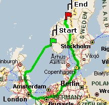
1. Go to the [MapPoint] site Says the reader: [The resulting map] "shows you a two-day, 1,685.9 mile route between two Norwegian coastal cities (about 300 miles apart on the map), requiring three sea voyages and visiting six foreign countries along the way! One has to suppose there is a much better route that the site didn't find." I couldn't get it to work. MapPoint reported that "A route between the locations you entered could not be calculated. One of the locations may not contain necessary connectors such as ferry routes or main roads. Please change one or both of the locations." I'd like to see this map on an intro GIS course exam with the question: "Why might this have happened?"
Kudos and Conundrums Kudos (concepts we applaud) Microsoft to Create GIS for India. The AP reports that Microsoft Corp. will help the Indian government "digitize its vast collection of satellite images, data from sensors and other information about the country's terrain." It's the first project under a newly signed memorandum of understanding noted recently in conjunction with the new Microsoft Research lab in the country. The goal is to produce a GIS "to make data available to the public in an easily understandable form." While the aim is to support relief efforts, I'd be curious if the raw data will become available to the public. That's one of the challenges in that country today. Further, since the data is likely already digital, the work should be mostly compilation. A columnist from the Seattle area, home of Microsoft, indicated the tsunamis did indeed direct the work of the new lab, though some of the vision (such as identifying areas vulnerable to the tsunamis) had been articulated before the lab opened. Conundrums (concepts we question/give us pause) VOIP 911. Members of the Voice on the Net Coalition held a meeting last week. Among other things, they encouraged the government to leave them alone when it came to 911. They hoped the government would focus on mobile 911 issues and not place additional requirements on VOIP offerings that would require location determination for emergency response. The companies are exploring solutions including those based on GPS and Wi-Fi. For now, VOIP 911 depends on users inputting their sometimes changing locations by hand.
Please note: Material used herein is often supplied by external sources and used as is. � Announcements Leica Geosystems' Surveying & Engineering Division established a new Singapore subsidiary: Leica Geosystems Technologies Pte Ltd. This new company combines its carved-out business in Leica Instruments (S) Pte Ltd with those from its U.S. operations in Grand Rapids, Michigan as a consequence of its previously announced restructuring plan. The Urban and Regional Information Systems Association (URISA) has recently posted the application materials for its prestigious Exemplary Systems in Government (ESIGTM) Awards. In the aftermath of the Tsunami disaster in Asia, volunteers from ESRI (Thailand) Co. Ltd. went to the Phangnga province in Thailand to assist search teams and analyze the damage with the use of GPS, GIS and remote sensing technology. The Emergency Interoperability Consortium (EIC) announced that it has signed a Memorandum of Agreement (MOA) with the Department of Homeland Security (DHS) to promote the development and proliferation of data sharing standards for emergency response. ACD Systems International Inc., makers of ACDSee photo management software and Canvas technical illustration software, announced its affiliation with the ESRI Business Partner Program. In light of the recent tsunami disaster in Indonesia and other parts of Asia, the U.S. Geological Survey (USGS), in cooperation with the American Geological Institute (AGI), is providing copies of the Global GIS DVD-ROM to U.S. Department of State-led teams traveling to Humanitarian Information Centers in affected areas. The data is provided locked to ESRI's ArcView Data Publisher. I wonder how valuable it is in that form? � Contracts and Sales The City of Kingston has selected ESRI as the standard for its GIS platform. CoServ Electric, a not-for-profit utility co-op serving Northern Texas for more than 65 years, has selected Miner and Miner's Responder for their Outage Management System (OMS). The co-op serves 105,000 electric retail and business customers in a service area including parts of Collin, Denton, Wise, Cooke, Grayson, and Tarrant counties. m-spatial announced Vodafone Germany as the first international customer for MapWay, its turn-key suite of maps and walking directions services for use on mass market mobile phones. TruePosition, a provider of location-based technologies and solutions, announced a three-year agreement to deploy its high accuracy wireless location solution to Kansas-based mobile operator, WestLink Communications. � Products AMC Inc. released GPS2CAD Ver. 3.5, software that enables users to effectively bring into their design environment the GPS points they have collected, their favorite CAD application, and public domain aerial photos and Topo maps. Version 3.5 follows the earlier release of Version 3.1, and now includes significant new capabilities for importing and exporting data from different sources. Coinciding with this release is the launch of a new website dedicated solely to supporting this program. The previous website will remain, but its focus will shift to a more general engineering theme. Idevio announced that RaveGeo is available for ArcGIS. This means that ESRI users now stream geographic data, something that previously had only been available in advanced military systems. RaveGeo is a compression and streaming technology for multi-resolution vector maps. With the release of the RaveGeo ArcGIS plug-in, RaveGeo now is also available to the many users of ArcGIS from ESRI. Origin GeoSystems, Inc. announced the launch of Origin Reader, an enterprise GIS Viewing and Data Distribution solution and the newest addition to its popular Origin GIS software suite for utilities. The United States Geological Survey (USGS) in cooperation with NASA has developed a new Level 1G systematic (geometrically and radiometrically corrected) stitched data product from the Earth Observing-1 (EO-1) Advanced Land Imager (ALI). The new ALI product represents an effort to increase the quality and usability of the current ALI data products available from EO-1. The previously available ALI image product was limited to radiometrically corrected (Level 1R) data with no geometric correction or georeferencing applied. The CEDRA Corporation announced the release of its CEDRA-DxfExport software, an ArcView GIS and ArcGIS extension, which enables a user to create an AutoCAD Drawing Interchange File (DXF file) for all visible features in the current map from within ArcView 3.x or ArcMap. After a request, the company informed me: "The CEDRA Dxf-Export does come with all CEDRA AVseries software extensions, however, due to popular demand we are releasing a stand-a-lone version at a fee of $195.00" It further explained that the product also includes other tools for ArcGIS users. Bellevue, WA -based GPSFlight, Inc. released a Decode DLL software library that brings wireless GPS telemetry to any Windows application. Delivered as a COM object complete with documentation, the Decode library allows application developers to add support for GPSFlight wireless GPS telemetry systems -- including the ability to track multiple objects simultaneously in real-time -- to existing software packages. @Road, Inc. launched the @Road Solution Suite for Transportation and Distribution, a comprehensive set of bundled services and features that combines GPS tracking, route compliance, electronic driver logs, vehicle diagnostics, and more. Transportation companies can now use @Road for an enterprise-grade mobile resource management solution to help streamline operations, improve driver productivity, and enhance customer service. Ricoh Corporation launched the Pro G3, a high-resolution digital camera that embeds captured images with GPS coordinate information received from either its on-board GPS unit or from external GPS devices. This sentence does not accurately explain what happens, but was included in the press release: "Once these captured 'geo-images' are transferred to a PC, they are automatically converted to shape files or merged to geo-databases for instant integration into GIS." The location points are converted to shape files with a link to the image, along with position and date/time information, I was assured by a reseller. Also, "geo-database" does refer to ESRI geodatabases. � Events The Association of American Geographers is pleased to announce that Barry Lopez, National Book Award winning author of Arctic Dreams; Timothy Wirth, former U.S. Senator and Undersecretary of State and current President of the United Nations Foundation; and Chip Groat, Director of the U.S. Geological Survey, will address the more than 5,000 attendees expected at our 2005 Annual Meeting, to be held in Denver from April 5 to 9, 2005. The meeting kicks off the AAG's second century of geographic research, education, and applications. The SwaGIS (That's Swaziland) Annual General Meeting will be held on the 27th of January at Mountain Inn in Mbabane. Contact: bheki(at)skpe.co.sz GEA2005, the XI International Geodesy Fair and Spatial Information Technologies will be held in Poznan, Poland, September 15-17 2005. GEA 2005 will be covering a broader range of topics within the framework of geodesy, geoinformatics, and land management, highlighting the areas of e-government, GIS Internet applications, and location-based services. Galdos System will host GML Days in Vancouver, British Columbia, Canada from July 18th to July 22nd. GML Days 2005 will be the fourth annual conference on the OGC Geography Mark-up (sic) Language (GML) and Web Services for GIS. GML is rapidly emerging as the world standard for the XML encoding of geographic information and is the foundation for the Geo-Web. On May 17-18, 2005 the Pennsylvania GIS Conference will bring the Pennsylvania GIS community together for the 13th year to present, discuss and debate critical issues affecting the development and use of geospatial data and technology in the Commonwealth. This year the conference will move to a new venue in the recently renovated Radisson Penn Harris Hotel and Convention Center in Camp Hill, just across the Susquehanna River from Harrisburg, PA. � Training � People Leica Geosystems GIS & Mapping announced that Jim Farley has joined the division as Vice President, Business Development. He has spent more than twenty years in the information technology industry in both mainstream IT and GIS, working in the public and private sectors and in academia. For the past four years Farley was Senior Principal Product Manager, Spatial and Location Products in Server Technologies at Oracle. Jim also serves on the editorial advisory board of Earth Observation Magazine. Vexcel Corporation announced that Bill Gail, former Director of Earth Science Advanced Programs at Ball Aerospace, has joined Vexcel as Vice President of Mapping and Photogrammetric Solutions. GeoDecisions recently named Brian Jensen GIS Analyst for the firm's Madison, Wis. office.
Advertise With Us
Contact GIS Monitor is published by: GITC America, Inc.
Subscribe/Unsubscribe |